Property Record
605 Barataria Blvd, Marrero, LA 70072
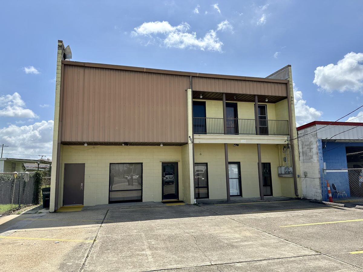


This Property Is For Sale
NEARBY LISTINGS FOR SALE OR LEASE
Property Detail
605 Barataria Blvd
New Orleans-Metairie, LA
Marrero Sub
0410001723
GETZINGER
Realpropertynec
Jefferson
X
Louisiana
22051C0215F
2
2023
0.15 AC
2023
Outer Jefferson Parish
026600
New Orleans/Metairie/Kenner
DEMOGRAPHICS near 605 Barataria Blvd
1 Mile
3 Mile
5 Mile
2024 Total Population
8,272
119,197
293,186
2029 Population
7,936
114,780
283,317
Pop Growth 2024-2029
(4.06%)
(3.71%)
(3.37%)
Average Age
44
41
40
2024 Total Households
3,726
51,305
123,366
HH Growth 2024-2029
(4.24%)
(3.86%)
(3.31%)
Median Household Inc
$40,845
$57,521
$53,258
Avg Household Size
2.20
2.20
2.20
2024 Avg HH Vehicles
2.00
1.00
1.00
Median Home Value
$165,330
$257,886
$234,928
Median Year Built
1963
1959
1963
Nearby Places
- Restaurants
- Banks
- Shops
- Fitness
- Groceries
PUBLIC TRANSPORTATION
COMMUTER RAIL
New Orleans Union Passenger Terminal (City of New Orleans - Amtrak, Crescent - Amtrak, Sunset Limited - Amtrak)
DRIVE
WALK
Distance
New Orleans Union Passenger Terminal (City of New Orleans - Amtrak, Crescent - Amtrak, Sunset Limited - Amtrak)
13 min
8.5 mi
AIRPORT
Louis Armstrong New Orleans International
DRIVE
WALK
Distance
Louis Armstrong New Orleans International
31 min
18.5 mi
Freight Ports
Port of New Orleans
DRIVE
WALK
Distance
Port of New Orleans
18 min
9.2 mi
Nearby Properties
Address
Land Use
TOTAL SIZE
Lot Size
Zoning
Address
Land Use
TOTAL SIZE
Lot Size
Zoning
468,704 SF
7.58 AC
Address
Land Use
TOTAL SIZE
Lot Size
Zoning
3.66 AC
Address
Land Use
TOTAL SIZE
Lot Size
Zoning
197,182 SF
0.01 AC
Address
Land Use
TOTAL SIZE
Lot Size
Zoning
Address
Land Use
TOTAL SIZE
Lot Size
Zoning
Address
Land Use
TOTAL SIZE
Lot Size
Zoning
609,449 SF
1.23 AC
Address
Land Use
TOTAL SIZE
Lot Size
Zoning
Address
Land Use
TOTAL SIZE
Lot Size
Zoning
4.12 AC
Address
Land Use
TOTAL SIZE
Lot Size
Zoning
315,570 SF
4.42 AC
Address
Land Use
TOTAL SIZE
Lot Size
Zoning
Address
Land Use
TOTAL SIZE
Lot Size
Zoning
11.29 AC
Address
Land Use
TOTAL SIZE
Lot Size
Zoning
Address
Land Use
TOTAL SIZE
Lot Size
Zoning
Address
Land Use
TOTAL SIZE
Lot Size
Zoning
Address
Land Use
TOTAL SIZE
Lot Size
Zoning
151,320 SF
27.55 AC
Address
Land Use
TOTAL SIZE
Lot Size
Zoning
Address
Land Use
TOTAL SIZE
Lot Size
Zoning
9.02 AC
Address
Land Use
TOTAL SIZE
Lot Size
Zoning
65,800 SF
1.65 AC
Address
Land Use
TOTAL SIZE
Lot Size
Zoning
7,468 SF
8.13 AC
Address
Land Use
TOTAL SIZE
Lot Size
Zoning
Address
Land Use
TOTAL SIZE
Lot Size
Zoning
53,036 SF
2.81 AC
Address
Land Use
TOTAL SIZE
Lot Size
Zoning
Address
Land Use
TOTAL SIZE
Lot Size
Zoning
Address
Land Use
TOTAL SIZE
Lot Size
Zoning
298,450 SF
17.22 AC
Address
Land Use
TOTAL SIZE
Lot Size
Zoning
14.69 AC
Address
Land Use
TOTAL SIZE
Lot Size
Zoning
Address
Land Use
TOTAL SIZE
Lot Size
Zoning
3.55 AC
Address
Land Use
TOTAL SIZE
Lot Size
Zoning
12.79 AC
Address
Land Use
TOTAL SIZE
Lot Size
Zoning
Address
Land Use
TOTAL SIZE
Lot Size
Zoning
102,672 SF
1.62 AC
The World's #1 Commercial Real Estate Marketplace
Connect with us
© 2025 CoStar Group
The information above has been obtained from sources believed reliable. While we do not doubt its accuracy we have not verified it and make no guarantee, warranty or representation about it. It is your responsibility to independently confirm its accuracy and completeness. Any projections, opinions, assumptions, or estimates used are for example only and do not represent the current or future performance of the property. The value of this transaction to you depends on tax and other factors which should be evaluated by your tax, financial, and legal advisors. You and your advisors should conduct a careful, independent investigation of the property to determine to your satisfaction the suitability of the property for your needs.