Property Record
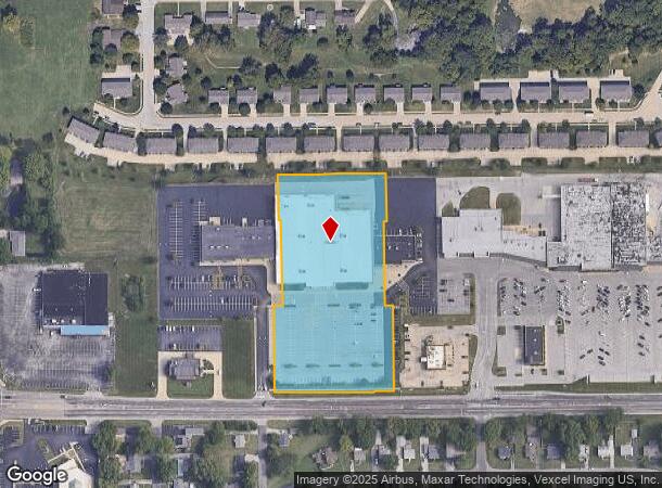
605 Belt Line Rd, Collinsville, IL 62234

NEARBY LISTINGS FOR SALE OR LEASE
Property Detail
605 Belt Line Rd
St. Louis
Kohls Plaza
St. Louis, MO-IL
KOHLS PLAZA LOT 2 326 X 240.31 IRREGULAR
13-2-21-22-13-301-053
Madison
Commercialnec
Illinois
2023
2
2023
1.80 AC
403502
Metro East Illinois
64,411 SF
DEMOGRAPHICS near 605 Belt Line Rd
1 Mile
3 Mile
5 Mile
2024 Total Population
7,725
31,855
56,695
2029 Population
7,627
31,447
55,951
Pop Growth 2024-2029
(1.27%)
(1.28%)
(1.31%)
Average Age
41
42
41
2024 Total Households
3,441
13,780
23,291
HH Growth 2024-2029
(1.31%)
(1.30%)
(1.35%)
Median Household Inc
$58,475
$67,113
$71,759
Avg Household Size
2.20
2.30
2.40
2024 Avg HH Vehicles
2.00
2.00
2.00
Median Home Value
$142,902
$159,380
$170,914
Median Year Built
1971
1973
1978
Nearby Places
- Restaurants
- Banks
- Shops
- Fitness
- Groceries
PUBLIC TRANSPORTATION
COMMUTER RAIL
Fairview Heights (Lambert Airport Shiloh-Scott - St. Louis MetroLink (MetroLink), Shrewsbury-Lansdowne I-44 Emerson Park - St. Louis MetroLink (MetroLink))
DRIVE
WALK
Distance
Fairview Heights (Lambert Airport Shiloh-Scott - St. Louis MetroLink (MetroLink), Shrewsbury-Lansdowne I-44 Emerson Park - St. Louis MetroLink (MetroLink))
16 min
9.1 mi
AIRPORT
Scott AFB/Midamerica St Louis
DRIVE
WALK
Distance
Scott AFB/Midamerica St Louis
34 min
20.3 mi
St Louis Lambert International
DRIVE
WALK
Distance
St Louis Lambert International
38 min
26.5 mi
Freight Ports
Port Milwaukee
DRIVE
WALK
Distance
Port Milwaukee
402 min
356.4 mi
Nearby Properties
Address
Land Use
TOTAL SIZE
Lot Size
Zoning
Address
Land Use
TOTAL SIZE
Lot Size
Zoning
148,997 SF
10 AC
Address
Land Use
TOTAL SIZE
Lot Size
Zoning
216,370 SF
23.25 AC
Address
Land Use
TOTAL SIZE
Lot Size
Zoning
131,296 SF
14.60 AC
Address
Land Use
TOTAL SIZE
Lot Size
Zoning
48,640 SF
3.84 AC
Address
Land Use
TOTAL SIZE
Lot Size
Zoning
25,743 SF
3.49 AC
Address
Land Use
TOTAL SIZE
Lot Size
Zoning
5,280 SF
3.69 AC
Address
Land Use
TOTAL SIZE
Lot Size
Zoning
Address
Land Use
TOTAL SIZE
Lot Size
Zoning
54,699 SF
2.20 AC
Address
Land Use
TOTAL SIZE
Lot Size
Zoning
3,000 SF
5.76 AC
Address
Land Use
TOTAL SIZE
Lot Size
Zoning
57,825 SF
2.68 AC
Address
Land Use
TOTAL SIZE
Lot Size
Zoning
32,331 SF
14.98 AC
Address
Land Use
TOTAL SIZE
Lot Size
Zoning
57,342 SF
Address
Land Use
TOTAL SIZE
Lot Size
Zoning
40,168 SF
1.08 AC
Address
Land Use
TOTAL SIZE
Lot Size
Zoning
40,430 SF
Address
Land Use
TOTAL SIZE
Lot Size
Zoning
3,868 SF
0.22 AC
Address
Land Use
TOTAL SIZE
Lot Size
Zoning
84,816 SF
0.89 AC
Address
Land Use
TOTAL SIZE
Lot Size
Zoning
48,743 SF
8.77 AC
Address
Land Use
TOTAL SIZE
Lot Size
Zoning
5,475 SF
2.91 AC
Address
Land Use
TOTAL SIZE
Lot Size
Zoning
26,408 SF
2.94 AC
Address
Land Use
TOTAL SIZE
Lot Size
Zoning
35,940 SF
1.50 AC
Address
Land Use
TOTAL SIZE
Lot Size
Zoning
50,400 SF
6.67 AC
Address
Land Use
TOTAL SIZE
Lot Size
Zoning
5,280 SF
2.72 AC
Address
Land Use
TOTAL SIZE
Lot Size
Zoning
46,660 SF
3.50 AC
Address
Land Use
TOTAL SIZE
Lot Size
Zoning
Address
Land Use
TOTAL SIZE
Lot Size
Zoning
40,176 SF
7.44 AC
Address
Land Use
TOTAL SIZE
Lot Size
Zoning
39,750 SF
3.90 AC
Address
Land Use
TOTAL SIZE
Lot Size
Zoning
31,024 SF
11.62 AC
Address
Land Use
TOTAL SIZE
Lot Size
Zoning
31,041 SF
1.62 AC
Address
Land Use
TOTAL SIZE
Lot Size
Zoning
9,904 SF
5.50 AC
The World's #1 Commercial Real Estate Marketplace
Connect with us
© 2025 CoStar Group
The information above has been obtained from sources believed reliable. While we do not doubt its accuracy we have not verified it and make no guarantee, warranty or representation about it. It is your responsibility to independently confirm its accuracy and completeness. Any projections, opinions, assumptions, or estimates used are for example only and do not represent the current or future performance of the property. The value of this transaction to you depends on tax and other factors which should be evaluated by your tax, financial, and legal advisors. You and your advisors should conduct a careful, independent investigation of the property to determine to your satisfaction the suitability of the property for your needs.