Property Record
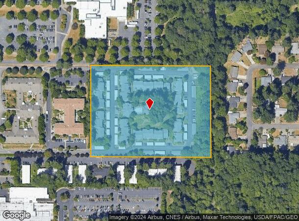
606 Lilly Rd Ne, Olympia, WA 98506


NEARBY LISTINGS FOR SALE OR LEASE
Property Detail
606 Lilly Rd Ne
Olympia-Tumwater, WA
Bla#Bla-Ss-5497
11808330400
SECTION 08 TOWNSHIP 18 RANGE 1W QUARTER SW SW SS-5497 LT A DOCUMENT 006/030
Multifamilydwelling
Thurston
X
Washington
53067C0187F
a
2024
7.45 AC
2024
North Olympia
012223
Olympia
126,179 SF
DEMOGRAPHICS near 606 Lilly Rd Ne
1 Mile
3 Mile
5 Mile
2024 Total Population
7,929
60,292
163,421
2029 Population
8,379
63,863
172,771
Pop Growth 2024-2029
+ 5.68%
+ 5.92%
+ 5.72%
Average Age
43
41
41
2024 Total Households
3,324
25,242
66,286
HH Growth 2024-2029
+ 5.75%
+ 6.12%
+ 5.84%
Median Household Inc
$61,242
$71,998
$77,982
Avg Household Size
2.20
2.30
2.40
2024 Avg HH Vehicles
1.00
2.00
2.00
Median Home Value
$359,272
$390,080
$404,239
Median Year Built
1988
1981
1988
Nearby Places
- Restaurants
- Banks
- Shops
- Fitness
- Groceries
PUBLIC TRANSPORTATION
COMMUTER RAIL
Olympia-Lacey Amtrak Station (Amtrak Cascades - Amtrak, Coast Starlight - Amtrak)
DRIVE
WALK
Distance
Olympia-Lacey Amtrak Station (Amtrak Cascades - Amtrak, Coast Starlight - Amtrak)
16 min
6.3 mi
Freight Ports
Port of Tacoma
DRIVE
WALK
Distance
Port of Tacoma
41 min
29.0 mi
Nearby Properties
Address
Land Use
TOTAL SIZE
Lot Size
Zoning
Address
Land Use
TOTAL SIZE
Lot Size
Zoning
874,760 SF
28.63 AC
MS
Address
Land Use
TOTAL SIZE
Lot Size
Zoning
485,918 SF
6.64 AC
CAP
Address
Land Use
TOTAL SIZE
Lot Size
Zoning
6,928 SF
1.33 AC
UW
Address
Land Use
TOTAL SIZE
Lot Size
Zoning
497,558 SF
28.57 AC
CBD 7
Address
Land Use
TOTAL SIZE
Lot Size
Zoning
98,652 SF
95.43 AC
UW
Address
Land Use
TOTAL SIZE
Lot Size
Zoning
660,544 SF
44.67 AC
MD
Address
Land Use
TOTAL SIZE
Lot Size
Zoning
203,039 SF
38.05 AC
OSI-S
Address
Land Use
TOTAL SIZE
Lot Size
Zoning
272,388 SF
4.69 AC
HD
Address
Land Use
TOTAL SIZE
Lot Size
Zoning
114,331 SF
1.43 AC
CAP
Address
Land Use
TOTAL SIZE
Lot Size
Zoning
171,420 SF
63.61 AC
SMU
Address
Land Use
TOTAL SIZE
Lot Size
Zoning
204,136 SF
11.91 AC
RM-24
Address
Land Use
TOTAL SIZE
Lot Size
Zoning
147,156 SF
18.75 AC
MS
Address
Land Use
TOTAL SIZE
Lot Size
Zoning
180,132 SF
6.66 AC
HD
Address
Land Use
TOTAL SIZE
Lot Size
Zoning
173,239 SF
7.66 AC
HD
Address
Land Use
TOTAL SIZE
Lot Size
Zoning
64.18 AC
HPBDBC
Address
Land Use
TOTAL SIZE
Lot Size
Zoning
115,977 SF
35.61 AC
OSI-S
Address
Land Use
TOTAL SIZE
Lot Size
Zoning
62.35 AC
HPBDBC
Address
Land Use
TOTAL SIZE
Lot Size
Zoning
266,887 SF
1.38 AC
UW
Address
Land Use
TOTAL SIZE
Lot Size
Zoning
185,054 SF
6.29 AC
HD
Address
Land Use
TOTAL SIZE
Lot Size
Zoning
347,361 SF
1.38 AC
DB
Address
Land Use
TOTAL SIZE
Lot Size
Zoning
221,642 SF
4.96 AC
CBD 5
Address
Land Use
TOTAL SIZE
Lot Size
Zoning
357,949 SF
28.17 AC
WD
Address
Land Use
TOTAL SIZE
Lot Size
Zoning
163,167 SF
8.20 AC
CBD 5
Address
Land Use
TOTAL SIZE
Lot Size
Zoning
69,898 SF
19.70 AC
CBD 7
Address
Land Use
TOTAL SIZE
Lot Size
Zoning
273,214 SF
19.54 AC
WD
Address
Land Use
TOTAL SIZE
Lot Size
Zoning
53.54 AC
HPBD-C
Address
Land Use
TOTAL SIZE
Lot Size
Zoning
140,433 SF
0.69 AC
UR
Address
Land Use
TOTAL SIZE
Lot Size
Zoning
103,401 SF
1.33 AC
UW
Address
Land Use
TOTAL SIZE
Lot Size
Zoning
168,325 SF
15.35 AC
HD
Address
Land Use
TOTAL SIZE
Lot Size
Zoning
103,401 SF
1.45 AC
UW
The World's #1 Commercial Real Estate Marketplace
Connect with us
© 2025 CoStar Group
The information above has been obtained from sources believed reliable. While we do not doubt its accuracy we have not verified it and make no guarantee, warranty or representation about it. It is your responsibility to independently confirm its accuracy and completeness. Any projections, opinions, assumptions, or estimates used are for example only and do not represent the current or future performance of the property. The value of this transaction to you depends on tax and other factors which should be evaluated by your tax, financial, and legal advisors. You and your advisors should conduct a careful, independent investigation of the property to determine to your satisfaction the suitability of the property for your needs.