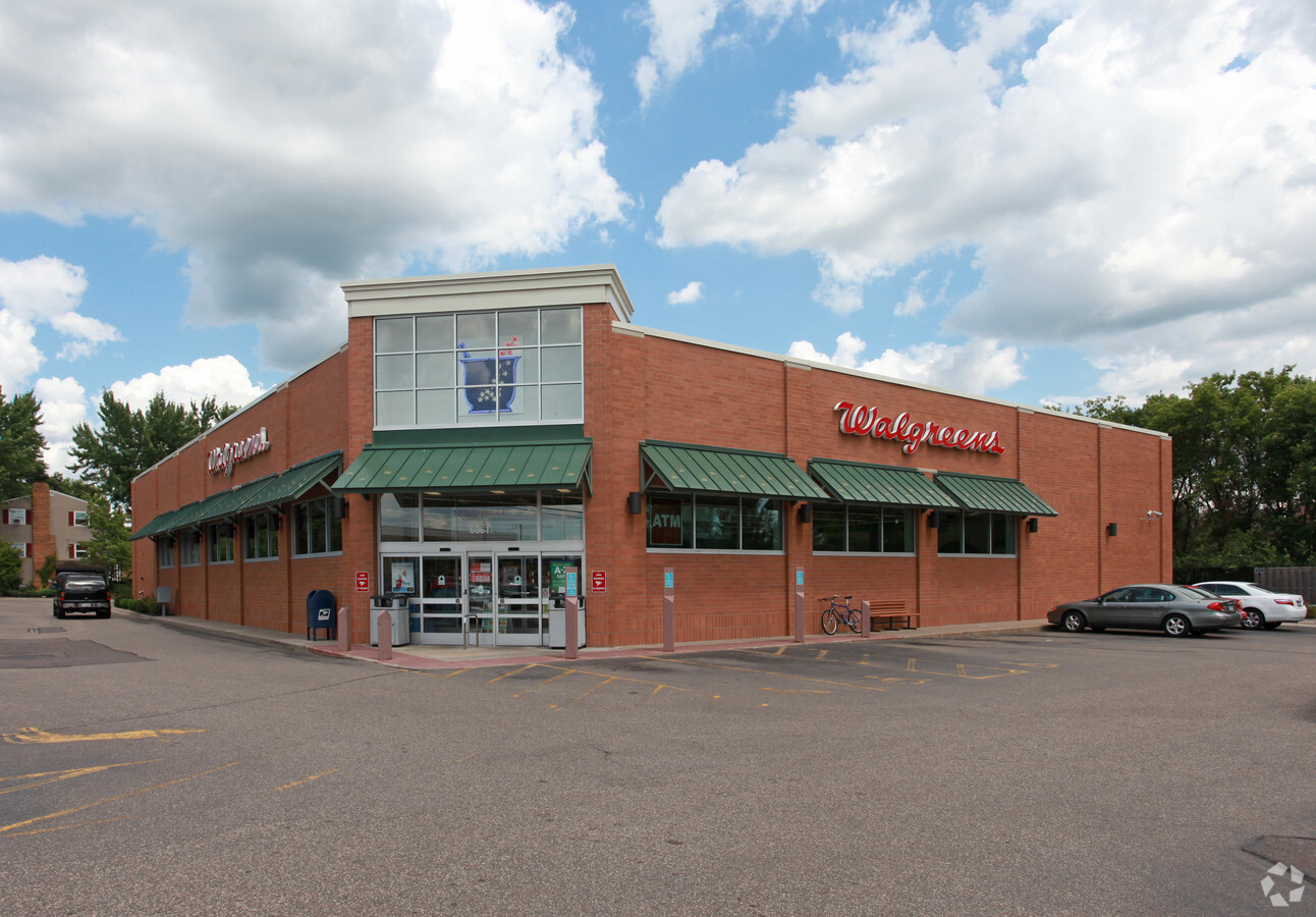
Property Record
6061 Osgood Ave N, Stillwater, MN 55082
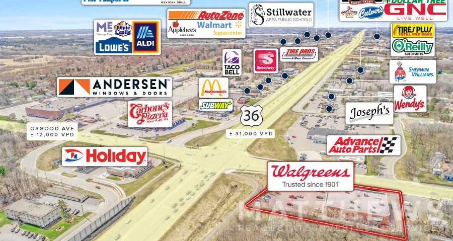

NEARBY LISTINGS FOR SALE OR LEASE
Property Detail
6061 Osgood Ave N
33-030-20-44-0033
BLOCK 6 LOT 14 SUBDIVISIONCD 2691 SUBDIVISIONNAME MC MILLAN AND COOLEY'S ADD BLOCK 6 LOT 11 SUBDIVISIONCD 2691 SUBDIVISIONNAM
Commercialnec
Washington
X
Minnesota
27163C0266E
14
2024
0.96 AC
2023
Maplewood
070703
Minneapolis/St Paul
13,550 SF
Minneapolis-St. Paul-Bloomington, MN-WI
DEMOGRAPHICS near 6061 Osgood Ave N
1 Mile
3 Mile
5 Mile
2024 Total Population
6,769
28,289
49,669
2029 Population
7,304
30,648
53,912
Pop Growth 2024-2029
+ 7.90%
+ 8.34%
+ 8.54%
Average Age
44
44
43
2024 Total Households
3,075
11,946
19,871
HH Growth 2024-2029
+ 8.20%
+ 8.54%
+ 8.64%
Median Household Inc
$88,440
$102,191
$112,991
Avg Household Size
2.10
2.30
2.50
2024 Avg HH Vehicles
2.00
2.00
2.00
Median Home Value
$336,990
$381,586
$422,065
Median Year Built
1972
1982
1985
Nearby Places
- Restaurants
- Banks
- Shops
- Fitness
- Groceries
PUBLIC TRANSPORTATION
AIRPORT
Minneapolis-St Paul International/Wold-Chamberlain
DRIVE
WALK
Distance
Minneapolis-St Paul International/Wold-Chamberlain
39 min
28.6 mi
Freight Ports
Port Milwaukee
DRIVE
WALK
Distance
Port Milwaukee
353 min
319.4 mi
SALE & LEASE HISTORY
LISTING DATE
SALE/LEASE

Oct 14, 2019
For Sale
Apr 30, 2020
For Sale
Nearby Properties
Address
Land Use
TOTAL SIZE
Lot Size
Zoning
Address
Land Use
TOTAL SIZE
Lot Size
Zoning
1,104,275 SF
28.19 AC
Address
Land Use
TOTAL SIZE
Lot Size
Zoning
519,636 SF
40.40 AC
Address
Land Use
TOTAL SIZE
Lot Size
Zoning
523,394 SF
117.99 AC
Address
Land Use
TOTAL SIZE
Lot Size
Zoning
600,000 SF
77.70 AC
Address
Land Use
TOTAL SIZE
Lot Size
Zoning
197,300 SF
0.55 AC
Address
Land Use
TOTAL SIZE
Lot Size
Zoning
198,596 SF
5 AC
Address
Land Use
TOTAL SIZE
Lot Size
Zoning
Address
Land Use
TOTAL SIZE
Lot Size
Zoning
141,294 SF
7.11 AC
Address
Land Use
TOTAL SIZE
Lot Size
Zoning
138,444 SF
16.11 AC
Address
Land Use
TOTAL SIZE
Lot Size
Zoning
84.75 AC
Address
Land Use
TOTAL SIZE
Lot Size
Zoning
81,240 SF
18.16 AC
Address
Land Use
TOTAL SIZE
Lot Size
Zoning
215,849 SF
2.96 AC
Address
Land Use
TOTAL SIZE
Lot Size
Zoning
55,150 SF
5.50 AC
Address
Land Use
TOTAL SIZE
Lot Size
Zoning
132,967 SF
18.10 AC
Address
Land Use
TOTAL SIZE
Lot Size
Zoning
45,777 SF
5.12 AC
Address
Land Use
TOTAL SIZE
Lot Size
Zoning
71,040 SF
12.02 AC
Address
Land Use
TOTAL SIZE
Lot Size
Zoning
110,932 SF
1.59 AC
Address
Land Use
TOTAL SIZE
Lot Size
Zoning
Address
Land Use
TOTAL SIZE
Lot Size
Zoning
66,665 SF
9.76 AC
Address
Land Use
TOTAL SIZE
Lot Size
Zoning
99,736 SF
3.43 AC
Address
Land Use
TOTAL SIZE
Lot Size
Zoning
46,145 SF
4.75 AC
Address
Land Use
TOTAL SIZE
Lot Size
Zoning
163,449 SF
8.68 AC
Address
Land Use
TOTAL SIZE
Lot Size
Zoning
65,255 SF
5.08 AC
Address
Land Use
TOTAL SIZE
Lot Size
Zoning
126,423 SF
2.84 AC
Address
Land Use
TOTAL SIZE
Lot Size
Zoning
84,546 SF
1.10 AC
Address
Land Use
TOTAL SIZE
Lot Size
Zoning
114,012 SF
10.77 AC
Address
Land Use
TOTAL SIZE
Lot Size
Zoning
95,480 SF
1.11 AC
Address
Land Use
TOTAL SIZE
Lot Size
Zoning
71,848 SF
1.52 AC
Address
Land Use
TOTAL SIZE
Lot Size
Zoning
91,354 SF
5.51 AC
Address
Land Use
TOTAL SIZE
Lot Size
Zoning
125,897 SF
9.98 AC
The World's #1 Commercial Real Estate Marketplace
Connect with us
© 2025 CoStar Group
The information above has been obtained from sources believed reliable. While we do not doubt its accuracy we have not verified it and make no guarantee, warranty or representation about it. It is your responsibility to independently confirm its accuracy and completeness. Any projections, opinions, assumptions, or estimates used are for example only and do not represent the current or future performance of the property. The value of this transaction to you depends on tax and other factors which should be evaluated by your tax, financial, and legal advisors. You and your advisors should conduct a careful, independent investigation of the property to determine to your satisfaction the suitability of the property for your needs.