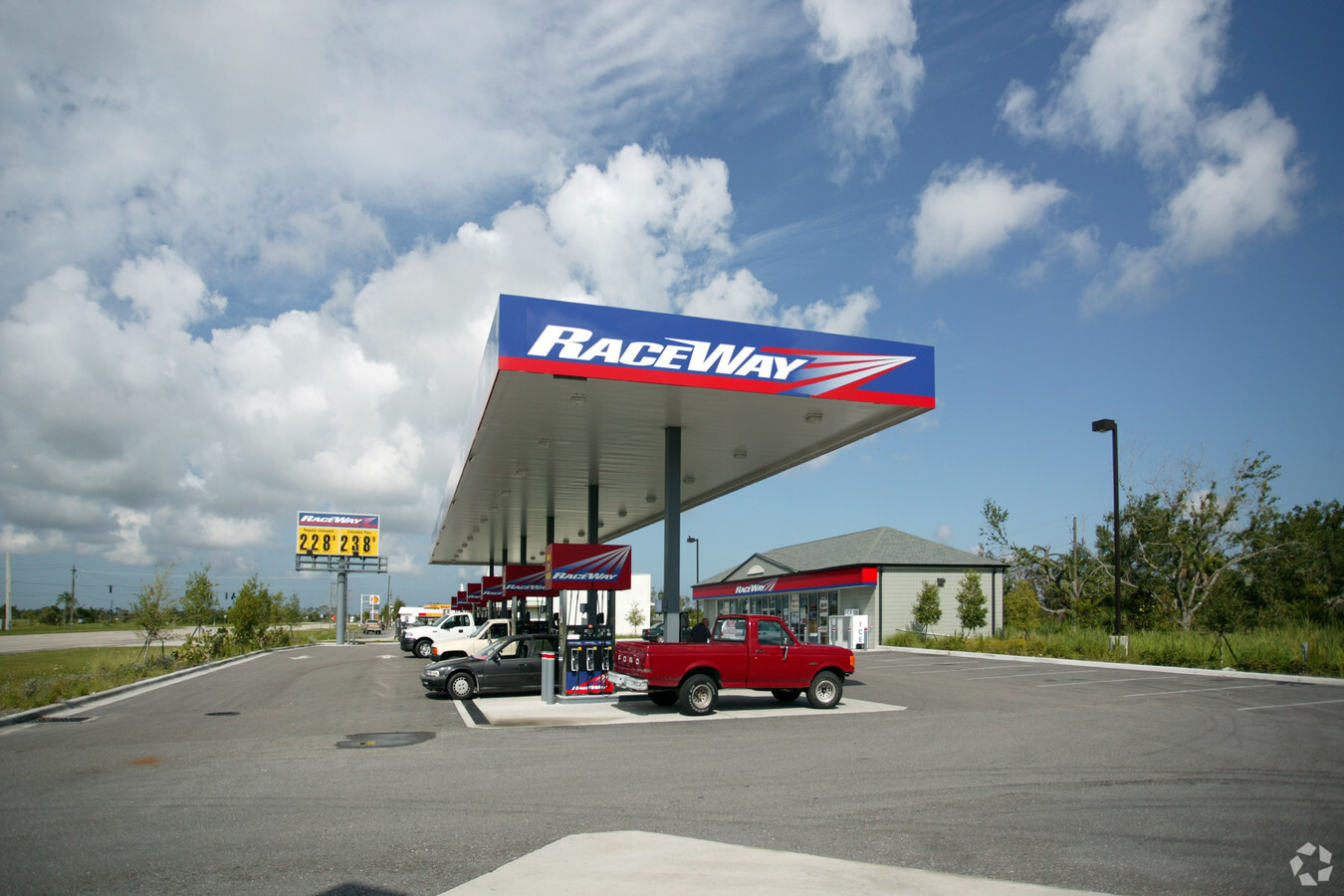
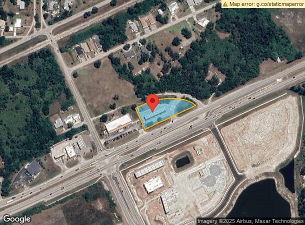
Property Record
6077 Duncan Rd, Punta Gorda, FL 33950
NEARBY LISTINGS FOR SALE OR LEASE
Property Detail
6077 Duncan Rd
Punta Gorda, FL
Golf Club Ests
412304231002
GOLF CLUB ESTS BLK K LOTS 7 8 910 11 12 13 14 17 18 19 20 LESS PT OF LTS 11 12 13 14 15 16 17 18 19 20 TAKEN BY DOT FOR US 17 440/320 458/553 556/316 1862/296 2307/1588 E2535/2119 E3478/349 UNREC NAME CHANGE
Servicestationmarket
Charlotte
AE
Florida
12015C0234G
7,11
2023
1.09 AC
2023
Charlotte County
010200
Southwest Florida
7,280 SF
DEMOGRAPHICS near 6077 Duncan Rd
1 Mile
3 Mile
5 Mile
2024 Total Population
1,748
12,979
57,791
2029 Population
2,103
15,704
69,681
Pop Growth 2024-2029
+ 20.31%
+ 21.00%
+ 20.57%
Average Age
55
49
56
2024 Total Households
827
6,042
27,727
HH Growth 2024-2029
+ 20.44%
+ 21.23%
+ 20.89%
Median Household Inc
$36,159
$41,077
$56,131
Avg Household Size
2.00
2.10
2.00
2024 Avg HH Vehicles
1.00
2.00
2.00
Median Home Value
$163,311
$207,667
$266,837
Median Year Built
1993
1991
1991
Nearby Places
- Restaurants
- Banks
- Shops
- Fitness
- Groceries
PUBLIC TRANSPORTATION
AIRPORT
Punta Gorda
DRIVE
WALK
Distance
Punta Gorda
6 min
2.8 mi
Freight Ports
Port Manatee
DRIVE
WALK
Distance
Port Manatee
83 min
71.1 mi
Nearby Properties
Address
Land Use
TOTAL SIZE
Lot Size
Zoning
Address
Land Use
TOTAL SIZE
Lot Size
Zoning
349,844 SF
78.47 AC
P
Address
Land Use
TOTAL SIZE
Lot Size
Zoning
163,527 SF
44.20 AC
ECAP
Address
Land Use
TOTAL SIZE
Lot Size
Zoning
77,154 SF
10.30 AC
PD-P
Address
Land Use
TOTAL SIZE
Lot Size
Zoning
161,439 SF
171 AC
RE1
Address
Land Use
TOTAL SIZE
Lot Size
Zoning
345,043 SF
33.12 AC
ECAP
Address
Land Use
TOTAL SIZE
Lot Size
Zoning
121,585 SF
696.03 AC
RE1
Address
Land Use
TOTAL SIZE
Lot Size
Zoning
47,443 SF
7.94 AC
CC
Address
Land Use
TOTAL SIZE
Lot Size
Zoning
62,415 SF
281.65 AC
ECAP
Address
Land Use
TOTAL SIZE
Lot Size
Zoning
15,253 SF
13.27 AC
P
Address
Land Use
TOTAL SIZE
Lot Size
Zoning
134,308 SF
16 AC
RSF3.5
Address
Land Use
TOTAL SIZE
Lot Size
Zoning
44,185 SF
1.16 AC
CC
Address
Land Use
TOTAL SIZE
Lot Size
Zoning
6,313 SF
15.49 AC
P
Address
Land Use
TOTAL SIZE
Lot Size
Zoning
208,560 SF
36.69 AC
PD-GM
Address
Land Use
TOTAL SIZE
Lot Size
Zoning
279,650 SF
374.81 AC
ECAP
Address
Land Use
TOTAL SIZE
Lot Size
Zoning
31,608 SF
8.02 AC
NC
Address
Land Use
TOTAL SIZE
Lot Size
Zoning
24,580 SF
84.50 AC
PKR
Address
Land Use
TOTAL SIZE
Lot Size
Zoning
12,159 SF
0.56 AC
PD-CC
Address
Land Use
TOTAL SIZE
Lot Size
Zoning
43,914 SF
4.06 AC
HC
Address
Land Use
TOTAL SIZE
Lot Size
Zoning
116,186 SF
20.02 AC
RMF10
Address
Land Use
TOTAL SIZE
Lot Size
Zoning
49,958 SF
6.81 AC
CC
Address
Land Use
TOTAL SIZE
Lot Size
Zoning
82,379 SF
0.88 AC
CC
Address
Land Use
TOTAL SIZE
Lot Size
Zoning
30,940 SF
0.41 AC
NC
Address
Land Use
TOTAL SIZE
Lot Size
Zoning
68,492 SF
6.38 AC
HC
Address
Land Use
TOTAL SIZE
Lot Size
Zoning
43,755 SF
8.18 AC
CC
Address
Land Use
TOTAL SIZE
Lot Size
Zoning
25,356 SF
1.40 AC
CC
Address
Land Use
TOTAL SIZE
Lot Size
Zoning
63,902 SF
5.87 AC
HC
Address
Land Use
TOTAL SIZE
Lot Size
Zoning
37,155 SF
3.98 AC
NR-10
Address
Land Use
TOTAL SIZE
Lot Size
Zoning
10,395 SF
0.66 AC
CC
Address
Land Use
TOTAL SIZE
Lot Size
Zoning
181,137 SF
12.34 AC
NR-15
Address
Land Use
TOTAL SIZE
Lot Size
Zoning
17.06 AC
CG
The World's #1 Commercial Real Estate Marketplace
Connect with us
© 2025 CoStar Group
The information above has been obtained from sources believed reliable. While we do not doubt its accuracy we have not verified it and make no guarantee, warranty or representation about it. It is your responsibility to independently confirm its accuracy and completeness. Any projections, opinions, assumptions, or estimates used are for example only and do not represent the current or future performance of the property. The value of this transaction to you depends on tax and other factors which should be evaluated by your tax, financial, and legal advisors. You and your advisors should conduct a careful, independent investigation of the property to determine to your satisfaction the suitability of the property for your needs.