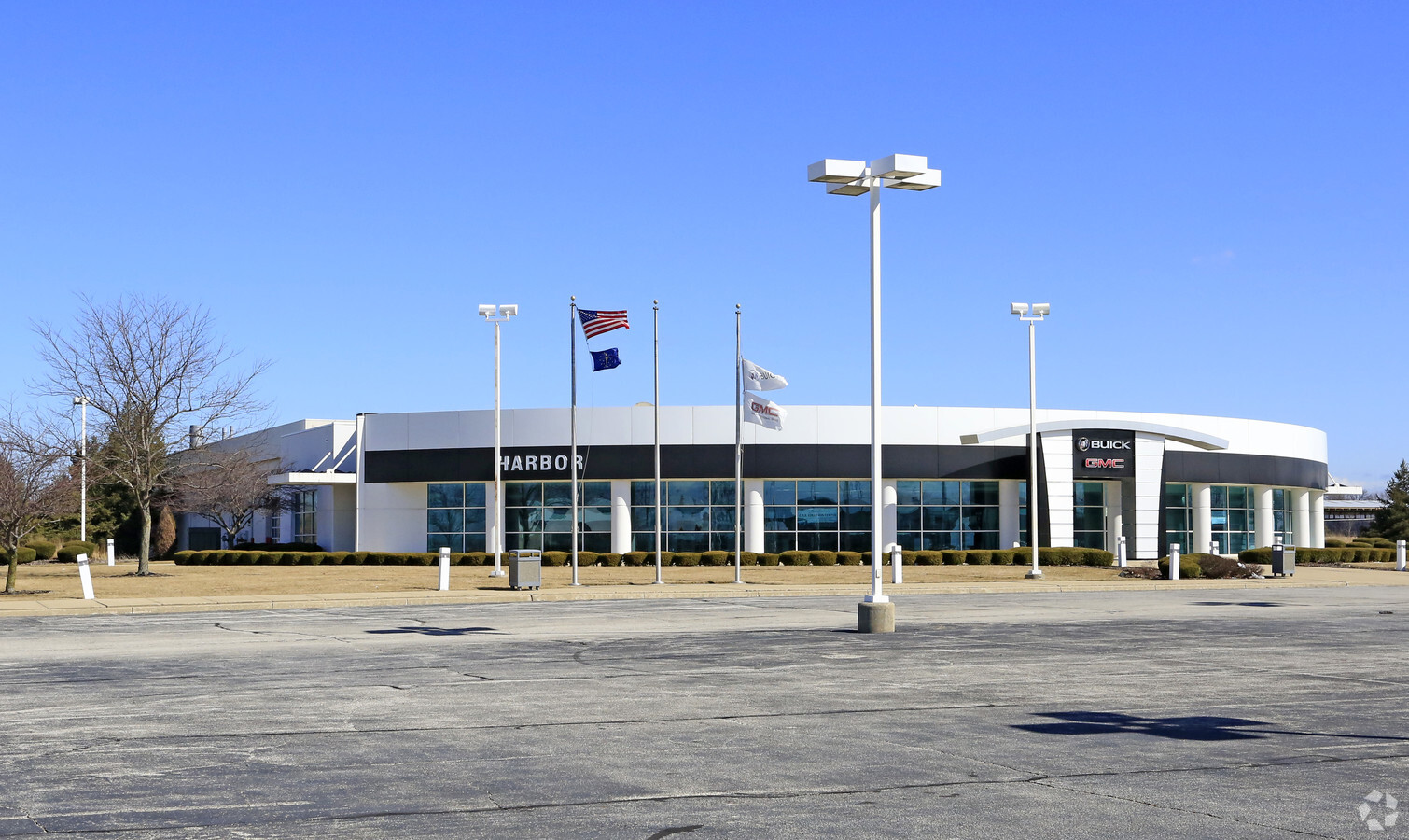
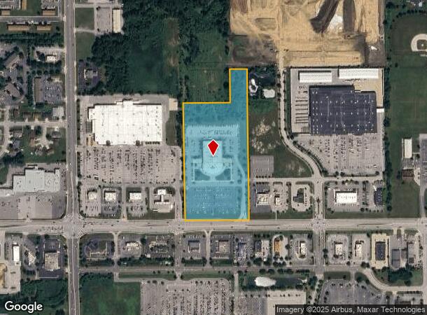
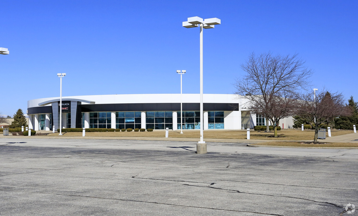
Property Record
6100 Us Highway 6, Portage, IN 46368

NEARBY LISTINGS FOR SALE OR LEASE
Property Detail
6100 Us Highway 6
64-05-24-351-005.000-016
PAR E536.5 S1327.8 EX N287.81W390SE SW24-36-7 EX PT SLD STATE 13.058A TIF DITCH
Vehiclerentalsvehiclesales
Porter
X
Indiana
18127C0116D
13.06 AC
2023
Porter County
2023
Chicago
050506
Chicago-Naperville-Elgin, IL-IN-WI
42,066 SF
DEMOGRAPHICS near 6100 Us Highway 6
1 Mile
3 Mile
5 Mile
2024 Total Population
6,469
47,043
85,514
2029 Population
6,573
47,831
86,616
Pop Growth 2024-2029
+ 1.61%
+ 1.68%
+ 1.29%
Average Age
41
40
40
2024 Total Households
2,528
18,092
33,082
HH Growth 2024-2029
+ 1.58%
+ 1.70%
+ 1.31%
Median Household Inc
$67,928
$65,252
$65,497
Avg Household Size
2.40
2.50
2.50
2024 Avg HH Vehicles
2.00
2.00
2.00
Median Home Value
$205,863
$171,237
$180,377
Median Year Built
1988
1976
1976
Nearby Places
- Restaurants
- Banks
- Shops
- Fitness
- Groceries
PUBLIC TRANSPORTATION
COMMUTER RAIL
Ogden Dunes (Portage) Station (South Shore Line - Northern Indiana Commuter Transportation District (South Shore Line))
DRIVE
WALK
Distance
Ogden Dunes (Portage) Station (South Shore Line - Northern Indiana Commuter Transportation District (South Shore Line))
12 min
6.2 mi
Miller (Gary) Station (South Shore Line - Northern Indiana Commuter Transportation District (South Shore Line))
DRIVE
WALK
Distance
Miller (Gary) Station (South Shore Line - Northern Indiana Commuter Transportation District (South Shore Line))
16 min
7.7 mi
Freight Ports
Port Milwaukee
DRIVE
WALK
Distance
Port Milwaukee
161 min
127.3 mi
Nearby Properties
Address
Land Use
TOTAL SIZE
Lot Size
Zoning
Address
Land Use
TOTAL SIZE
Lot Size
Zoning
218,452 SF
18.01 AC
Address
Land Use
TOTAL SIZE
Lot Size
Zoning
215,770 SF
16.52 AC
Address
Land Use
TOTAL SIZE
Lot Size
Zoning
112,216 SF
9.98 AC
Address
Land Use
TOTAL SIZE
Lot Size
Zoning
169,427 SF
8.70 AC
Address
Land Use
TOTAL SIZE
Lot Size
Zoning
69,459 SF
13.97 AC
Address
Land Use
TOTAL SIZE
Lot Size
Zoning
223,221 SF
16.69 AC
Address
Land Use
TOTAL SIZE
Lot Size
Zoning
95,281 SF
6.74 AC
Address
Land Use
TOTAL SIZE
Lot Size
Zoning
168,126 SF
13.79 AC
Address
Land Use
TOTAL SIZE
Lot Size
Zoning
50,382 SF
9.83 AC
Address
Land Use
TOTAL SIZE
Lot Size
Zoning
191,547 SF
18.29 AC
Address
Land Use
TOTAL SIZE
Lot Size
Zoning
48,955 SF
14.50 AC
Address
Land Use
TOTAL SIZE
Lot Size
Zoning
70,762 SF
3.04 AC
Address
Land Use
TOTAL SIZE
Lot Size
Zoning
159,933 SF
142.83 AC
Address
Land Use
TOTAL SIZE
Lot Size
Zoning
133,249 SF
11.80 AC
Address
Land Use
TOTAL SIZE
Lot Size
Zoning
39,644 SF
2.84 AC
Address
Land Use
TOTAL SIZE
Lot Size
Zoning
70,454 SF
1.14 AC
Address
Land Use
TOTAL SIZE
Lot Size
Zoning
70,454 SF
1.20 AC
Address
Land Use
TOTAL SIZE
Lot Size
Zoning
89,232 SF
7.70 AC
Address
Land Use
TOTAL SIZE
Lot Size
Zoning
108,527 SF
10.52 AC
Address
Land Use
TOTAL SIZE
Lot Size
Zoning
124,160 SF
20.84 AC
Address
Land Use
TOTAL SIZE
Lot Size
Zoning
134,075 SF
12.39 AC
Address
Land Use
TOTAL SIZE
Lot Size
Zoning
140,434 SF
15.26 AC
Address
Land Use
TOTAL SIZE
Lot Size
Zoning
29,251 SF
25.96 AC
Address
Land Use
TOTAL SIZE
Lot Size
Zoning
37,252 SF
5.72 AC
Address
Land Use
TOTAL SIZE
Lot Size
Zoning
96,488 SF
10.21 AC
Address
Land Use
TOTAL SIZE
Lot Size
Zoning
50,712 SF
2.59 AC
Address
Land Use
TOTAL SIZE
Lot Size
Zoning
52,478 SF
12.18 AC
Address
Land Use
TOTAL SIZE
Lot Size
Zoning
67,072 SF
6.70 AC
Address
Land Use
TOTAL SIZE
Lot Size
Zoning
48,153 SF
5.13 AC
The World's #1 Commercial Real Estate Marketplace
Connect with us
© 2025 CoStar Group
The information above has been obtained from sources believed reliable. While we do not doubt its accuracy we have not verified it and make no guarantee, warranty or representation about it. It is your responsibility to independently confirm its accuracy and completeness. Any projections, opinions, assumptions, or estimates used are for example only and do not represent the current or future performance of the property. The value of this transaction to you depends on tax and other factors which should be evaluated by your tax, financial, and legal advisors. You and your advisors should conduct a careful, independent investigation of the property to determine to your satisfaction the suitability of the property for your needs.