Property Record
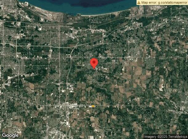
6106 E 83Rd Ave, Hobart, IN 46342

This Property Is For Sale
NEARBY LISTINGS FOR SALE OR LEASE
Property Detail
6106 E 83Rd Ave
Chicago-Naperville-Elgin, IL-IN-WI
Enterprise Pk
45-13-19-400-004.000-046
W.936.39FT OF E.1466.39FT OF N.500FT LYG S. OF RT #30 SE1/4 S.19 T.35 R.7 EX. S.60FT 9.43AC
Agriculturalland
Lake
X
Indiana
18089C0257E
1
2023
9.43 AC
2024
Indiana
042200
Chicago
DEMOGRAPHICS near 6106 E 83Rd Ave
1 Mile
3 Mile
5 Mile
2024 Total Population
399
8,624
54,975
2029 Population
396
8,577
55,189
Pop Growth 2024-2029
(0.75%)
(0.54%)
+ 0.39%
Average Age
46
43
42
2024 Total Households
152
3,559
21,770
HH Growth 2024-2029
(0.66%)
(0.59%)
+ 0.35%
Median Household Inc
$100,962
$82,863
$78,560
Avg Household Size
2.60
2.40
2.50
2024 Avg HH Vehicles
2.00
2.00
2.00
Median Home Value
$248,876
$246,090
$221,624
Median Year Built
1971
1989
1983
Nearby Places
- Restaurants
- Banks
- Shops
- Fitness
- Groceries
PUBLIC TRANSPORTATION
COMMUTER RAIL
Miller (Gary) Station (South Shore Line - Northern Indiana Commuter Transportation District (South Shore Line))
DRIVE
WALK
Distance
Miller (Gary) Station (South Shore Line - Northern Indiana Commuter Transportation District (South Shore Line))
15 min
6.0 mi
Freight Ports
Port Milwaukee
DRIVE
WALK
Distance
Port Milwaukee
162 min
123.6 mi
Nearby Properties
Address
Land Use
TOTAL SIZE
Lot Size
Zoning
Address
Land Use
TOTAL SIZE
Lot Size
Zoning
862,805 SF
36.93 AC
R33
Address
Land Use
TOTAL SIZE
Lot Size
Zoning
83,904 SF
15.47 AC
Address
Land Use
TOTAL SIZE
Lot Size
Zoning
159,954 SF
8.49 AC
Address
Land Use
TOTAL SIZE
Lot Size
Zoning
161,118 SF
22.13 AC
R33
Address
Land Use
TOTAL SIZE
Lot Size
Zoning
212,330 SF
10.70 AC
Address
Land Use
TOTAL SIZE
Lot Size
Zoning
102,255 SF
3.96 AC
R33
Address
Land Use
TOTAL SIZE
Lot Size
Zoning
64,619 SF
4.21 AC
Address
Land Use
TOTAL SIZE
Lot Size
Zoning
100,690 SF
15.44 AC
Address
Land Use
TOTAL SIZE
Lot Size
Zoning
46,093 SF
4.66 AC
Address
Land Use
TOTAL SIZE
Lot Size
Zoning
105,865 SF
9.09 AC
Address
Land Use
TOTAL SIZE
Lot Size
Zoning
48,228 SF
4.53 AC
Address
Land Use
TOTAL SIZE
Lot Size
Zoning
16,300 SF
2.31 AC
Address
Land Use
TOTAL SIZE
Lot Size
Zoning
65,216 SF
7.61 AC
R33
Address
Land Use
TOTAL SIZE
Lot Size
Zoning
29,251 SF
25.96 AC
Address
Land Use
TOTAL SIZE
Lot Size
Zoning
52,442 SF
4.48 AC
Address
Land Use
TOTAL SIZE
Lot Size
Zoning
41,211 SF
1.89 AC
R33
Address
Land Use
TOTAL SIZE
Lot Size
Zoning
15,568 SF
6.63 AC
R33
Address
Land Use
TOTAL SIZE
Lot Size
Zoning
17,421 SF
8.70 AC
R33
Address
Land Use
TOTAL SIZE
Lot Size
Zoning
70,294 SF
5.42 AC
Address
Land Use
TOTAL SIZE
Lot Size
Zoning
34,345 SF
16.91 AC
Address
Land Use
TOTAL SIZE
Lot Size
Zoning
88,300 SF
5.11 AC
Address
Land Use
TOTAL SIZE
Lot Size
Zoning
26,056 SF
1.13 AC
R33
Address
Land Use
TOTAL SIZE
Lot Size
Zoning
34,804 SF
14 AC
Address
Land Use
TOTAL SIZE
Lot Size
Zoning
14,992 SF
1.54 AC
R33
Address
Land Use
TOTAL SIZE
Lot Size
Zoning
54,718 SF
14.90 AC
Address
Land Use
TOTAL SIZE
Lot Size
Zoning
13,017 SF
1.78 AC
Address
Land Use
TOTAL SIZE
Lot Size
Zoning
55,760 SF
2 AC
Address
Land Use
TOTAL SIZE
Lot Size
Zoning
23,328 SF
1.07 AC
Address
Land Use
TOTAL SIZE
Lot Size
Zoning
12,996 SF
1.65 AC
Address
Land Use
TOTAL SIZE
Lot Size
Zoning
15,056 SF
1.53 AC
R33
The World's #1 Commercial Real Estate Marketplace
Connect with us
© 2025 CoStar Group
The information above has been obtained from sources believed reliable. While we do not doubt its accuracy we have not verified it and make no guarantee, warranty or representation about it. It is your responsibility to independently confirm its accuracy and completeness. Any projections, opinions, assumptions, or estimates used are for example only and do not represent the current or future performance of the property. The value of this transaction to you depends on tax and other factors which should be evaluated by your tax, financial, and legal advisors. You and your advisors should conduct a careful, independent investigation of the property to determine to your satisfaction the suitability of the property for your needs.