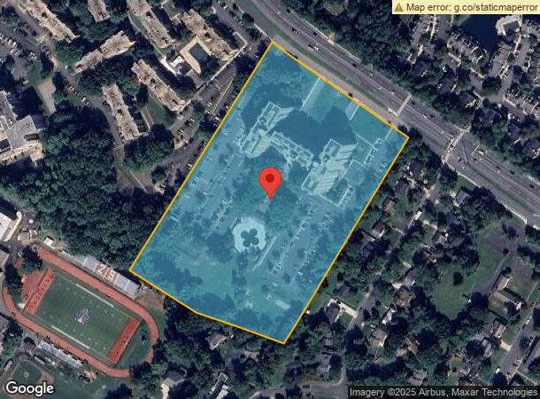
Property Record
6129 Leesburg Pike, Falls Church, VA 22041


NEARBY LISTINGS FOR SALE OR LEASE
Property Detail
6129 Leesburg Pike
Washington-Arlington-Alexandria, DC-VA-MD-WV
Munson Hill
0611-01-0011
MUNSON HILL PT PCL A
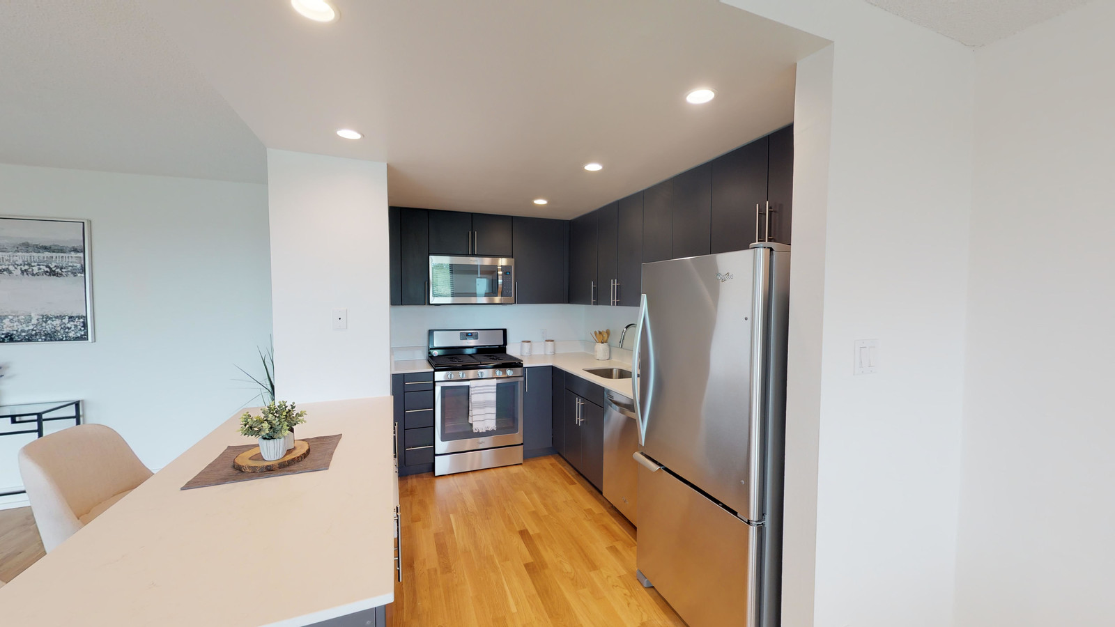
Apartment
Fairfax
X
Virginia
5100540050D
11
2023
12.53 AC
2023
Lake Barcroft
4516022001
Washington, DC
331,277 SF
DEMOGRAPHICS near 6129 Leesburg Pike
1 Mile
3 Mile
5 Mile
2024 Total Population
24,056
247,282
568,263
2029 Population
23,729
243,998
558,557
Pop Growth 2024-2029
(1.36%)
(1.33%)
(1.71%)
Average Age
38
38
38
2024 Total Households
8,086
99,004
235,198
HH Growth 2024-2029
(1.64%)
(1.34%)
(1.82%)
Median Household Inc
$77,132
$109,990
$116,565
Avg Household Size
2.80
2.40
2.30
2024 Avg HH Vehicles
2.00
2.00
2.00
Median Home Value
$682,873
$688,471
$708,034
Median Year Built
1965
1970
1973
Nearby Places
- Restaurants
- Banks
- Shops
- Fitness
- Groceries
PUBLIC TRANSPORTATION
COMMUTER RAIL
Backlick Road (Manassas Line - Virginia Railway Express)
DRIVE
WALK
Distance
Backlick Road (Manassas Line - Virginia Railway Express)
14 min
6.5 mi
Crystal City (Fredericksburg Line - Virginia Railway Express, Manassas Line - Virginia Railway Express)
DRIVE
WALK
Distance
Crystal City (Fredericksburg Line - Virginia Railway Express, Manassas Line - Virginia Railway Express)
14 min
6.6 mi
AIRPORT
Ronald Reagan Washington Ntl
DRIVE
WALK
Distance
Ronald Reagan Washington Ntl
15 min
7.6 mi
Washington Dulles International
DRIVE
WALK
Distance
Washington Dulles International
38 min
21.8 mi
Freight Ports
Port of Baltimore
DRIVE
WALK
Distance
Port of Baltimore
72 min
47.7 mi
Nearby Properties
Address
Land Use
TOTAL SIZE
Lot Size
Zoning
Address
Land Use
TOTAL SIZE
Lot Size
Zoning
1,732,719 SF
15.91 AC
CDD#4
Address
Land Use
TOTAL SIZE
Lot Size
Zoning
20.19 AC
S-3A/S-D
Address
Land Use
TOTAL SIZE
Lot Size
Zoning
1,882 SF
0.97 AC
C-O-A
Address
Land Use
TOTAL SIZE
Lot Size
Zoning
62,298 SF
2.58 AC
R-5
Address
Land Use
TOTAL SIZE
Lot Size
Zoning
1,174,771 SF
20.30 AC
RA
Address
Land Use
TOTAL SIZE
Lot Size
Zoning
986,000 SF
2.30 AC
C-O-A
Address
Land Use
TOTAL SIZE
Lot Size
Zoning
924,015 SF
89.81 AC
S-3A
Address
Land Use
TOTAL SIZE
Lot Size
Zoning
12,786 SF
2.19 AC
C-2
Address
Land Use
TOTAL SIZE
Lot Size
Zoning
224,700 SF
1.30 AC
C-O-2.5
Address
Land Use
TOTAL SIZE
Lot Size
Zoning
9,800 SF
1.40 AC
C-O-A
Address
Land Use
TOTAL SIZE
Lot Size
Zoning
0.94 AC
C-O-2.5
Address
Land Use
TOTAL SIZE
Lot Size
Zoning
523,155 SF
1.76 AC
RA-H-3.2
Address
Land Use
TOTAL SIZE
Lot Size
Zoning
355,530 SF
1.95 AC
C-O-2.5
Address
Land Use
TOTAL SIZE
Lot Size
Zoning
309,281 SF
1.44 AC
C-O-2.5
Address
Land Use
TOTAL SIZE
Lot Size
Zoning
512,045 SF
12.94 AC
CDD#4
Address
Land Use
TOTAL SIZE
Lot Size
Zoning
744,702 SF
8.19 AC
C-O/C-O-1.
Address
Land Use
TOTAL SIZE
Lot Size
Zoning
60.60 AC
CDD#4
Address
Land Use
TOTAL SIZE
Lot Size
Zoning
585,900 SF
2.60 AC
C-O-A
Address
Land Use
TOTAL SIZE
Lot Size
Zoning
8,000 SF
0.60 AC
C-O-A
Address
Land Use
TOTAL SIZE
Lot Size
Zoning
474,000 SF
3.68 AC
CRMU/H
Address
Land Use
TOTAL SIZE
Lot Size
Zoning
463,979 SF
19.23 AC
R-20
Address
Land Use
TOTAL SIZE
Lot Size
Zoning
30 AC
CDD#4
Address
Land Use
TOTAL SIZE
Lot Size
Zoning
460,082 SF
10.53 AC
CRMU/H
Address
Land Use
TOTAL SIZE
Lot Size
Zoning
4,795 SF
1.32 AC
RA-H-3.2
Address
Land Use
TOTAL SIZE
Lot Size
Zoning
498,506 SF
6.97 AC
PRM
Address
Land Use
TOTAL SIZE
Lot Size
Zoning
337,770 SF
1.15 AC
C-O-A
Address
Land Use
TOTAL SIZE
Lot Size
Zoning
989,001 SF
4.14 AC
C-O-2.5
Address
Land Use
TOTAL SIZE
Lot Size
Zoning
996,000 SF
1.20 AC
C-O-A
Address
Land Use
TOTAL SIZE
Lot Size
Zoning
151,400 SF
32.23 AC
S-3A
Address
Land Use
TOTAL SIZE
Lot Size
Zoning
853,724 SF
32.32 AC
R-20
The World's #1 Commercial Real Estate Marketplace
Connect with us
© 2025 CoStar Group
The information above has been obtained from sources believed reliable. While we do not doubt its accuracy we have not verified it and make no guarantee, warranty or representation about it. It is your responsibility to independently confirm its accuracy and completeness. Any projections, opinions, assumptions, or estimates used are for example only and do not represent the current or future performance of the property. The value of this transaction to you depends on tax and other factors which should be evaluated by your tax, financial, and legal advisors. You and your advisors should conduct a careful, independent investigation of the property to determine to your satisfaction the suitability of the property for your needs.