Property Record
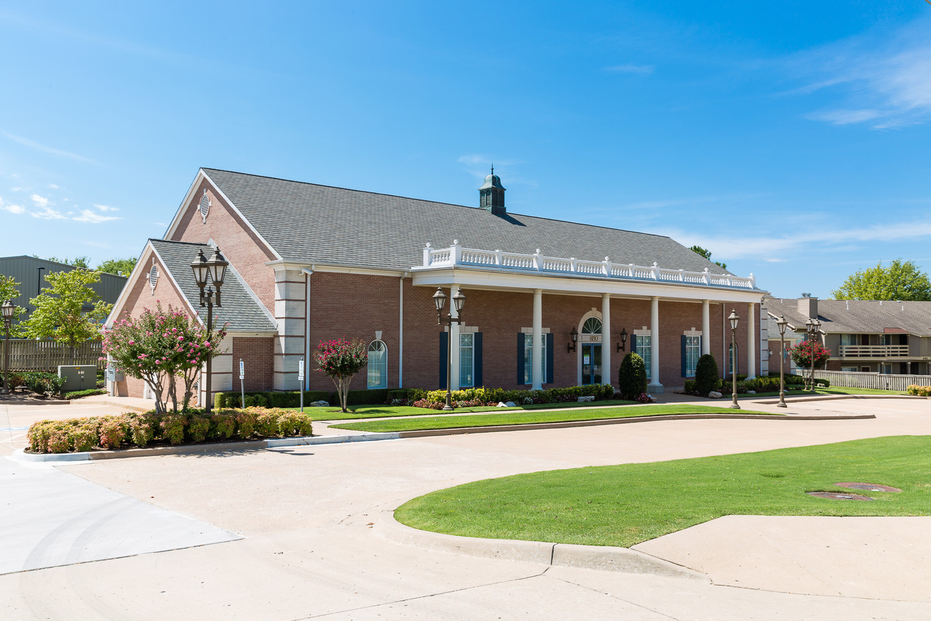
6130 E 81St St, Tulsa, OK 74137


Current Lease Availabilities
NEARBY LISTINGS FOR SALE OR LEASE
Property Detail
6130 E 81St St
Tulsa, OK
8100 Bank South
78070-83-15-00020
LT 1 BLK 1
Officebuilding
Tulsa
X
Oklahoma
40143C0367L
1
2023
1.64 AC
2024
South Central
007632
Tulsa
11,784 SF
DEMOGRAPHICS near 6130 E 81St St
1 Mile
3 Mile
5 Mile
2024 Total Population
12,865
90,910
210,377
2029 Population
13,180
93,628
217,223
Pop Growth 2024-2029
+ 2.45%
+ 2.99%
+ 3.25%
Average Age
41
41
40
2024 Total Households
5,671
38,682
88,796
HH Growth 2024-2029
+ 2.57%
+ 3.02%
+ 3.30%
Median Household Inc
$80,096
$72,013
$64,787
Avg Household Size
2.20
2.20
2.30
2024 Avg HH Vehicles
2.00
2.00
2.00
Median Home Value
$252,240
$253,298
$243,803
Median Year Built
1984
1984
1982
Nearby Places
- Restaurants
- Banks
- Shops
- Fitness
- Groceries
PUBLIC TRANSPORTATION
AIRPORT
Tulsa International
DRIVE
WALK
Distance
Tulsa International
25 min
12.7 mi
Freight Ports
Tulsa Port Of Catoosa
DRIVE
WALK
Distance
Tulsa Port Of Catoosa
29 min
21.3 mi
Nearby Properties
Address
Land Use
TOTAL SIZE
Lot Size
Zoning
Address
Land Use
TOTAL SIZE
Lot Size
Zoning
2,622,731 SF
26.90 AC
OH
Address
Land Use
TOTAL SIZE
Lot Size
Zoning
717,386 SF
49.74 AC
OL
Address
Land Use
TOTAL SIZE
Lot Size
Zoning
815,416 SF
149.86 AC
RS3
Address
Land Use
TOTAL SIZE
Lot Size
Zoning
323,882 SF
20 AC
CO
Address
Land Use
TOTAL SIZE
Lot Size
Zoning
157,138 SF
9.28 AC
CO
Address
Land Use
TOTAL SIZE
Lot Size
Zoning
184,679 SF
33.97 AC
AG
Address
Land Use
TOTAL SIZE
Lot Size
Zoning
236,738 SF
11.56 AC
PUD
Address
Land Use
TOTAL SIZE
Lot Size
Zoning
139,648 SF
20.75 AC
RS3
Address
Land Use
TOTAL SIZE
Lot Size
Zoning
204,580 SF
78.45 AC
AG
Address
Land Use
TOTAL SIZE
Lot Size
Zoning
162,957 SF
29.92 AC
AG
Address
Land Use
TOTAL SIZE
Lot Size
Zoning
592,682 SF
30.42 AC
CO
Address
Land Use
TOTAL SIZE
Lot Size
Zoning
55,384 SF
14.81 AC
AG
Address
Land Use
TOTAL SIZE
Lot Size
Zoning
6,338 SF
104.15 AC
AG
Address
Land Use
TOTAL SIZE
Lot Size
Zoning
107,538 SF
19.74 AC
OM
Address
Land Use
TOTAL SIZE
Lot Size
Zoning
61,153 SF
7.16 AC
CH
Address
Land Use
TOTAL SIZE
Lot Size
Zoning
62,086 SF
79.79 AC
AG
Address
Land Use
TOTAL SIZE
Lot Size
Zoning
56,611 SF
26.92 AC
RS2
Address
Land Use
TOTAL SIZE
Lot Size
Zoning
8,388 SF
63.49 AC
AG
Address
Land Use
TOTAL SIZE
Lot Size
Zoning
176,243 SF
5.77 AC
CS
Address
Land Use
TOTAL SIZE
Lot Size
Zoning
65,812 SF
14.12 AC
RS1
Address
Land Use
TOTAL SIZE
Lot Size
Zoning
58,864 SF
5.18 AC
RS3
Address
Land Use
TOTAL SIZE
Lot Size
Zoning
65,385 SF
16.59 AC
AG
Address
Land Use
TOTAL SIZE
Lot Size
Zoning
33,668 SF
8.04 AC
CO
Address
Land Use
TOTAL SIZE
Lot Size
Zoning
27,278 SF
2.49 AC
CS
Address
Land Use
TOTAL SIZE
Lot Size
Zoning
2,178,542 SF
46.63 AC
OM
Address
Land Use
TOTAL SIZE
Lot Size
Zoning
86,747 SF
19.01 AC
RS3
Address
Land Use
TOTAL SIZE
Lot Size
Zoning
72,042 SF
5.10 AC
RS3
Address
Land Use
TOTAL SIZE
Lot Size
Zoning
355,931 SF
29.06 AC
RM1
Address
Land Use
TOTAL SIZE
Lot Size
Zoning
91,314 SF
19.62 AC
RS3
Address
Land Use
TOTAL SIZE
Lot Size
Zoning
35,785 SF
4.55 AC
RS1
The World's #1 Commercial Real Estate Marketplace
Connect with us
© 2025 CoStar Group
The information above has been obtained from sources believed reliable. While we do not doubt its accuracy we have not verified it and make no guarantee, warranty or representation about it. It is your responsibility to independently confirm its accuracy and completeness. Any projections, opinions, assumptions, or estimates used are for example only and do not represent the current or future performance of the property. The value of this transaction to you depends on tax and other factors which should be evaluated by your tax, financial, and legal advisors. You and your advisors should conduct a careful, independent investigation of the property to determine to your satisfaction the suitability of the property for your needs.