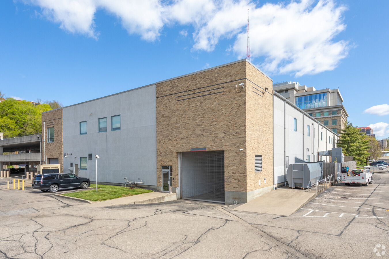
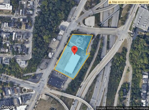
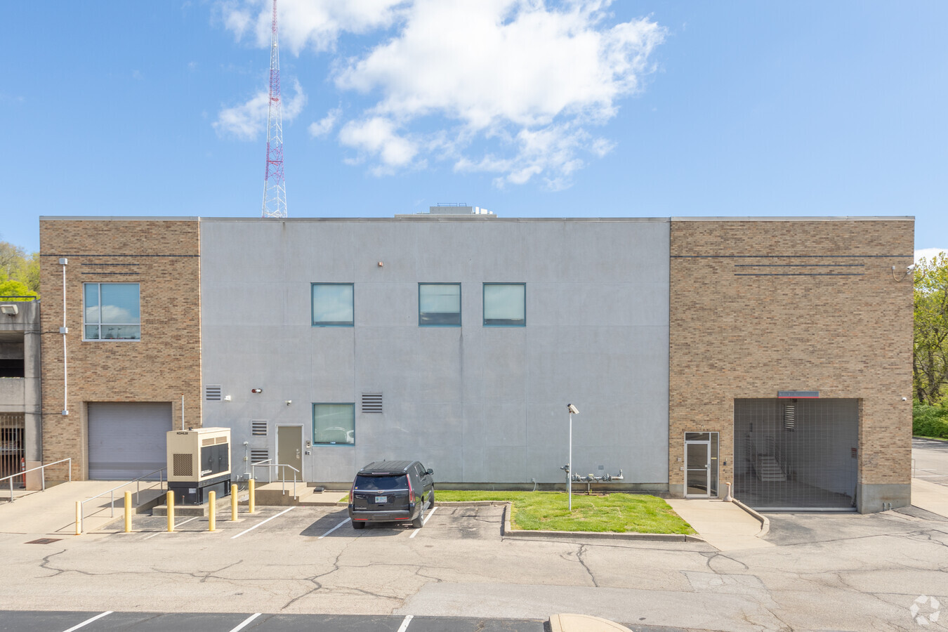
Property Record
615 Elsinore Pl, Cincinnati, OH 45202
NEARBY LISTINGS FOR SALE OR LEASE
Property Detail
615 Elsinore Pl
071-0001-0031
READING RD 3.411 ACS R2 T3 S7
Officebuilding
Hamilton
X
Ohio
21037C0007E
3.41 AC
2023
Clifton/Midtown
2023
Cincinnati/Dayton
001100
Cincinnati, OH-KY-IN
29,704 SF
DEMOGRAPHICS near 615 Elsinore Pl
1 Mile
3 Mile
5 Mile
2024 Total Population
23,739
159,854
328,263
2029 Population
24,360
163,313
331,950
Pop Growth 2024-2029
+ 2.62%
+ 2.16%
+ 1.12%
Average Age
37
36
37
2024 Total Households
12,500
73,258
145,795
HH Growth 2024-2029
+ 2.55%
+ 2.27%
+ 1.12%
Median Household Inc
$71,002
$47,939
$49,975
Avg Household Size
1.70
1.90
2.10
2024 Avg HH Vehicles
1.00
1.00
1.00
Median Home Value
$377,208
$238,539
$219,999
Median Year Built
1948
1949
1949
Nearby Places
- Restaurants
- Banks
- Shops
- Fitness
- Groceries
PUBLIC TRANSPORTATION
TRANSIT/SUBWAY
Hanke Exchange Station, 12Th & Main (Streetcar - OTR - Banks - Southwest Ohio Regional Transit Authority)
Drive
Walk
Distance
Hanke Exchange Station, 12Th & Main (Streetcar - OTR - Banks - Southwest Ohio Regional Transit Authority)
2 min
13 min
0.7 mi
Jack Casino Station, Main & Court (Streetcar - OTR - Banks - Southwest Ohio Regional Transit Authority)
Drive
Walk
Distance
Jack Casino Station, Main & Court (Streetcar - OTR - Banks - Southwest Ohio Regional Transit Authority)
3 min
14 min
0.7 mi
Central Parkway & Vine Station (Streetcar - OTR - Banks - Southwest Ohio Regional Transit Authority)
Drive
Walk
Distance
Central Parkway & Vine Station (Streetcar - OTR - Banks - Southwest Ohio Regional Transit Authority)
2 min
16 min
0.8 mi
8Th & Main Station (Streetcar - OTR - Banks - Southwest Ohio Regional Transit Authority)
Drive
Walk
Distance
8Th & Main Station (Streetcar - OTR - Banks - Southwest Ohio Regional Transit Authority)
2 min
16 min
0.8 mi
Public Library Station, 9Th & Walnut (Streetcar - OTR - Banks - Southwest Ohio Regional Transit Authority)
Drive
Walk
Distance
Public Library Station, 9Th & Walnut (Streetcar - OTR - Banks - Southwest Ohio Regional Transit Authority)
3 min
17 min
0.9 mi
COMMUTER RAIL
Cincinnati Union Terminal (Cardinal - Amtrak)
Drive
Walk
Distance
Cincinnati Union Terminal (Cardinal - Amtrak)
7 min
2.2 mi
AIRPORT
Cincinnati/Northern Kentucky International
Drive
Walk
Distance
Cincinnati/Northern Kentucky International
30 min
16.1 mi
Freight Ports
Port of Toledo
Drive
Walk
Distance
Port of Toledo
243 min
204.0 mi
SALE & LEASE HISTORY
LISTING DATE
SALE/LEASE

Jul 11, 2017
For Lease
Dec 13, 2018
For Lease
Nearby Properties
Address
Land Use
TOTAL SIZE
Lot Size
Zoning
Address
Land Use
TOTAL SIZE
Lot Size
Zoning
77.73 AC
IR
Address
Land Use
TOTAL SIZE
Lot Size
Zoning
6.35 AC
IR
Address
Land Use
TOTAL SIZE
Lot Size
Zoning
1.97 AC
DD
Address
Land Use
TOTAL SIZE
Lot Size
Zoning
39.99 AC
MG
Address
Land Use
TOTAL SIZE
Lot Size
Zoning
11.82 AC
Address
Land Use
TOTAL SIZE
Lot Size
Zoning
19.36 AC
Address
Land Use
TOTAL SIZE
Lot Size
Zoning
17.10 AC
DD
Address
Land Use
TOTAL SIZE
Lot Size
Zoning
62.10 AC
Address
Land Use
TOTAL SIZE
Lot Size
Zoning
11.40 AC
IR
Address
Land Use
TOTAL SIZE
Lot Size
Zoning
13.80 AC
Address
Land Use
TOTAL SIZE
Lot Size
Zoning
22.45 AC
Address
Land Use
TOTAL SIZE
Lot Size
Zoning
60750
1.52 AC
Address
Land Use
TOTAL SIZE
Lot Size
Zoning
263300
1.74 AC
Address
Land Use
TOTAL SIZE
Lot Size
Zoning
3.09 AC
Address
Land Use
TOTAL SIZE
Lot Size
Zoning
3.40 AC
IR
Address
Land Use
TOTAL SIZE
Lot Size
Zoning
89500
0.58 AC
Address
Land Use
TOTAL SIZE
Lot Size
Zoning
Address
Land Use
TOTAL SIZE
Lot Size
Zoning
Address
Land Use
TOTAL SIZE
Lot Size
Zoning
2.80 AC
IR
Address
Land Use
TOTAL SIZE
Lot Size
Zoning
2.60 AC
Address
Land Use
TOTAL SIZE
Lot Size
Zoning
3.51 AC
DD
Address
Land Use
TOTAL SIZE
Lot Size
Zoning
9962
712 AC
Address
Land Use
TOTAL SIZE
Lot Size
Zoning
Address
Land Use
TOTAL SIZE
Lot Size
Zoning
9.14 AC
Address
Land Use
TOTAL SIZE
Lot Size
Zoning
Address
Land Use
TOTAL SIZE
Lot Size
Zoning
165016
15.23 AC
Address
Land Use
TOTAL SIZE
Lot Size
Zoning
Address
Land Use
TOTAL SIZE
Lot Size
Zoning
7.14 AC
Address
Land Use
TOTAL SIZE
Lot Size
Zoning
147895
0.63 AC
Address
Land Use
TOTAL SIZE
Lot Size
Zoning
Start a new search to find other properties for sale or lease
Connect with us
© 2024 CoStar Group
The information above has been obtained from sources believed reliable. While we do not doubt its accuracy we have not verified it and make no guarantee, warranty or representation about it. It is your responsibility to independently confirm its accuracy and completeness. Any projections, opinions, assumptions, or estimates used are for example only and do not represent the current or future performance of the property. The value of this transaction to you depends on tax and other factors which should be evaluated by your tax, financial, and legal advisors. You and your advisors should conduct a careful, independent investigation of the property to determine to your satisfaction the suitability of the property for your needs.