Property Record
615 Railroad Ave, Centreville, MD 21617
NEARBY LISTINGS FOR SALE OR LEASE
-
-
View all Centreville listings for lease on LoopNet.com
Property Detail
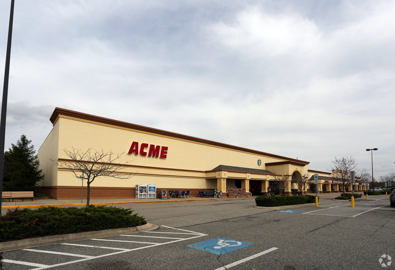
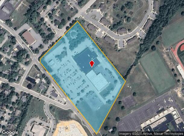
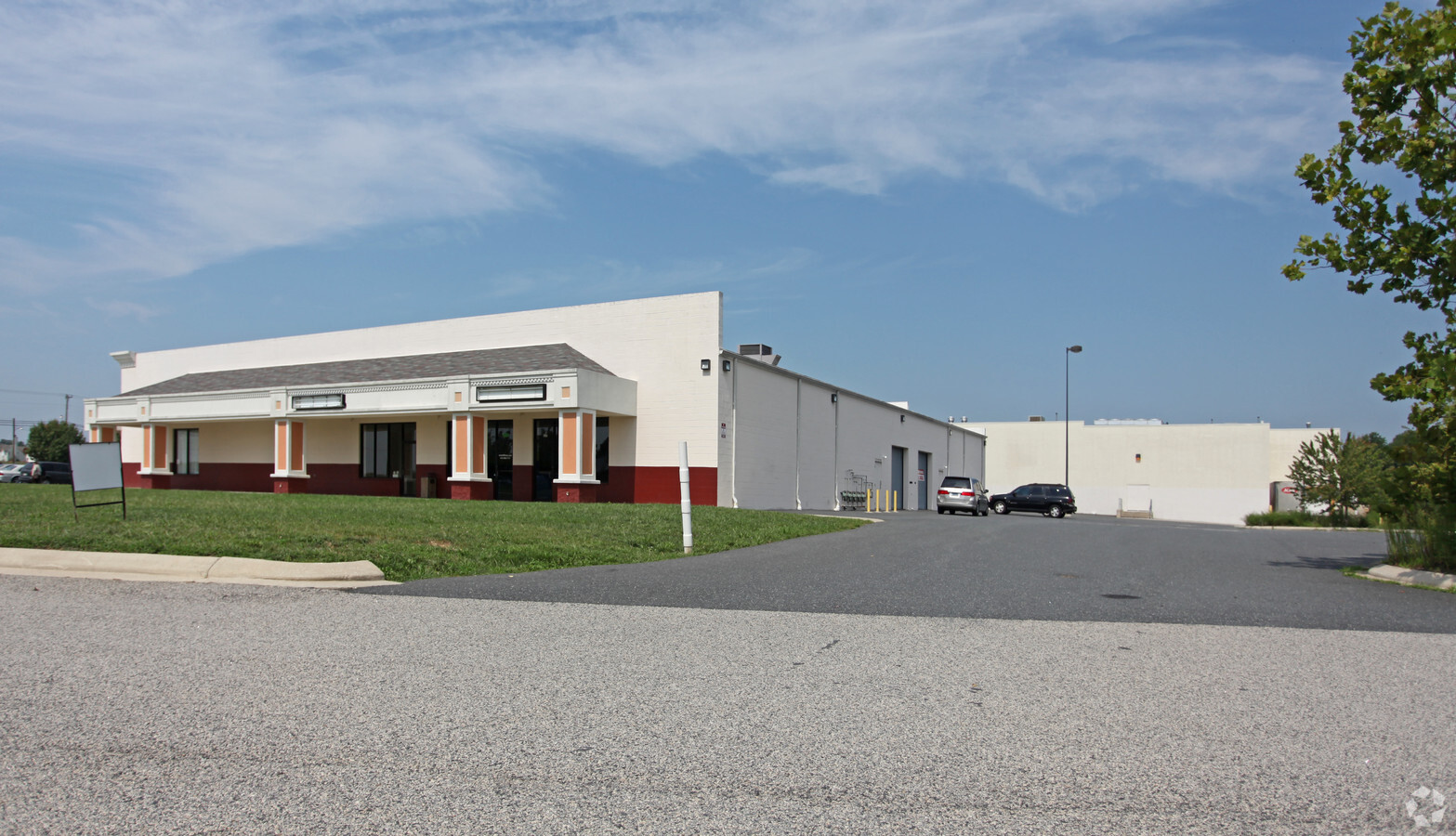
615 Railroad Ave
03-034631
Little Hut Limited Partnership
Stripcommercialcenter
10.953 A PT OF PAR D N/E MD RT 304 E/CENTREVILLE
X
Queen Annes
24035C0216D
Maryland
2024
10.95 AC
2024
Queen Anne's County
810400
Baltimore
22,866 SF
Baltimore-Columbia-Towson, MD
DEMOGRAPHICS near 615 Railroad Ave
1 Mile
3 Mile
5 Mile
2024 Total Population
2,420
6,944
9,017
2029 Population
2,631
7,520
9,764
Pop Growth 2024-2029
+ 8.72%
+ 8.29%
+ 8.28%
Average Age
46
42
42
2024 Total Households
1,021
2,635
3,432
HH Growth 2024-2029
+ 8.62%
+ 8.31%
+ 8.28%
Median Household Inc
$89,781
$112,547
$112,286
Avg Household Size
2.30
2.60
2.60
2024 Avg HH Vehicles
2.00
2.00
2.00
Median Home Value
$385,892
$394,669
$393,917
Median Year Built
1990
1999
1994
Nearby Places
- Restaurants
- Banks
- Shops
- Fitness
- Groceries
SALE & LEASE HISTORY
LISTING DATE
SALE/LEASE

May 09, 2017
For Lease
Nearby Properties
Address
Land Use
TOTAL SIZE
Lot Size
Zoning
Address
Land Use
TOTAL SIZE
Lot Size
Zoning
194,070 SF
141 AC
AG
Address
Land Use
TOTAL SIZE
Lot Size
Zoning
43,796 SF
1.25 AC
C-1
Address
Land Use
TOTAL SIZE
Lot Size
Zoning
25,085 SF
6.75 AC
C-3
Address
Land Use
TOTAL SIZE
Lot Size
Zoning
33,853 SF
11.82 AC
PBD
Address
Land Use
TOTAL SIZE
Lot Size
Zoning
4,684 SF
100 AC
CS
Address
Land Use
TOTAL SIZE
Lot Size
Zoning
4,416 SF
53.89 AC
SI
Address
Land Use
TOTAL SIZE
Lot Size
Zoning
3,182 SF
35.04 AC
R-2
Address
Land Use
TOTAL SIZE
Lot Size
Zoning
67,600 SF
5.50 AC
PBD
Address
Land Use
TOTAL SIZE
Lot Size
Zoning
59,719 SF
11.32 AC
Address
Land Use
TOTAL SIZE
Lot Size
Zoning
18,764 SF
5.06 AC
C-2
Address
Land Use
TOTAL SIZE
Lot Size
Zoning
53,556 SF
12.65 AC
R-2
Address
Land Use
TOTAL SIZE
Lot Size
Zoning
58,202 SF
12.05 AC
R-1
Address
Land Use
TOTAL SIZE
Lot Size
Zoning
912 SF
32.71 AC
SI
Address
Land Use
TOTAL SIZE
Lot Size
Zoning
19,409 SF
6.53 AC
CS
Address
Land Use
TOTAL SIZE
Lot Size
Zoning
2,700 SF
17.17 AC
C-3
Address
Land Use
TOTAL SIZE
Lot Size
Zoning
15,240 SF
49.73 AC
SI
Address
Land Use
TOTAL SIZE
Lot Size
Zoning
37,996 SF
1.52 AC
C-1
Address
Land Use
TOTAL SIZE
Lot Size
Zoning
3,162 SF
12.29 AC
SI
Address
Land Use
TOTAL SIZE
Lot Size
Zoning
13,851 SF
16.75 AC
R-1
Address
Land Use
TOTAL SIZE
Lot Size
Zoning
28,772 SF
1.87 AC
C-1
Address
Land Use
TOTAL SIZE
Lot Size
Zoning
37,884 SF
4.06 AC
PBD
Address
Land Use
TOTAL SIZE
Lot Size
Zoning
19,644 SF
0.71 AC
C-1
Address
Land Use
TOTAL SIZE
Lot Size
Zoning
5,724 SF
13.35 AC
C-3
Address
Land Use
TOTAL SIZE
Lot Size
Zoning
15,510 SF
3.46 AC
PBD
Address
Land Use
TOTAL SIZE
Lot Size
Zoning
5,889 SF
0.73 AC
NC-1
Address
Land Use
TOTAL SIZE
Lot Size
Zoning
9,400 SF
1.61 AC
R-2
Address
Land Use
TOTAL SIZE
Lot Size
Zoning
21,636 SF
2.20 AC
PBD
Address
Land Use
TOTAL SIZE
Lot Size
Zoning
64.97 AC
PBD
Address
Land Use
TOTAL SIZE
Lot Size
Zoning
15,357 SF
3.34 AC
R-1
The World's #1 Commercial Real Estate Marketplace
Connect with us
© 2025 CoStar Group
The information above has been obtained from sources believed reliable. While we do not doubt its accuracy we have not verified it and make no guarantee, warranty or representation about it. It is your responsibility to independently confirm its accuracy and completeness. Any projections, opinions, assumptions, or estimates used are for example only and do not represent the current or future performance of the property. The value of this transaction to you depends on tax and other factors which should be evaluated by your tax, financial, and legal advisors. You and your advisors should conduct a careful, independent investigation of the property to determine to your satisfaction the suitability of the property for your needs.