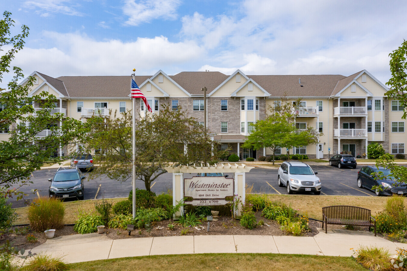
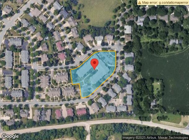
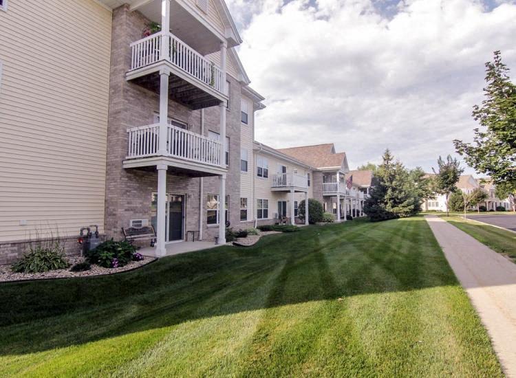
Property Record
6160 Dell Dr, Madison, WI 53718
NEARBY LISTINGS FOR SALE OR LEASE
Property Detail
6160 Dell Dr
Madison, WI
Richmond Hill
0710-141-0416-2
RICHMOND HILL, LOTS 152-159.
Commercialnec
Dane
X
Wisconsin
55025C0434H
152
2023
2.52 AC
2023
East Madison
011407
Milwaukee/Madison
91,524 SF
DEMOGRAPHICS near 6160 Dell Dr
1 Mile
3 Mile
5 Mile
2024 Total Population
7,813
40,054
108,381
2029 Population
8,132
41,496
112,658
Pop Growth 2024-2029
+ 4.08%
+ 3.60%
+ 3.95%
Average Age
42
41
40
2024 Total Households
3,451
17,665
48,644
HH Growth 2024-2029
+ 4.06%
+ 3.66%
+ 4.01%
Median Household Inc
$83,579
$76,512
$75,705
Avg Household Size
2.10
2.20
2.20
2024 Avg HH Vehicles
2.00
2.00
2.00
Median Home Value
$289,168
$274,861
$293,981
Median Year Built
1997
1979
1977
Nearby Places
- Restaurants
- Banks
- Shops
- Fitness
- Groceries
PUBLIC TRANSPORTATION
AIRPORT
Dane County Regional/Truax Field
DRIVE
WALK
Distance
Dane County Regional/Truax Field
14 min
8.3 mi
Freight Ports
Port Milwaukee
DRIVE
WALK
Distance
Port Milwaukee
91 min
75.0 mi
SALE & LEASE HISTORY
LISTING DATE
SALE/LEASE

Jun 21, 2019
For Sale
Aug 13, 2019
For Sale
Nearby Properties
Address
Land Use
TOTAL SIZE
Lot Size
Zoning
Address
Land Use
TOTAL SIZE
Lot Size
Zoning
289,884 SF
19.36 AC
SR-V2
Address
Land Use
TOTAL SIZE
Lot Size
Zoning
13,440 SF
10.98 AC
IL
Address
Land Use
TOTAL SIZE
Lot Size
Zoning
168,685 SF
14.05 AC
IL
Address
Land Use
TOTAL SIZE
Lot Size
Zoning
372,177 SF
19.47 AC
SR-V2
Address
Land Use
TOTAL SIZE
Lot Size
Zoning
12,450 SF
9.40 AC
SE
Address
Land Use
TOTAL SIZE
Lot Size
Zoning
225,108 SF
2 AC
PD
Address
Land Use
TOTAL SIZE
Lot Size
Zoning
149,897 SF
17.72 AC
IL
Address
Land Use
TOTAL SIZE
Lot Size
Zoning
6,868 SF
18.35 AC
IL
Address
Land Use
TOTAL SIZE
Lot Size
Zoning
167,519 SF
4.51 AC
PD
Address
Land Use
TOTAL SIZE
Lot Size
Zoning
217,952 SF
6.47 AC
PD
Address
Land Use
TOTAL SIZE
Lot Size
Zoning
3.49 AC
Address
Land Use
TOTAL SIZE
Lot Size
Zoning
176,496 SF
3.51 AC
PD
Address
Land Use
TOTAL SIZE
Lot Size
Zoning
154,403 SF
1.21 AC
PD
Address
Land Use
TOTAL SIZE
Lot Size
Zoning
202,800 SF
13.05 AC
IL
Address
Land Use
TOTAL SIZE
Lot Size
Zoning
79,180 SF
7.46 AC
PD
Address
Land Use
TOTAL SIZE
Lot Size
Zoning
95,909 SF
1 AC
TE
Address
Land Use
TOTAL SIZE
Lot Size
Zoning
280,000 SF
15.01 AC
IL
Address
Land Use
TOTAL SIZE
Lot Size
Zoning
156,368 SF
4.01 AC
PD
Address
Land Use
TOTAL SIZE
Lot Size
Zoning
117,606 SF
1.85 AC
TR-U2
Address
Land Use
TOTAL SIZE
Lot Size
Zoning
143,076 SF
5.15 AC
PD
Address
Land Use
TOTAL SIZE
Lot Size
Zoning
149,369 SF
2.91 AC
PD
Address
Land Use
TOTAL SIZE
Lot Size
Zoning
134,814 SF
3.79 AC
SR-V2
Address
Land Use
TOTAL SIZE
Lot Size
Zoning
86,935 SF
41.37 AC
PD
Address
Land Use
TOTAL SIZE
Lot Size
Zoning
78,300 SF
14.35 AC
CC
Address
Land Use
TOTAL SIZE
Lot Size
Zoning
111,768 SF
2.38 AC
PD
Address
Land Use
TOTAL SIZE
Lot Size
Zoning
68,307 SF
3.03 AC
CC-T
Address
Land Use
TOTAL SIZE
Lot Size
Zoning
175,270 SF
6.11 AC
SR-V2
Address
Land Use
TOTAL SIZE
Lot Size
Zoning
42,967 SF
5.25 AC
SR-V2
Address
Land Use
TOTAL SIZE
Lot Size
Zoning
113,341 SF
11.66 AC
IL
Address
Land Use
TOTAL SIZE
Lot Size
Zoning
95,009 SF
2.04 AC
SR-V2
The World's #1 Commercial Real Estate Marketplace
Connect with us
© 2025 CoStar Group
The information above has been obtained from sources believed reliable. While we do not doubt its accuracy we have not verified it and make no guarantee, warranty or representation about it. It is your responsibility to independently confirm its accuracy and completeness. Any projections, opinions, assumptions, or estimates used are for example only and do not represent the current or future performance of the property. The value of this transaction to you depends on tax and other factors which should be evaluated by your tax, financial, and legal advisors. You and your advisors should conduct a careful, independent investigation of the property to determine to your satisfaction the suitability of the property for your needs.