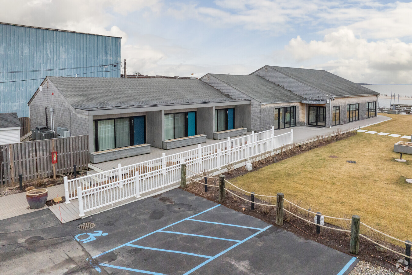
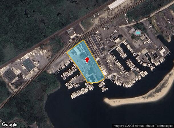
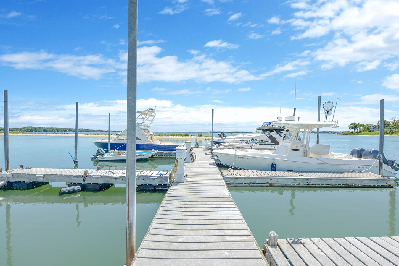
Property Record
61600 Route 25, Southold, NY 11971
Current Lease Availabilities
NEARBY LISTINGS FOR SALE OR LEASE
-
-
View all Southold listings for lease on LoopNet.com
Property Detail
61600 Route 25
Nassau County-Suffolk County, NY
ARREARS
1000-056-00-06-00-003-004
Suffolk
Portharbor
New York
AE
3
36103C0159H
2 AC
2023
Suffolk
2023
Long Island (New York)
170204
DEMOGRAPHICS near 61600 Route 25
1 Mile
3 Mile
5 Mile
2024 Total Population
1,071
12,037
20,034
2029 Population
1,097
12,377
20,622
Pop Growth 2024-2029
+ 2.43%
+ 2.82%
+ 2.94%
Average Age
48
48
48
2024 Total Households
452
5,123
8,650
HH Growth 2024-2029
+ 2.21%
+ 2.77%
+ 2.92%
Median Household Inc
$92,307
$93,760
$92,482
Avg Household Size
2.30
2.30
2.30
2024 Avg HH Vehicles
2.00
2.00
2.00
Median Home Value
$679,824
$753,608
$762,066
Median Year Built
1976
1971
1972
Nearby Places
- Restaurants
- Banks
- Shops
- Fitness
- Groceries
PUBLIC TRANSPORTATION
COMMUTER RAIL
Southold Station (Greenport Branch - Long Island Rail Road)
DRIVE
WALK
Distance
Southold Station (Greenport Branch - Long Island Rail Road)
3 min
1.6 mi
Greenport Station (Greenport Branch - Long Island Rail Road)
DRIVE
WALK
Distance
Greenport Station (Greenport Branch - Long Island Rail Road)
6 min
3.3 mi
Freight Ports
Port of New Haven
DRIVE
WALK
Distance
Port of New Haven
171 min
75.5 mi
Nearby Properties
Address
Land Use
TOTAL SIZE
Lot Size
Zoning
Address
Land Use
TOTAL SIZE
Lot Size
Zoning
6,000 SF
25.70 AC
AA
Address
Land Use
TOTAL SIZE
Lot Size
Zoning
33,799 SF
7.53 AC
AA
Address
Land Use
TOTAL SIZE
Lot Size
Zoning
9,468 SF
3.20 AC
AA
Address
Land Use
TOTAL SIZE
Lot Size
Zoning
23,354 SF
0.64 AC
AA
Address
Land Use
TOTAL SIZE
Lot Size
Zoning
1,396 SF
6.45 AC
AA
Address
Land Use
TOTAL SIZE
Lot Size
Zoning
12,064 SF
7.75 AC
AA
Address
Land Use
TOTAL SIZE
Lot Size
Zoning
2,076 SF
42.20 AC
AA
Address
Land Use
TOTAL SIZE
Lot Size
Zoning
904 SF
20.30 AC
AA
Address
Land Use
TOTAL SIZE
Lot Size
Zoning
4,340 SF
0.88 AC
AA
Address
Land Use
TOTAL SIZE
Lot Size
Zoning
1,284 SF
11.38 AC
C
Address
Land Use
TOTAL SIZE
Lot Size
Zoning
2,400 SF
0.93 AC
RWB
Address
Land Use
TOTAL SIZE
Lot Size
Zoning
4,845 SF
0.80 AC
AA
Address
Land Use
TOTAL SIZE
Lot Size
Zoning
2,000 SF
0.54 AC
B
Address
Land Use
TOTAL SIZE
Lot Size
Zoning
17.80 AC
A
Address
Land Use
TOTAL SIZE
Lot Size
Zoning
7,022 SF
0.70 AC
C
Address
Land Use
TOTAL SIZE
Lot Size
Zoning
4,476 SF
0.13 AC
AA
Address
Land Use
TOTAL SIZE
Lot Size
Zoning
10,250 SF
10.10 AC
C
Address
Land Use
TOTAL SIZE
Lot Size
Zoning
38.11 AC
R-40 RO
Address
Land Use
TOTAL SIZE
Lot Size
Zoning
1.02 AC
A
Address
Land Use
TOTAL SIZE
Lot Size
Zoning
6,120 SF
0.54 AC
C
Address
Land Use
TOTAL SIZE
Lot Size
Zoning
778 SF
7.68 AC
AA
Address
Land Use
TOTAL SIZE
Lot Size
Zoning
4.12 AC
AA
Address
Land Use
TOTAL SIZE
Lot Size
Zoning
3,910 SF
0.30 AC
B
Address
Land Use
TOTAL SIZE
Lot Size
Zoning
2,928 SF
0.37 AC
B
Address
Land Use
TOTAL SIZE
Lot Size
Zoning
3,709 SF
0.15 AC
B
Address
Land Use
TOTAL SIZE
Lot Size
Zoning
0.87 AC
A
Address
Land Use
TOTAL SIZE
Lot Size
Zoning
2,360 SF
1.50 AC
AA
Address
Land Use
TOTAL SIZE
Lot Size
Zoning
3,140 SF
0.62 AC
B
Address
Land Use
TOTAL SIZE
Lot Size
Zoning
2,292 SF
0.25 AC
AA
Address
Land Use
TOTAL SIZE
Lot Size
Zoning
4.90 AC
C
The World's #1 Commercial Real Estate Marketplace
Connect with us
© 2025 CoStar Group
The information above has been obtained from sources believed reliable. While we do not doubt its accuracy we have not verified it and make no guarantee, warranty or representation about it. It is your responsibility to independently confirm its accuracy and completeness. Any projections, opinions, assumptions, or estimates used are for example only and do not represent the current or future performance of the property. The value of this transaction to you depends on tax and other factors which should be evaluated by your tax, financial, and legal advisors. You and your advisors should conduct a careful, independent investigation of the property to determine to your satisfaction the suitability of the property for your needs.