Property Record
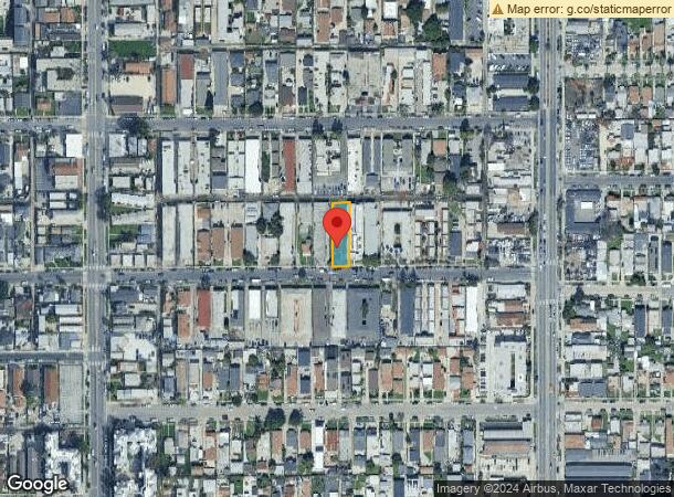
617 W 82Nd St, Los Angeles, CA 90044
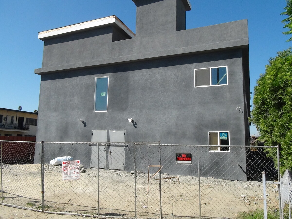
This Property Is For Sale
NEARBY LISTINGS FOR SALE OR LEASE
Property Detail
617 W 82Nd St
Los Angeles-Long Beach-Glendale, CA
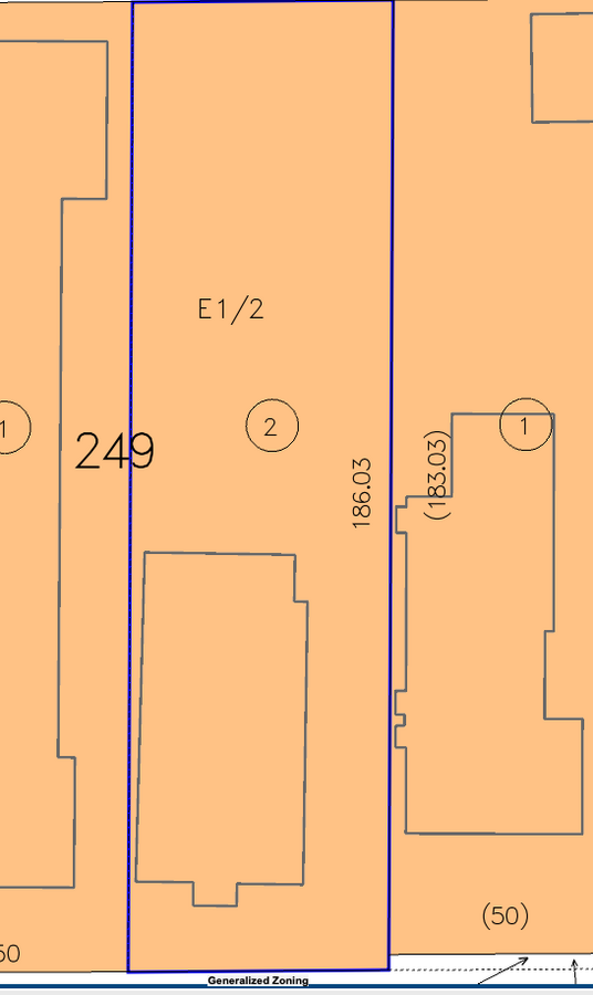
Sunnyside Park Addition
6032-024-021
SUNNY SIDE PARK ADDITION E 50 FT OF LOT/SEC 249
Residentialacreage
Los Angeles
X
California
06037C1785G
249
2024
0.21 AC
2024
Inglewood/South LA
238310
Los Angeles
1,698 SF
DEMOGRAPHICS near 617 W 82Nd St
1 Mile
3 Mile
5 Mile
2024 Total Population
62,460
440,577
1,047,844
2029 Population
60,247
422,864
1,005,471
Pop Growth 2024-2029
(3.54%)
(4.02%)
(4.04%)
Average Age
34
36
36
2024 Total Households
16,875
119,066
298,017
HH Growth 2024-2029
(3.81%)
(4.27%)
(4.20%)
Median Household Inc
$41,956
$51,180
$54,147
Avg Household Size
3.50
3.50
3.30
2024 Avg HH Vehicles
2.00
2.00
2.00
Median Home Value
$534,191
$599,514
$642,138
Median Year Built
1952
1949
1953
Nearby Places
- Restaurants
- Banks
- Shops
- Fitness
- Groceries
PUBLIC TRANSPORTATION
COMMUTER RAIL
Los Angeles (Coast Starlight - Amtrak, Pacific Surfliner - Amtrak, Southwest Chief - Amtrak, Texas Eagle - Amtrak)
DRIVE
WALK
Distance
Los Angeles (Coast Starlight - Amtrak, Pacific Surfliner - Amtrak, Southwest Chief - Amtrak, Texas Eagle - Amtrak)
13 min
8.6 mi
Union Station (91 Line - Southern California Regional Rail Authority (Metrolink), Antelope Valley Line - Southern California Regional Rail Authority (Metrolink), Orange County Line - Southern California Regional Rail Authority (Metrolink), Riverside Line - Southern California Regional Rail Authority (Metrolink), San Bernardino Line - Southern California Regional Rail Authority (Metrolink), Ventura County Line - Southern California Regional Rail Authority (Metrolink))
DRIVE
WALK
Distance
Union Station (91 Line - Southern California Regional Rail Authority (Metrolink), Antelope Valley Line - Southern California Regional Rail Authority (Metrolink), Orange County Line - Southern California Regional Rail Authority (Metrolink), Riverside Line - Southern California Regional Rail Authority (Metrolink), San Bernardino Line - Southern California Regional Rail Authority (Metrolink), Ventura County Line - Southern California Regional Rail Authority (Metrolink))
15 min
8.8 mi
AIRPORT
Los Angeles International
DRIVE
WALK
Distance
Los Angeles International
16 min
8.4 mi
Long Beach (Daugherty Field)
DRIVE
WALK
Distance
Long Beach (Daugherty Field)
23 min
16.3 mi
Bob Hope
DRIVE
WALK
Distance
Bob Hope
32 min
23.8 mi
Freight Ports
Port of Long Beach
DRIVE
WALK
Distance
Port of Long Beach
25 min
18.2 mi
Nearby Properties
Address
Land Use
TOTAL SIZE
Lot Size
Zoning
Address
Land Use
TOTAL SIZE
Lot Size
Zoning
57,488 SF
4.30 AC
LAPF
Address
Land Use
TOTAL SIZE
Lot Size
Zoning
127,484 SF
7.33 AC
LAM2
Address
Land Use
TOTAL SIZE
Lot Size
Zoning
81,735 SF
4.10 AC
LAR4
Address
Land Use
TOTAL SIZE
Lot Size
Zoning
104,291 SF
7.34 AC
LAR3
Address
Land Use
TOTAL SIZE
Lot Size
Zoning
103,656 SF
6.98 AC
LCM1
Address
Land Use
TOTAL SIZE
Lot Size
Zoning
101,049 SF
4.10 AC
LCM2-C3
Address
Land Use
TOTAL SIZE
Lot Size
Zoning
106,908 SF
5.07 AC
LCM2*
Address
Land Use
TOTAL SIZE
Lot Size
Zoning
402,118 SF
9.39 AC
LAC2
Address
Land Use
TOTAL SIZE
Lot Size
Zoning
111,213 SF
12.04 AC
LAR4
Address
Land Use
TOTAL SIZE
Lot Size
Zoning
188,030 SF
3.09 AC
LAR5
Address
Land Use
TOTAL SIZE
Lot Size
Zoning
101,562 SF
7.53 AC
LAR3
Address
Land Use
TOTAL SIZE
Lot Size
Zoning
51,006 SF
0.50 AC
LAC2
Address
Land Use
TOTAL SIZE
Lot Size
Zoning
Address
Land Use
TOTAL SIZE
Lot Size
Zoning
102,260 SF
16.84 AC
LAR4
Address
Land Use
TOTAL SIZE
Lot Size
Zoning
80,606 SF
1.40 AC
INC2*
Address
Land Use
TOTAL SIZE
Lot Size
Zoning
73,697 SF
3.14 AC
LAC2
Address
Land Use
TOTAL SIZE
Lot Size
Zoning
90,887 SF
0.94 AC
LCR320U*
Address
Land Use
TOTAL SIZE
Lot Size
Zoning
131,879 SF
1.96 AC
LAC2
Address
Land Use
TOTAL SIZE
Lot Size
Zoning
189,808 SF
4.07 AC
LAM2
Address
Land Use
TOTAL SIZE
Lot Size
Zoning
333,054 SF
19.17 AC
INR1*
Address
Land Use
TOTAL SIZE
Lot Size
Zoning
108,496 SF
9.82 AC
LAM2
Address
Land Use
TOTAL SIZE
Lot Size
Zoning
38,567 SF
1.11 AC
LAR3
Address
Land Use
TOTAL SIZE
Lot Size
Zoning
40,065 SF
1.24 AC
LAC2
Address
Land Use
TOTAL SIZE
Lot Size
Zoning
89,036 SF
0.67 AC
LAC2
Address
Land Use
TOTAL SIZE
Lot Size
Zoning
107,421 SF
11.50 AC
INCR
Address
Land Use
TOTAL SIZE
Lot Size
Zoning
93,319 SF
1.70 AC
LAM2
Address
Land Use
TOTAL SIZE
Lot Size
Zoning
49,860 SF
1.08 AC
LAC2
Address
Land Use
TOTAL SIZE
Lot Size
Zoning
171,971 SF
5.21 AC
LCM2*
Address
Land Use
TOTAL SIZE
Lot Size
Zoning
44,769 SF
0.84 AC
LAC2
Address
Land Use
TOTAL SIZE
Lot Size
Zoning
57,587 SF
5.03 AC
LAM2
The World's #1 Commercial Real Estate Marketplace
Connect with us
© 2025 CoStar Group
The information above has been obtained from sources believed reliable. While we do not doubt its accuracy we have not verified it and make no guarantee, warranty or representation about it. It is your responsibility to independently confirm its accuracy and completeness. Any projections, opinions, assumptions, or estimates used are for example only and do not represent the current or future performance of the property. The value of this transaction to you depends on tax and other factors which should be evaluated by your tax, financial, and legal advisors. You and your advisors should conduct a careful, independent investigation of the property to determine to your satisfaction the suitability of the property for your needs.