Property Record
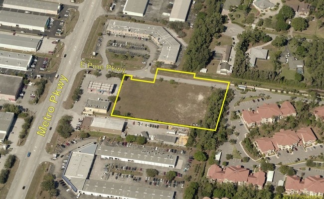
6180 E Pine Pkwy, Fort Myers, FL 33966


NEARBY LISTINGS FOR SALE OR LEASE
Property Detail
6180 E Pine Pkwy
Cape Coral-Fort Myers, FL
Metro Parkway Corridor
19-45-25-07-00000.0020
METRO PARCELS S/D PB 39 PG 33 LOT 2
Industrialacreage
Lee
AH
Florida
12071C0436H
2
2024
2.22 AC
2025
S Ft Myers/San Carlos
001208
Southwest Florida
DEMOGRAPHICS near 6180 E Pine Pkwy
1 Mile
3 Mile
5 Mile
2024 Total Population
7,083
58,377
144,098
2029 Population
8,271
69,213
171,107
Pop Growth 2024-2029
+ 16.77%
+ 18.56%
+ 18.74%
Average Age
43
48
47
2024 Total Households
3,261
26,858
66,383
HH Growth 2024-2029
+ 16.31%
+ 18.17%
+ 18.40%
Median Household Inc
$59,849
$63,848
$64,322
Avg Household Size
2.10
2.10
2.10
2024 Avg HH Vehicles
1.00
1.00
2.00
Median Home Value
$268,285
$266,286
$282,793
Median Year Built
1988
1988
1993
Nearby Places
Map Layers
Map Styles
 Street
 Aerial
- Restaurants
- Banks
- Shops
- Fitness
- Groceries
PUBLIC TRANSPORTATION
AIRPORT
Southwest Florida International
DRIVE
WALK
Distance
Southwest Florida International
15 min
7.5 mi
Punta Gorda
DRIVE
WALK
Distance
Punta Gorda
43 min
33.3 mi
Freight Ports
Port Manatee
DRIVE
WALK
Distance
Port Manatee
123 min
105.0 mi
SALE & LEASE HISTORY
LISTING DATE
SALE/LEASE

Jun 24, 2024
For Sale
Jun 19, 2017
For Sale
Nearby Properties
Address
Land Use
TOTAL SIZE
Lot Size
Zoning
Address
Land Use
TOTAL SIZE
Lot Size
Zoning
741,488 SF
23.22 AC
CPD
Address
Land Use
TOTAL SIZE
Lot Size
Zoning
1,001,577 SF
140.54 AC
AG-2
Address
Land Use
TOTAL SIZE
Lot Size
Zoning
990,859 SF
38 AC
CI
Address
Land Use
TOTAL SIZE
Lot Size
Zoning
541,926 SF
54.06 AC
RM2
Address
Land Use
TOTAL SIZE
Lot Size
Zoning
689,351 SF
42.34 AC
RM-16/
Address
Land Use
TOTAL SIZE
Lot Size
Zoning
425,522 SF
380.73 AC
IL
Address
Land Use
TOTAL SIZE
Lot Size
Zoning
576,858 SF
77.73 AC
CF-2
Address
Land Use
TOTAL SIZE
Lot Size
Zoning
562,104 SF
18.98 AC
RPD
Address
Land Use
TOTAL SIZE
Lot Size
Zoning
15.08 AC
Address
Land Use
TOTAL SIZE
Lot Size
Zoning
331,738 SF
39.51 AC
RM-10
Address
Land Use
TOTAL SIZE
Lot Size
Zoning
445,073 SF
44.82 AC
C-1
Address
Land Use
TOTAL SIZE
Lot Size
Zoning
346,817 SF
26.28 AC
MPD
Address
Land Use
TOTAL SIZE
Lot Size
Zoning
427,764 SF
12.73 AC
C1
Address
Land Use
TOTAL SIZE
Lot Size
Zoning
25.16 AC
RPD
Address
Land Use
TOTAL SIZE
Lot Size
Zoning
441,655 SF
33.09 AC
RM-2
Address
Land Use
TOTAL SIZE
Lot Size
Zoning
364,206 SF
106.76 AC
PUD
Address
Land Use
TOTAL SIZE
Lot Size
Zoning
347,746 SF
29.74 AC
RM-10
Address
Land Use
TOTAL SIZE
Lot Size
Zoning
444,774 SF
36.07 AC
MPD
Address
Land Use
TOTAL SIZE
Lot Size
Zoning
349,074 SF
39.54 AC
MPD
Address
Land Use
TOTAL SIZE
Lot Size
Zoning
381,135 SF
15.07 AC
MPD
Address
Land Use
TOTAL SIZE
Lot Size
Zoning
313,327 SF
29.72 AC
C-1
Address
Land Use
TOTAL SIZE
Lot Size
Zoning
59,832 SF
4.23 AC
CPD
Address
Land Use
TOTAL SIZE
Lot Size
Zoning
261,136 SF
11.68 AC
AG-2
Address
Land Use
TOTAL SIZE
Lot Size
Zoning
206,290 SF
31.37 AC
CFPD
Address
Land Use
TOTAL SIZE
Lot Size
Zoning
170,495 SF
7.80 AC
CPD
Address
Land Use
TOTAL SIZE
Lot Size
Zoning
127,625 SF
11.45 AC
CPD
Address
Land Use
TOTAL SIZE
Lot Size
Zoning
116,776 SF
9.06 AC
CPD
Address
Land Use
TOTAL SIZE
Lot Size
Zoning
104,988 SF
20.99 AC
C1
Address
Land Use
TOTAL SIZE
Lot Size
Zoning
137,556 SF
4.73 AC
C-1
Address
Land Use
TOTAL SIZE
Lot Size
Zoning
316,597 SF
19.19 AC
IPD
The World's #1 Commercial Real Estate Marketplace
Connect with us
© 2026 CoStar Group
The information above has been obtained from sources believed reliable. While we do not doubt its accuracy we have not verified it and make no guarantee, warranty or representation about it. It is your responsibility to independently confirm its accuracy and completeness. Any projections, opinions, assumptions, or estimates used are for example only and do not represent the current or future performance of the property. The value of this transaction to you depends on tax and other factors which should be evaluated by your tax, financial, and legal advisors. You and your advisors should conduct a careful, independent investigation of the property to determine to your satisfaction the suitability of the property for your needs.