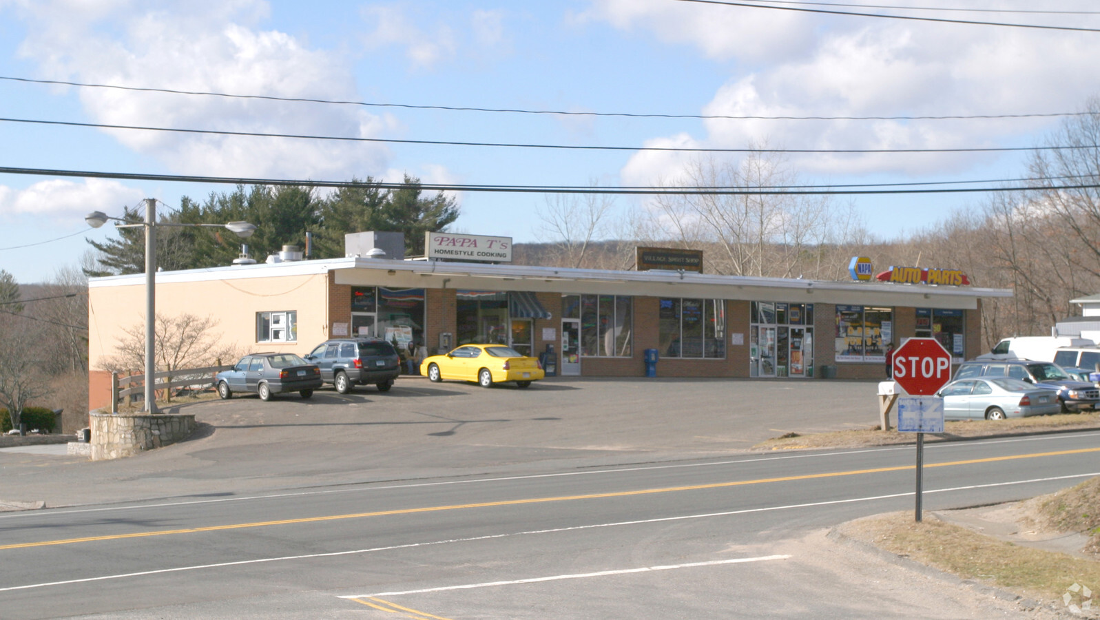
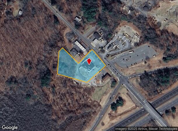
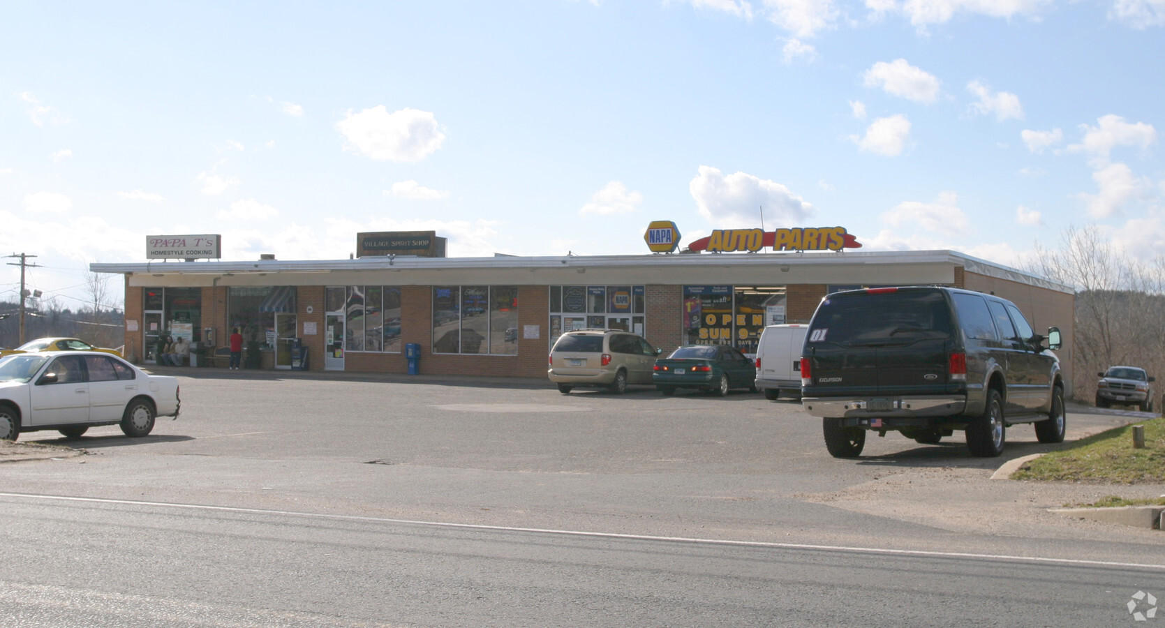
Property Record
62 Merrow Rd, Tolland, CT 06084
NEARBY LISTINGS FOR SALE OR LEASE
Property Detail
62 Merrow Rd
Hartford-West Hartford-East Hartford, CT
Tolland
TOLL-000028-L000000-000003
Connecticut
Commercialbuilding
3-0
2024
2.13 AC
2024
Tolland County
533103
Hartford
14,561 SF
DEMOGRAPHICS near 62 Merrow Rd
1 Mile
3 Mile
5 Mile
2024 Total Population
1,007
11,065
36,216
2029 Population
1,003
10,985
36,104
Pop Growth 2024-2029
(0.40%)
(0.72%)
(0.31%)
Average Age
42
42
41
2024 Total Households
372
4,109
14,703
HH Growth 2024-2029
(0.27%)
(0.80%)
(0.33%)
Median Household Inc
$113,437
$115,983
$78,349
Avg Household Size
2.70
2.70
2.40
2024 Avg HH Vehicles
2.00
2.00
2.00
Median Home Value
$311,065
$319,504
$295,614
Median Year Built
1975
1979
1972
Nearby Places
- Restaurants
- Banks
- Shops
- Fitness
- Groceries
PUBLIC TRANSPORTATION
AIRPORT
Bradley International
DRIVE
WALK
Distance
Bradley International
47 min
27.3 mi
Freight Ports
Port of New Haven
DRIVE
WALK
Distance
Port of New Haven
70 min
55.9 mi
SALE & LEASE HISTORY
LISTING DATE
SALE/LEASE

Feb 23, 2023
For Sale
Nearby Properties
Address
Land Use
TOTAL SIZE
Lot Size
Zoning
Address
Land Use
TOTAL SIZE
Lot Size
Zoning
258,330 SF
68.50 AC
RDD
Address
Land Use
TOTAL SIZE
Lot Size
Zoning
168,410 SF
100.15 AC
RDD
Address
Land Use
TOTAL SIZE
Lot Size
Zoning
46.42 AC
VCZ-R
Address
Land Use
TOTAL SIZE
Lot Size
Zoning
20.50 AC
Address
Land Use
TOTAL SIZE
Lot Size
Zoning
48 AC
RDD
Address
Land Use
TOTAL SIZE
Lot Size
Zoning
47,300 SF
24.48 AC
NCZ
Address
Land Use
TOTAL SIZE
Lot Size
Zoning
59.01 AC
RDD
Address
Land Use
TOTAL SIZE
Lot Size
Zoning
65,721 SF
6.39 AC
WRDD
Address
Land Use
TOTAL SIZE
Lot Size
Zoning
17.35 AC
TBP
Address
Land Use
TOTAL SIZE
Lot Size
Zoning
10 AC
RDD
Address
Land Use
TOTAL SIZE
Lot Size
Zoning
71,343 SF
26.01 AC
Address
Land Use
TOTAL SIZE
Lot Size
Zoning
1,200 SF
108 AC
Address
Land Use
TOTAL SIZE
Lot Size
Zoning
27,740 SF
11.92 AC
RDD
Address
Land Use
TOTAL SIZE
Lot Size
Zoning
26,602 SF
5.47 AC
VCZ
Address
Land Use
TOTAL SIZE
Lot Size
Zoning
37,556 SF
7.91 AC
GDD
Address
Land Use
TOTAL SIZE
Lot Size
Zoning
10,728 SF
39.68 AC
RDD
Address
Land Use
TOTAL SIZE
Lot Size
Zoning
50.71 AC
Address
Land Use
TOTAL SIZE
Lot Size
Zoning
15.32 AC
NCZ
Address
Land Use
TOTAL SIZE
Lot Size
Zoning
9.05 AC
NCZ
Address
Land Use
TOTAL SIZE
Lot Size
Zoning
16,414 SF
3.44 AC
GDD
Address
Land Use
TOTAL SIZE
Lot Size
Zoning
1,132 SF
0.78 AC
RDD
Address
Land Use
TOTAL SIZE
Lot Size
Zoning
1.99 AC
VCZ
Address
Land Use
TOTAL SIZE
Lot Size
Zoning
42,630 SF
5.27 AC
TBP
Address
Land Use
TOTAL SIZE
Lot Size
Zoning
16,128 SF
4.91 AC
NCZ
Address
Land Use
TOTAL SIZE
Lot Size
Zoning
6,806 SF
131.13 AC
RDD
Address
Land Use
TOTAL SIZE
Lot Size
Zoning
3.42 AC
VCZ
Address
Land Use
TOTAL SIZE
Lot Size
Zoning
9,259 SF
2.24 AC
NCZ
Address
Land Use
TOTAL SIZE
Lot Size
Zoning
81 AC
RDD
Address
Land Use
TOTAL SIZE
Lot Size
Zoning
14,845 SF
6 AC
RDD
The World's #1 Commercial Real Estate Marketplace
Connect with us
© 2025 CoStar Group
The information above has been obtained from sources believed reliable. While we do not doubt its accuracy we have not verified it and make no guarantee, warranty or representation about it. It is your responsibility to independently confirm its accuracy and completeness. Any projections, opinions, assumptions, or estimates used are for example only and do not represent the current or future performance of the property. The value of this transaction to you depends on tax and other factors which should be evaluated by your tax, financial, and legal advisors. You and your advisors should conduct a careful, independent investigation of the property to determine to your satisfaction the suitability of the property for your needs.