Property Record
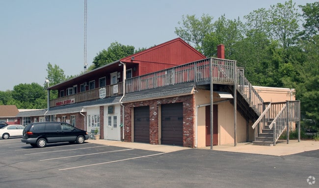
62 Danielson Pike, North Scituate, RI 02857

Property Detail
62 Danielson Pike
SCIT-000016-000073-000000
PROVIDENCE
Commercialbuilding
Rhode Island
BG V
73-0
B and X Area of moderate flood hazard, usually the area between the limits of the 100-year and 500-year floods.
1.30 AC
2025
Foster/Scituate
2025
Providence
013201
Providence-Warwick, RI-MA
5,578 SF
NEARBY LISTINGS FOR SALE OR LEASE
-
-
View all North Scituate listings for sale on LoopNet.com
DEMOGRAPHICS near 62 Danielson Pike
1 mile
3 mile
5 mile
2025 Total Population
1,268
13,253
44,357
2030 Population
1,324
13,912
46,560
Pop Growth 2025-2030
+ 4.42%
+ 4.97%
+ 4.97%
Average Age
44
45
45
2025 Total Households
506
5,281
17,536
HH Growth 2025-2030
+ 4.35%
+ 4.94%
+ 4.98%
Median Household Inc
$99,802
$110,326
$99,022
Avg Household Size
2.50
2.50
2.40
2025 Avg HH Vehicles
2.00
2.00
2.00
Median Home Value
$457,751
$443,237
$423,550
Median Year Built
1958
1971
1975
Nearby Places
Map Layers
Map Styles
 Street
 Aerial
Layers
 Traffic
 Biking
Places
Listings with unknown addresses are not visible on the map
- Restaurants
- Banks
- Shops
- Fitness
- Groceries
PUBLIC TRANSPORTATION
AIRPORT
Rhode Island Tf Green International
Drive
Walk
Distance
Rhode Island Tf Green International
24 min
14.8 mi
Worcester Regional
Drive
Walk
Distance
Worcester Regional
66 min
48.1 mi
Freight Ports
Port of Davisville, RI
Drive
Walk
Distance
Port of Davisville, RI
35 min
24.1 mi
Nearby Properties
Address
Land Use
TOTAL SIZE
Lot Size
Zoning
Address
Land Use
TOTAL SIZE
Lot Size
Zoning
135,831 SF
34.48 AC
RR-1
Address
Land Use
TOTAL SIZE
Lot Size
Zoning
9.59 AC
MU
Address
Land Use
TOTAL SIZE
Lot Size
Zoning
40.40 AC
RS-1
Address
Land Use
TOTAL SIZE
Lot Size
Zoning
40,586 SF
3.40 AC
RS-1
Address
Land Use
TOTAL SIZE
Lot Size
Zoning
36,973 SF
4.71 AC
R20
Address
Land Use
TOTAL SIZE
Lot Size
Zoning
50,886 SF
5.28 AC
BG
Address
Land Use
TOTAL SIZE
Lot Size
Zoning
2.37 AC
V
Address
Land Use
TOTAL SIZE
Lot Size
Zoning
53,824 SF
3.13 AC
V
Address
Land Use
TOTAL SIZE
Lot Size
Zoning
19,244 SF
0.70 AC
RS-1
Address
Land Use
TOTAL SIZE
Lot Size
Zoning
18,400 SF
4.71 AC
B2
Address
Land Use
TOTAL SIZE
Lot Size
Zoning
18,351 SF
1.20 AC
R40
Address
Land Use
TOTAL SIZE
Lot Size
Zoning
29,955 SF
2.99 AC
RS-1
Address
Land Use
TOTAL SIZE
Lot Size
Zoning
19,473 SF
52 AC
10
Address
Land Use
TOTAL SIZE
Lot Size
Zoning
21,870 SF
12.40 AC
RR-1
Address
Land Use
TOTAL SIZE
Lot Size
Zoning
0.55 AC
V
Address
Land Use
TOTAL SIZE
Lot Size
Zoning
2,008 SF
6.01 AC
RS-1
Address
Land Use
TOTAL SIZE
Lot Size
Zoning
5,000 SF
3.70 AC
BG
Address
Land Use
TOTAL SIZE
Lot Size
Zoning
16,500 SF
3.93 AC
B2
Address
Land Use
TOTAL SIZE
Lot Size
Zoning
11,688 SF
0.30 AC
RS-1
Address
Land Use
TOTAL SIZE
Lot Size
Zoning
2,144 SF
349.75 AC
R40
Address
Land Use
TOTAL SIZE
Lot Size
Zoning
9,068 SF
0.64 AC
V
Address
Land Use
TOTAL SIZE
Lot Size
Zoning
44,912 SF
4.79 AC
V
Address
Land Use
TOTAL SIZE
Lot Size
Zoning
Address
Land Use
TOTAL SIZE
Lot Size
Zoning
3.50 AC
BL
Address
Land Use
TOTAL SIZE
Lot Size
Zoning
8,459 SF
0.37 AC
RS-1
Address
Land Use
TOTAL SIZE
Lot Size
Zoning
9,792 SF
1.24 AC
B2
Address
Land Use
TOTAL SIZE
Lot Size
Zoning
27,265 SF
1.88 AC
B3
Address
Land Use
TOTAL SIZE
Lot Size
Zoning
8,599 SF
3.49 AC
10
Address
Land Use
TOTAL SIZE
Lot Size
Zoning
0.67 AC
V
Address
Land Use
TOTAL SIZE
Lot Size
Zoning
7,019 SF
1.87 AC
B2
The World's #1 Commercial Real Estate Marketplace
Connect with us
© 2026 CoStar Group
The information above has been obtained from sources believed reliable. While we do not doubt its accuracy we have not verified it and make no guarantee, warranty or representation about it. It is your responsibility to independently confirm its accuracy and completeness. Any projections, opinions, assumptions, or estimates used are for example only and do not represent the current or future performance of the property. The value of this transaction to you depends on tax and other factors which should be evaluated by your tax, financial, and legal advisors. You and your advisors should conduct a careful, independent investigation of the property to determine to your satisfaction the suitability of the property for your needs.