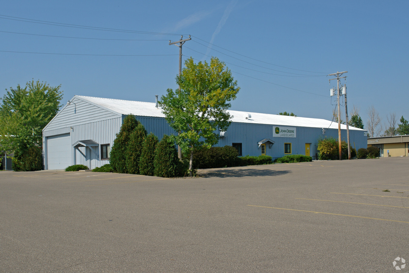
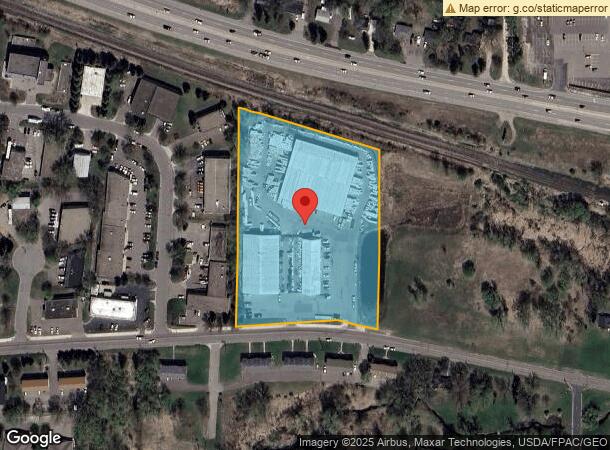
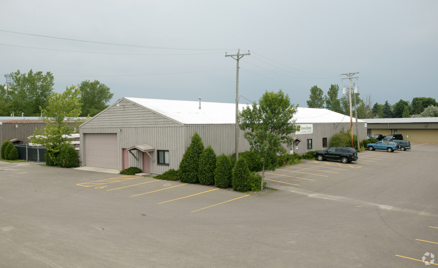
Property Record
620 Hamel Rd, Hamel, MN 55340
NEARBY LISTINGS FOR SALE OR LEASE
Property Detail
620 Hamel Rd
Minneapolis-St. Paul-Bloomington, MN-WI
Auditors Subd. No. 241
12-118-23-23-0055
LOT 008 B AUDITORS SUBD. NO. 241 THAT PART OF LOT 8 LYING ELY OF MEDINA INDUSTRIAL 2ND ADDN IRREGULAR
Industrialgeneral
Hennepin
X
Minnesota
27053C0166F
8
2024
4.87 AC
2023
Southwest
0271011076
Minneapolis/St Paul
DEMOGRAPHICS near 620 Hamel Rd
1 Mile
3 Mile
5 Mile
2024 Total Population
3,472
32,584
91,700
2029 Population
3,452
32,371
90,453
Pop Growth 2024-2029
(0.58%)
(0.65%)
(1.36%)
Average Age
37
37
39
2024 Total Households
1,141
10,566
33,144
HH Growth 2024-2029
(0.79%)
(0.85%)
(1.59%)
Median Household Inc
$182,455
$177,644
$148,718
Avg Household Size
3.00
3.00
2.70
2024 Avg HH Vehicles
2.00
2.00
2.00
Median Home Value
$669,598
$597,970
$487,304
Median Year Built
2008
2003
1993
Nearby Places
- Restaurants
- Banks
- Shops
- Fitness
- Groceries
PUBLIC TRANSPORTATION
AIRPORT
Minneapolis-St Paul International/Wold-Chamberlain
DRIVE
WALK
Distance
Minneapolis-St Paul International/Wold-Chamberlain
39 min
26.9 mi
Freight Ports
Port Milwaukee
DRIVE
WALK
Distance
Port Milwaukee
399 min
354.6 mi
Nearby Properties
Address
Land Use
TOTAL SIZE
Lot Size
Zoning
Address
Land Use
TOTAL SIZE
Lot Size
Zoning
Address
Land Use
TOTAL SIZE
Lot Size
Zoning
Address
Land Use
TOTAL SIZE
Lot Size
Zoning
21.09 AC
Address
Land Use
TOTAL SIZE
Lot Size
Zoning
Address
Land Use
TOTAL SIZE
Lot Size
Zoning
8.81 AC
Address
Land Use
TOTAL SIZE
Lot Size
Zoning
9.54 AC
Address
Land Use
TOTAL SIZE
Lot Size
Zoning
Address
Land Use
TOTAL SIZE
Lot Size
Zoning
Address
Land Use
TOTAL SIZE
Lot Size
Zoning
25.53 AC
Address
Land Use
TOTAL SIZE
Lot Size
Zoning
10.22 AC
Address
Land Use
TOTAL SIZE
Lot Size
Zoning
Address
Land Use
TOTAL SIZE
Lot Size
Zoning
9.04 AC
Address
Land Use
TOTAL SIZE
Lot Size
Zoning
7.33 AC
Address
Land Use
TOTAL SIZE
Lot Size
Zoning
6.43 AC
Address
Land Use
TOTAL SIZE
Lot Size
Zoning
32.70 AC
Address
Land Use
TOTAL SIZE
Lot Size
Zoning
6.89 AC
Address
Land Use
TOTAL SIZE
Lot Size
Zoning
6.75 AC
Address
Land Use
TOTAL SIZE
Lot Size
Zoning
25.11 AC
Address
Land Use
TOTAL SIZE
Lot Size
Zoning
11.19 AC
Address
Land Use
TOTAL SIZE
Lot Size
Zoning
Address
Land Use
TOTAL SIZE
Lot Size
Zoning
Address
Land Use
TOTAL SIZE
Lot Size
Zoning
Address
Land Use
TOTAL SIZE
Lot Size
Zoning
6.06 AC
Address
Land Use
TOTAL SIZE
Lot Size
Zoning
33.02 AC
Address
Land Use
TOTAL SIZE
Lot Size
Zoning
Address
Land Use
TOTAL SIZE
Lot Size
Zoning
10.70 AC
Address
Land Use
TOTAL SIZE
Lot Size
Zoning
5.45 AC
Address
Land Use
TOTAL SIZE
Lot Size
Zoning
11.52 AC
Address
Land Use
TOTAL SIZE
Lot Size
Zoning
10.79 AC
Address
Land Use
TOTAL SIZE
Lot Size
Zoning
9.82 AC
The World's #1 Commercial Real Estate Marketplace
Connect with us
© 2025 CoStar Group
The information above has been obtained from sources believed reliable. While we do not doubt its accuracy we have not verified it and make no guarantee, warranty or representation about it. It is your responsibility to independently confirm its accuracy and completeness. Any projections, opinions, assumptions, or estimates used are for example only and do not represent the current or future performance of the property. The value of this transaction to you depends on tax and other factors which should be evaluated by your tax, financial, and legal advisors. You and your advisors should conduct a careful, independent investigation of the property to determine to your satisfaction the suitability of the property for your needs.