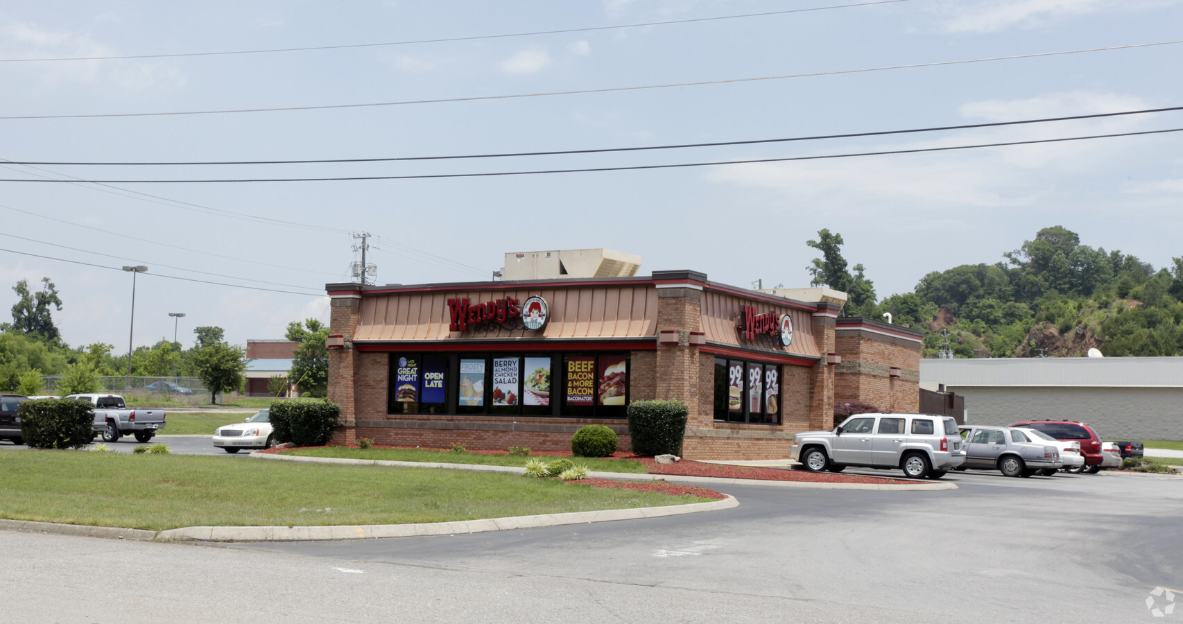
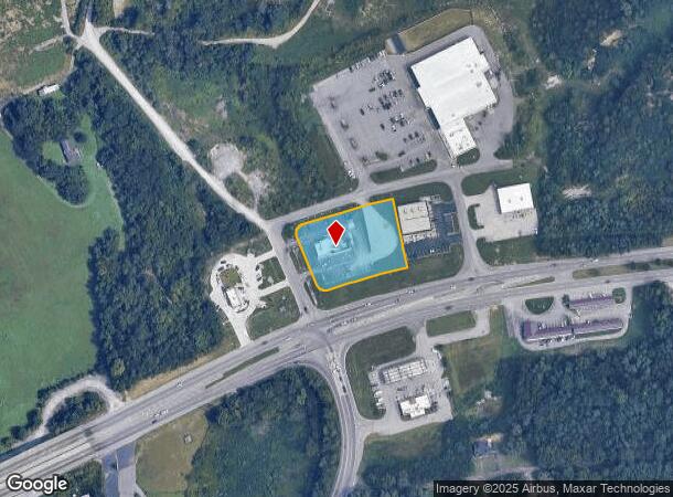
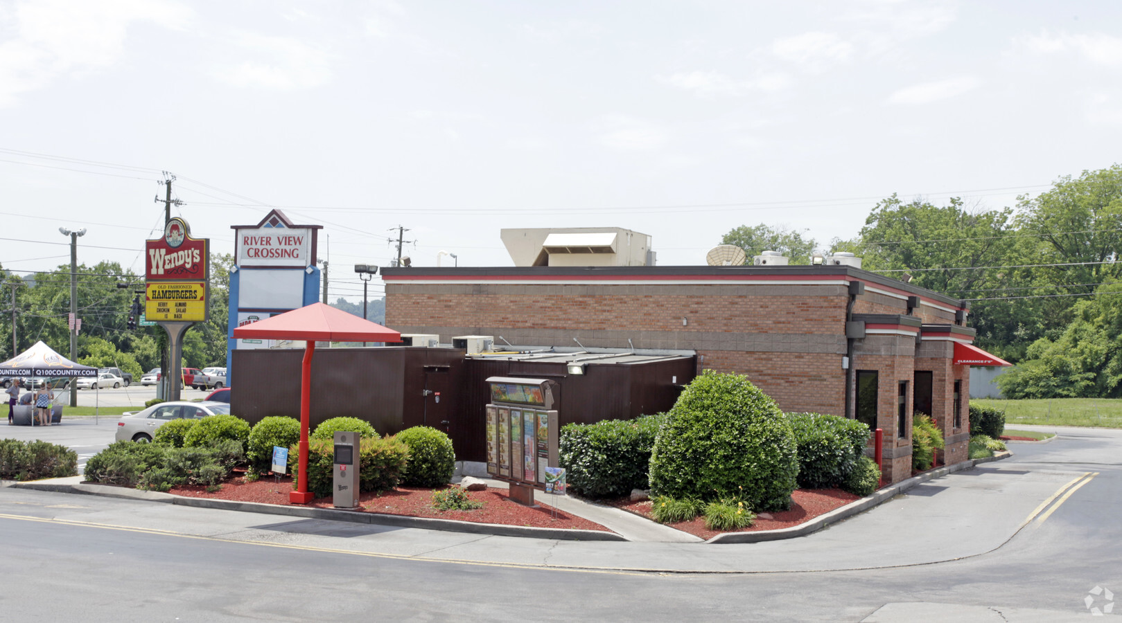
Property Record
6201 Asheville Hwy, Knoxville, TN 37924
NEARBY LISTINGS FOR SALE OR LEASE
Property Detail
6201 Asheville Hwy
071-00105
Anx (2000) 0-533-98
Restaurantdrivein
SUBDIVISIONNAME ANX (2000) 0-533-98
X
Knox
47093C0164G
Tennessee
2024
1.27 AC
2024
East
005301
Knoxville
2,596 SF
Knoxville, TN
DEMOGRAPHICS near 6201 Asheville Hwy
1 Mile
3 Mile
5 Mile
2024 Total Population
770
19,500
58,530
2029 Population
838
21,348
64,151
Pop Growth 2024-2029
+ 8.83%
+ 9.48%
+ 9.60%
Average Age
43
42
41
2024 Total Households
325
8,018
24,284
HH Growth 2024-2029
+ 9.23%
+ 9.55%
+ 9.76%
Median Household Inc
$72,906
$53,552
$48,318
Avg Household Size
2.30
2.40
2.30
2024 Avg HH Vehicles
2.00
2.00
2.00
Median Home Value
$229,000
$217,678
$203,818
Median Year Built
1967
1976
1976
Nearby Places
- Restaurants
- Banks
- Shops
- Fitness
- Groceries
PUBLIC TRANSPORTATION
AIRPORT
McGhee Tyson
DRIVE
WALK
Distance
McGhee Tyson
39 min
24.5 mi
Freight Ports
North Charleston Terminal
DRIVE
WALK
Distance
North Charleston Terminal
411 min
358.2 mi
Nearby Properties
Address
Land Use
TOTAL SIZE
Lot Size
Zoning
Address
Land Use
TOTAL SIZE
Lot Size
Zoning
605,000 SF
57.37 AC
Address
Land Use
TOTAL SIZE
Lot Size
Zoning
1,134 SF
6.97 AC
Address
Land Use
TOTAL SIZE
Lot Size
Zoning
227,687 SF
18 AC
Address
Land Use
TOTAL SIZE
Lot Size
Zoning
37,534 SF
5.03 AC
Address
Land Use
TOTAL SIZE
Lot Size
Zoning
27,420 SF
1.16 AC
Address
Land Use
TOTAL SIZE
Lot Size
Zoning
22,782 SF
11.02 AC
Address
Land Use
TOTAL SIZE
Lot Size
Zoning
89,492 SF
5.88 AC
Address
Land Use
TOTAL SIZE
Lot Size
Zoning
227,592 SF
22.25 AC
Address
Land Use
TOTAL SIZE
Lot Size
Zoning
106,946 SF
12.57 AC
Address
Land Use
TOTAL SIZE
Lot Size
Zoning
142,092 SF
13.90 AC
Address
Land Use
TOTAL SIZE
Lot Size
Zoning
100 SF
423.35 AC
Address
Land Use
TOTAL SIZE
Lot Size
Zoning
87,256 SF
21.45 AC
Address
Land Use
TOTAL SIZE
Lot Size
Zoning
63,149 SF
6.30 AC
Address
Land Use
TOTAL SIZE
Lot Size
Zoning
92,592 SF
1.89 AC
Address
Land Use
TOTAL SIZE
Lot Size
Zoning
93,427 SF
15.54 AC
Address
Land Use
TOTAL SIZE
Lot Size
Zoning
56,700 SF
5.20 AC
Address
Land Use
TOTAL SIZE
Lot Size
Zoning
54,198 SF
2.67 AC
Address
Land Use
TOTAL SIZE
Lot Size
Zoning
28,612 SF
3.62 AC
Address
Land Use
TOTAL SIZE
Lot Size
Zoning
1,150 SF
20.42 AC
Address
Land Use
TOTAL SIZE
Lot Size
Zoning
60,227 SF
5.37 AC
Address
Land Use
TOTAL SIZE
Lot Size
Zoning
9,712 SF
7.80 AC
Address
Land Use
TOTAL SIZE
Lot Size
Zoning
48,381 SF
5.03 AC
Address
Land Use
TOTAL SIZE
Lot Size
Zoning
67,755 SF
23.66 AC
Address
Land Use
TOTAL SIZE
Lot Size
Zoning
30,466 SF
3.28 AC
Address
Land Use
TOTAL SIZE
Lot Size
Zoning
48,588 SF
7.94 AC
Address
Land Use
TOTAL SIZE
Lot Size
Zoning
30,885 SF
1.63 AC
Address
Land Use
TOTAL SIZE
Lot Size
Zoning
31,384 SF
3.97 AC
Address
Land Use
TOTAL SIZE
Lot Size
Zoning
12,921 SF
4.88 AC
Address
Land Use
TOTAL SIZE
Lot Size
Zoning
43,572 SF
6 AC
Address
Land Use
TOTAL SIZE
Lot Size
Zoning
18,036 SF
1.46 AC
The World's #1 Commercial Real Estate Marketplace
Connect with us
© 2025 CoStar Group
The information above has been obtained from sources believed reliable. While we do not doubt its accuracy we have not verified it and make no guarantee, warranty or representation about it. It is your responsibility to independently confirm its accuracy and completeness. Any projections, opinions, assumptions, or estimates used are for example only and do not represent the current or future performance of the property. The value of this transaction to you depends on tax and other factors which should be evaluated by your tax, financial, and legal advisors. You and your advisors should conduct a careful, independent investigation of the property to determine to your satisfaction the suitability of the property for your needs.