Property Record
6201 Hillcrest Ave, Dallas, TX 75205
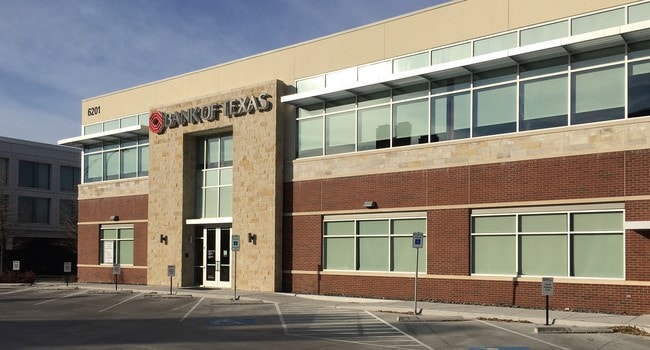


Property Detail
6201 Hillcrest Ave
602165000C01A0000
UNIVERSITY ANNEX 2ND INST BLK C LOT 1A ACS 0.5515 VOL94077/2440 DD041494 CO-DALLAS 2165000300100 16021650003
Officebuilding
DALLAS
Z97
Texas
B and X Area of moderate flood hazard, usually the area between the limits of the 100-year and 500-year floods.
1a
2024
0.55 AC
2025
Preston Center
019400
Dallas/Ft Worth
13,936 SF
Dallas-Fort Worth-Arlington, TX
NEARBY LISTINGS FOR SALE OR LEASE
DEMOGRAPHICS near 6201 Hillcrest Ave
1 mile
3 mile
5 mile
2025 Total Population
20,229
213,502
426,217
2030 Population
20,881
222,141
443,816
Pop Growth 2025-2030
+ 3.22%
+ 4.05%
+ 4.13%
Average Age
35
38
38
2025 Total Households
6,730
107,271
206,234
HH Growth 2025-2030
+ 3.52%
+ 4.18%
+ 4.40%
Median Household Inc
$169,802
$99,748
$93,811
Avg Household Size
2.50
1.90
2.00
2025 Avg HH Vehicles
2.00
2.00
2.00
Median Home Value
$1,089,947
$833,183
$745,172
Median Year Built
1991
1988
1988
Nearby Places
Map Layers
Map Styles
 Street
 Aerial
Transit
 Traffic
 Biking
Places
Listings with unknown addresses are not visible on the map
- Restaurants
- Banks
- Shops
- Fitness
- Groceries
PUBLIC TRANSPORTATION
COMMUTER RAIL
Medical/Market Ctr Station (TRINITY RAILWAY - Dallas Area Rapid Transit (DART))
Drive
Walk
Distance
Medical/Market Ctr Station (TRINITY RAILWAY - Dallas Area Rapid Transit (DART))
11 min
5.4 mi
Victory Station (DART LIGHT RAIL - GREEN LINE - Dallas Area Rapid Transit (DART), DART LIGHT RAIL - ORANGE LINE - Dallas Area Rapid Transit (DART), TRINITY RAILWAY - Dallas Area Rapid Transit (DART))
Drive
Walk
Distance
Victory Station (DART LIGHT RAIL - GREEN LINE - Dallas Area Rapid Transit (DART), DART LIGHT RAIL - ORANGE LINE - Dallas Area Rapid Transit (DART), TRINITY RAILWAY - Dallas Area Rapid Transit (DART))
9 min
5.6 mi
AIRPORT
Dallas Love Field
Drive
Walk
Distance
Dallas Love Field
11 min
4.6 mi
Dallas-Fort Worth International
Drive
Walk
Distance
Dallas-Fort Worth International
32 min
22.4 mi
Freight Ports
Port of Shreveport
Drive
Walk
Distance
Port of Shreveport
217 min
198.3 mi
SALE & LEASE HISTORY
LISTING DATE
SALE/LEASE

Sep 25, 2016
For Lease
Oct 07, 2021
For Lease
Nearby Properties
Address
Land Use
TOTAL SIZE
Lot Size
Zoning
Address
Land Use
TOTAL SIZE
Lot Size
Zoning
1,634,356 SF
92.90 AC
Z421
Address
Land Use
TOTAL SIZE
Lot Size
Zoning
4,157,377 SF
76.79 AC
Z248
Address
Land Use
TOTAL SIZE
Lot Size
Zoning
858,872 SF
23.90 AC
Z421
Address
Land Use
TOTAL SIZE
Lot Size
Zoning
299,170 SF
9.71 AC
Z97
Address
Land Use
TOTAL SIZE
Lot Size
Zoning
502,529 SF
3.08 AC
Z239
Address
Land Use
TOTAL SIZE
Lot Size
Zoning
100 SF
27.05 AC
Z421
Address
Land Use
TOTAL SIZE
Lot Size
Zoning
226,331 SF
1.12 AC
Address
Land Use
TOTAL SIZE
Lot Size
Zoning
77.76 AC
Z239
Address
Land Use
TOTAL SIZE
Lot Size
Zoning
1,086,919 SF
5.85 AC
Z239
Address
Land Use
TOTAL SIZE
Lot Size
Zoning
695,586 SF
2.34 AC
Z239
Address
Land Use
TOTAL SIZE
Lot Size
Zoning
812,701 SF
3.73 AC
Address
Land Use
TOTAL SIZE
Lot Size
Zoning
2,695,010 SF
8.69 AC
Z239
Address
Land Use
TOTAL SIZE
Lot Size
Zoning
545,752 SF
1.33 AC
Z239
Address
Land Use
TOTAL SIZE
Lot Size
Zoning
875,990 SF
4.30 AC
Z239
Address
Land Use
TOTAL SIZE
Lot Size
Zoning
763,340 SF
8.31 AC
Z165
Address
Land Use
TOTAL SIZE
Lot Size
Zoning
447,418 SF
5.69 AC
Z236
Address
Land Use
TOTAL SIZE
Lot Size
Zoning
446,593 SF
0.93 AC
Address
Land Use
TOTAL SIZE
Lot Size
Zoning
146,302 SF
5.66 AC
Z60
Address
Land Use
TOTAL SIZE
Lot Size
Zoning
814,976 SF
8.72 AC
Z151
Address
Land Use
TOTAL SIZE
Lot Size
Zoning
662,911 SF
4.36 AC
Z239
Address
Land Use
TOTAL SIZE
Lot Size
Zoning
801,209 SF
1.57 AC
Z239
Address
Land Use
TOTAL SIZE
Lot Size
Zoning
615,910 SF
2.31 AC
Z239
Address
Land Use
TOTAL SIZE
Lot Size
Zoning
595,955 SF
1.42 AC
Z239
Address
Land Use
TOTAL SIZE
Lot Size
Zoning
395,377 SF
14.61 AC
Z163
Address
Land Use
TOTAL SIZE
Lot Size
Zoning
601,951 SF
2.10 AC
Z239
Address
Land Use
TOTAL SIZE
Lot Size
Zoning
474,563 SF
2.42 AC
Z239
Address
Land Use
TOTAL SIZE
Lot Size
Zoning
749,138 SF
2.17 AC
Z239
Address
Land Use
TOTAL SIZE
Lot Size
Zoning
735,000 SF
2.05 AC
Z239
Address
Land Use
TOTAL SIZE
Lot Size
Zoning
335,752 SF
1.24 AC
Z239
Address
Land Use
TOTAL SIZE
Lot Size
Zoning
2,948 SF
25.35 AC
Z164
The World's #1 Commercial Real Estate Marketplace
Connect with us
© 2026 CoStar Group
The information above has been obtained from sources believed reliable. While we do not doubt its accuracy we have not verified it and make no guarantee, warranty or representation about it. It is your responsibility to independently confirm its accuracy and completeness. Any projections, opinions, assumptions, or estimates used are for example only and do not represent the current or future performance of the property. The value of this transaction to you depends on tax and other factors which should be evaluated by your tax, financial, and legal advisors. You and your advisors should conduct a careful, independent investigation of the property to determine to your satisfaction the suitability of the property for your needs.