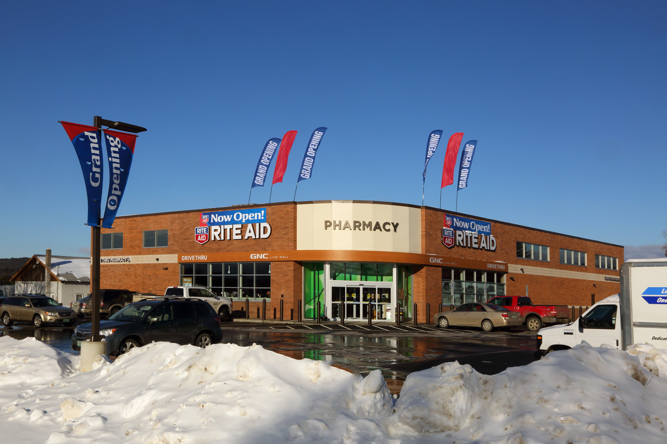
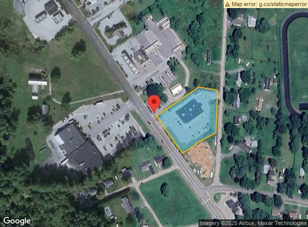
Property Record
621 Route 22A N, Fair Haven, VT 05743
NEARBY LISTINGS FOR SALE OR LEASE
Property Detail
621 Route 22A N
216-070-10113
LAND & COMM.
Commercialnec
Rutland
X
Vermont
50021C0332D
1.92 AC
0
Vermont South Area
2023
Other Market Areas
963700
Rutland, VT
DEMOGRAPHICS near 621 Route 22A N
1 Mile
3 Mile
5 Mile
2024 Total Population
1,869
4,025
6,920
2029 Population
1,849
3,975
6,838
Pop Growth 2024-2029
(1.07%)
(1.24%)
(1.18%)
Average Age
42
41
42
2024 Total Households
801
1,606
2,725
HH Growth 2024-2029
(1.00%)
(1.25%)
(1.21%)
Median Household Inc
$69,392
$64,435
$63,140
Avg Household Size
2.30
2.30
2.30
2024 Avg HH Vehicles
2.00
2.00
2.00
Median Home Value
$153,304
$158,662
$170,258
Median Year Built
1948
1949
1964
Nearby Places
- Restaurants
- Banks
- Shops
- Fitness
- Groceries
PUBLIC TRANSPORTATION
COMMUTER RAIL
Castleton Amtrak Station (Ethan Allen Express - Amtrak)
DRIVE
WALK
Distance
Castleton Amtrak Station (Ethan Allen Express - Amtrak)
8 min
6.7 mi
Whitehall Amtrak (Adirondack - Amtrak)
DRIVE
WALK
Distance
Whitehall Amtrak (Adirondack - Amtrak)
14 min
8.7 mi
Freight Ports
Albany, NY Port
DRIVE
WALK
Distance
Albany, NY Port
120 min
85.3 mi
SALE & LEASE HISTORY
LISTING DATE
SALE/LEASE

Jan 30, 2018
For Sale
Nearby Properties
Address
Land Use
TOTAL SIZE
Lot Size
Zoning
Address
Land Use
TOTAL SIZE
Lot Size
Zoning
30.25 AC
Address
Land Use
TOTAL SIZE
Lot Size
Zoning
Address
Land Use
TOTAL SIZE
Lot Size
Zoning
6.30 AC
Address
Land Use
TOTAL SIZE
Lot Size
Zoning
0.50 AC
Address
Land Use
TOTAL SIZE
Lot Size
Zoning
1,510.68 AC
Address
Land Use
TOTAL SIZE
Lot Size
Zoning
Address
Land Use
TOTAL SIZE
Lot Size
Zoning
0.49 AC
Address
Land Use
TOTAL SIZE
Lot Size
Zoning
6.20 AC
RC
Address
Land Use
TOTAL SIZE
Lot Size
Zoning
13.70 AC
Address
Land Use
TOTAL SIZE
Lot Size
Zoning
Address
Land Use
TOTAL SIZE
Lot Size
Zoning
32,800 SF
14 AC
I
Address
Land Use
TOTAL SIZE
Lot Size
Zoning
0.84 AC
Address
Land Use
TOTAL SIZE
Lot Size
Zoning
7,805 SF
2.12 AC
RC
Address
Land Use
TOTAL SIZE
Lot Size
Zoning
5,160 SF
1 AC
VC
Address
Land Use
TOTAL SIZE
Lot Size
Zoning
0.28 AC
Address
Land Use
TOTAL SIZE
Lot Size
Zoning
1.05 AC
Address
Land Use
TOTAL SIZE
Lot Size
Zoning
1,034 SF
257.50 AC
NONE
Address
Land Use
TOTAL SIZE
Lot Size
Zoning
114.06 AC
R4
Address
Land Use
TOTAL SIZE
Lot Size
Zoning
79.13 AC
Address
Land Use
TOTAL SIZE
Lot Size
Zoning
3.93 AC
Address
Land Use
TOTAL SIZE
Lot Size
Zoning
223 AC
Address
Land Use
TOTAL SIZE
Lot Size
Zoning
Address
Land Use
TOTAL SIZE
Lot Size
Zoning
1.58 AC
Address
Land Use
TOTAL SIZE
Lot Size
Zoning
Address
Land Use
TOTAL SIZE
Lot Size
Zoning
1.10 AC
Address
Land Use
TOTAL SIZE
Lot Size
Zoning
0.29 AC
Address
Land Use
TOTAL SIZE
Lot Size
Zoning
587.39 AC
Address
Land Use
TOTAL SIZE
Lot Size
Zoning
0.71 AC
Address
Land Use
TOTAL SIZE
Lot Size
Zoning
3,658 SF
4.10 AC
VC
The World's #1 Commercial Real Estate Marketplace
Connect with us
© 2025 CoStar Group
The information above has been obtained from sources believed reliable. While we do not doubt its accuracy we have not verified it and make no guarantee, warranty or representation about it. It is your responsibility to independently confirm its accuracy and completeness. Any projections, opinions, assumptions, or estimates used are for example only and do not represent the current or future performance of the property. The value of this transaction to you depends on tax and other factors which should be evaluated by your tax, financial, and legal advisors. You and your advisors should conduct a careful, independent investigation of the property to determine to your satisfaction the suitability of the property for your needs.