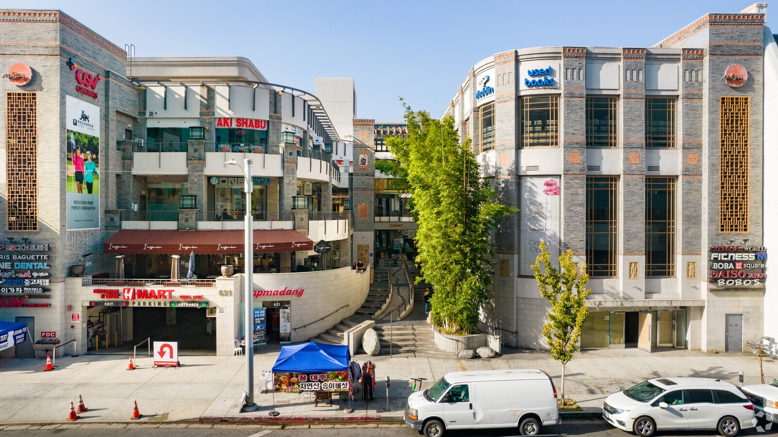
Property Record
621 S Western Ave, Los Angeles, CA 90005
NEARBY LISTINGS FOR SALE OR LEASE
Property Detail
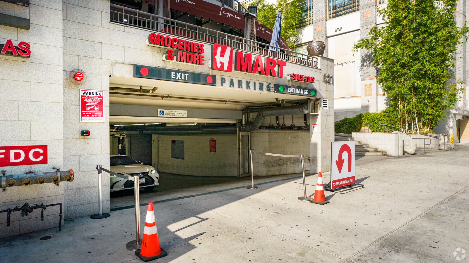
621 S Western Ave
Los Angeles-Long Beach-Glendale, CA
Westminster Place
5503-031-019
WESTMINSTER PLACE LOTS 5,6,10,11,12, AND 13 BLK H
Regionalshoppingcenterormallwithanchorstore
Los Angeles
X
California
06037C1610F
5-6
2024
1.45 AC
2024
Koreatown
211704
Los Angeles
100,436 SF
DEMOGRAPHICS near 621 S Western Ave
1 Mile
3 Mile
5 Mile
2024 Total Population
102,280
625,744
1,186,662
2029 Population
100,756
612,172
1,156,752
Pop Growth 2024-2029
(1.49%)
(2.17%)
(2.52%)
Average Age
39
39
39
2024 Total Households
44,544
256,631
491,672
HH Growth 2024-2029
(1.69%)
(2.16%)
(2.46%)
Median Household Inc
$50,318
$53,460
$60,979
Avg Household Size
2.20
2.30
2.30
2024 Avg HH Vehicles
1.00
1.00
1.00
Median Home Value
$1,021,051
$995,367
$988,597
Median Year Built
1967
1961
1959
Nearby Places
- Restaurants
- Banks
- Shops
- Fitness
- Groceries
PUBLIC TRANSPORTATION
TRANSIT/SUBWAY
Wilshire/Western Station (Purple Line - Los Angeles County Metropolitan Transportation Authority (Metro))
DRIVE
WALK
Distance
Wilshire/Western Station (Purple Line - Los Angeles County Metropolitan Transportation Authority (Metro))
0 min
3 min
0.2 mi
Wilshire/Normandie Station (Purple Line - Los Angeles County Metropolitan Transportation Authority (Metro))
DRIVE
WALK
Distance
Wilshire/Normandie Station (Purple Line - Los Angeles County Metropolitan Transportation Authority (Metro))
1 min
12 min
0.6 mi
COMMUTER RAIL
Los Angeles (Coast Starlight - Amtrak, Pacific Surfliner - Amtrak, Southwest Chief - Amtrak, Texas Eagle - Amtrak)
DRIVE
WALK
Distance
Los Angeles (Coast Starlight - Amtrak, Pacific Surfliner - Amtrak, Southwest Chief - Amtrak, Texas Eagle - Amtrak)
10 min
5.7 mi
Union Station (91 Line - Southern California Regional Rail Authority (Metrolink), Antelope Valley Line - Southern California Regional Rail Authority (Metrolink), Orange County Line - Southern California Regional Rail Authority (Metrolink), Riverside Line - Southern California Regional Rail Authority (Metrolink), San Bernardino Line - Southern California Regional Rail Authority (Metrolink), Ventura County Line - Southern California Regional Rail Authority (Metrolink))
DRIVE
WALK
Distance
Union Station (91 Line - Southern California Regional Rail Authority (Metrolink), Antelope Valley Line - Southern California Regional Rail Authority (Metrolink), Orange County Line - Southern California Regional Rail Authority (Metrolink), Riverside Line - Southern California Regional Rail Authority (Metrolink), San Bernardino Line - Southern California Regional Rail Authority (Metrolink), Ventura County Line - Southern California Regional Rail Authority (Metrolink))
12 min
5.9 mi
AIRPORT
Los Angeles International
DRIVE
WALK
Distance
Los Angeles International
22 min
11.9 mi
Bob Hope
DRIVE
WALK
Distance
Bob Hope
20 min
11.9 mi
Long Beach (Daugherty Field)
DRIVE
WALK
Distance
Long Beach (Daugherty Field)
35 min
25.0 mi
Freight Ports
Port of Long Beach
DRIVE
WALK
Distance
Port of Long Beach
38 min
26.8 mi
SALE & LEASE HISTORY
LISTING DATE
SALE/LEASE

Sep 08, 2020
For Lease
Jun 14, 2021
For Lease
Jul 06, 2022
For Lease
Nearby Properties
Address
Land Use
TOTAL SIZE
Lot Size
Zoning
Address
Land Use
TOTAL SIZE
Lot Size
Zoning
930,249 SF
7.39 AC
LAC2
Address
Land Use
TOTAL SIZE
Lot Size
Zoning
1,002,990 SF
8.42 AC
LAC4
Address
Land Use
TOTAL SIZE
Lot Size
Zoning
969,516 SF
14.75 AC
Address
Land Use
TOTAL SIZE
Lot Size
Zoning
108,464 SF
9.17 AC
LALASED
Address
Land Use
TOTAL SIZE
Lot Size
Zoning
969,264 SF
0.94 AC
LAC2
Address
Land Use
TOTAL SIZE
Lot Size
Zoning
200,811 SF
4.58 AC
LALASED
Address
Land Use
TOTAL SIZE
Lot Size
Zoning
764,804 SF
1.48 AC
Address
Land Use
TOTAL SIZE
Lot Size
Zoning
901,642 SF
Address
Land Use
TOTAL SIZE
Lot Size
Zoning
738,975 SF
2.71 AC
LAC2
Address
Land Use
TOTAL SIZE
Lot Size
Zoning
1,094,768 SF
0.73 AC
LAC2
Address
Land Use
TOTAL SIZE
Lot Size
Zoning
161,046 SF
6.88 AC
LAM1
Address
Land Use
TOTAL SIZE
Lot Size
Zoning
252,523 SF
2.26 AC
LAC2
Address
Land Use
TOTAL SIZE
Lot Size
Zoning
749,061 SF
2.39 AC
LAC2
Address
Land Use
TOTAL SIZE
Lot Size
Zoning
966,466 SF
3.99 AC
LAC2
Address
Land Use
TOTAL SIZE
Lot Size
Zoning
728,063 SF
2.08 AC
LAC4
Address
Land Use
TOTAL SIZE
Lot Size
Zoning
67,126 SF
48.09 AC
LAM1
Address
Land Use
TOTAL SIZE
Lot Size
Zoning
472,363 SF
3.24 AC
LAC4
Address
Land Use
TOTAL SIZE
Lot Size
Zoning
515,531 SF
14.65 AC
LAC2
Address
Land Use
TOTAL SIZE
Lot Size
Zoning
641,453 SF
2.93 AC
LAC4
Address
Land Use
TOTAL SIZE
Lot Size
Zoning
497,377 SF
3.29 AC
LAC4
Address
Land Use
TOTAL SIZE
Lot Size
Zoning
651,289 SF
3.79 AC
LACW
Address
Land Use
TOTAL SIZE
Lot Size
Zoning
793,274 SF
7.80 AC
LAR4
Address
Land Use
TOTAL SIZE
Lot Size
Zoning
110,580 SF
6.88 AC
LAC2
Address
Land Use
TOTAL SIZE
Lot Size
Zoning
724,958 SF
5.88 AC
LAC2
Address
Land Use
TOTAL SIZE
Lot Size
Zoning
556,235 SF
4.22 AC
LAC4
Address
Land Use
TOTAL SIZE
Lot Size
Zoning
520,825 SF
2.13 AC
LAC2
Address
Land Use
TOTAL SIZE
Lot Size
Zoning
961,271 SF
1.38 AC
LACW
Address
Land Use
TOTAL SIZE
Lot Size
Zoning
453,182 SF
2.76 AC
LAC4
Address
Land Use
TOTAL SIZE
Lot Size
Zoning
323,927 SF
0.85 AC
LALASED
Address
Land Use
TOTAL SIZE
Lot Size
Zoning
461,090 SF
0.47 AC
LAC2
The World's #1 Commercial Real Estate Marketplace
Connect with us
© 2025 CoStar Group
The information above has been obtained from sources believed reliable. While we do not doubt its accuracy we have not verified it and make no guarantee, warranty or representation about it. It is your responsibility to independently confirm its accuracy and completeness. Any projections, opinions, assumptions, or estimates used are for example only and do not represent the current or future performance of the property. The value of this transaction to you depends on tax and other factors which should be evaluated by your tax, financial, and legal advisors. You and your advisors should conduct a careful, independent investigation of the property to determine to your satisfaction the suitability of the property for your needs.