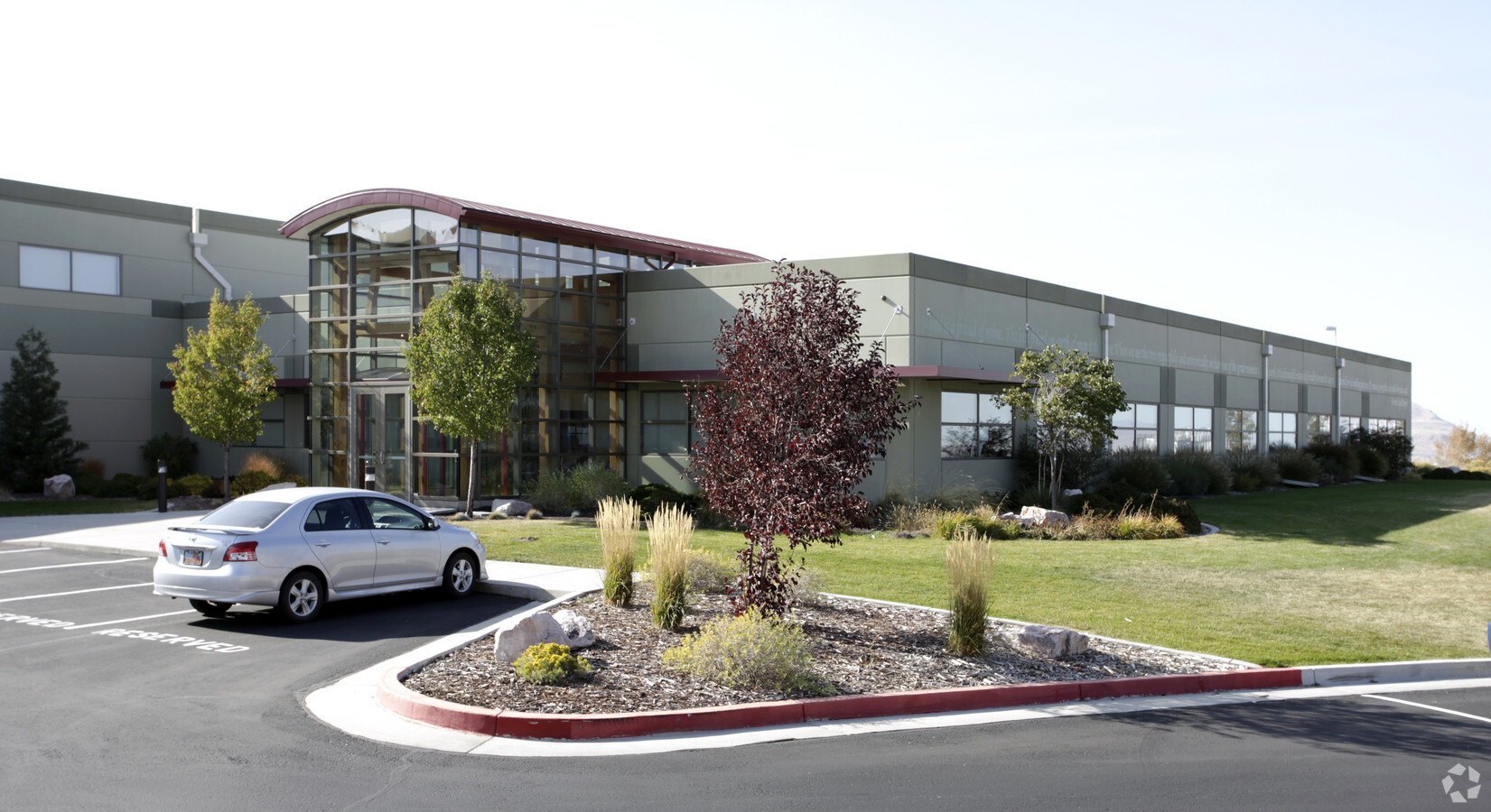
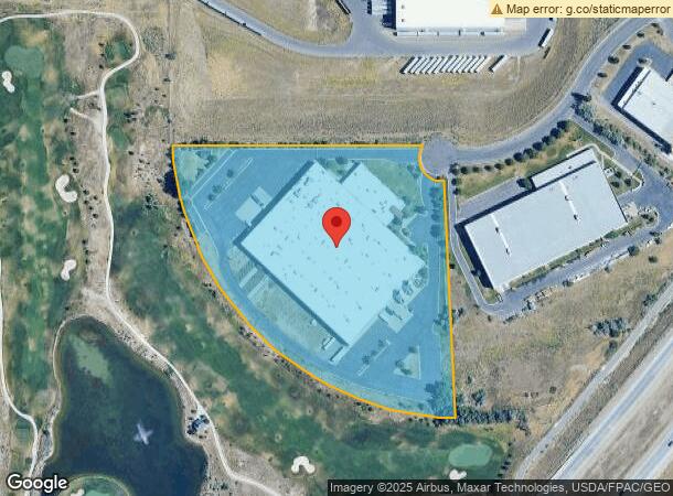
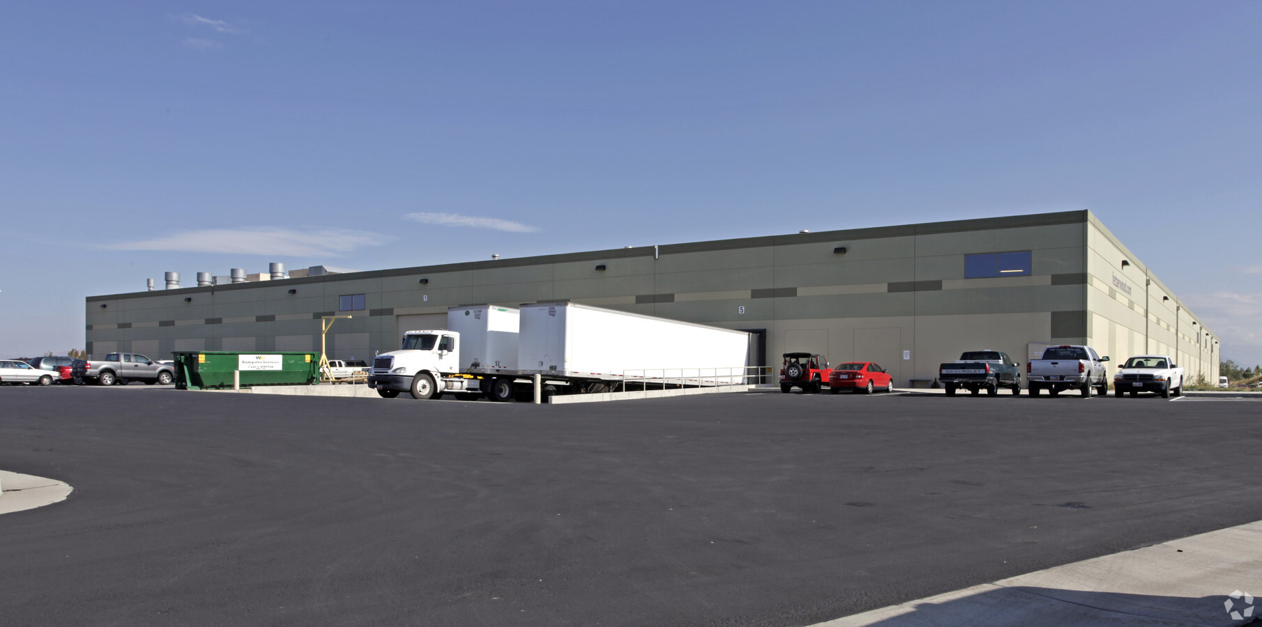
Property Record
6223 W Double Eagle Dr, Salt Lake City, UT 84118
NEARBY LISTINGS FOR SALE OR LEASE
Property Detail
6223 W Double Eagle Dr
Salt Lake City, UT
West Ridge Commerce Park
20-11-151-006-0000
LOT 307, WEST RIDGE COMMERCE PARK PH 3. 7845-0490 9039-0877 9121-8753
Lightindustrial
Salt Lake
X
Utah
49035C0275G
307
2023
9.31 AC
2023
West Murray
113545
Salt Lake City
132,800 SF
DEMOGRAPHICS near 6223 W Double Eagle Dr
1 Mile
3 Mile
5 Mile
2024 Total Population
5,806
113,706
269,934
2029 Population
5,824
114,410
273,432
Pop Growth 2024-2029
+ 0.31%
+ 0.62%
+ 1.30%
Average Age
33
35
35
2024 Total Households
1,409
30,705
76,975
HH Growth 2024-2029
+ 0.07%
+ 0.50%
+ 1.23%
Median Household Inc
$99,999
$85,072
$82,375
Avg Household Size
3.90
3.60
3.40
2024 Avg HH Vehicles
3.00
3.00
2.00
Median Home Value
$407,848
$338,204
$358,528
Median Year Built
2003
1982
1987
Nearby Places
- Restaurants
- Banks
- Shops
- Fitness
- Groceries
PUBLIC TRANSPORTATION
AIRPORT
Salt Lake City International
DRIVE
WALK
Distance
Salt Lake City International
19 min
10.9 mi
Freight Ports
Port of Stockton
DRIVE
WALK
Distance
Port of Stockton
713 min
693.4 mi
Nearby Properties
Address
Land Use
TOTAL SIZE
Lot Size
Zoning
Address
Land Use
TOTAL SIZE
Lot Size
Zoning
1,113,459 SF
80.09 AC
M
Address
Land Use
TOTAL SIZE
Lot Size
Zoning
329,306 SF
14.67 AC
5005
Address
Land Use
TOTAL SIZE
Lot Size
Zoning
832,383 SF
19.61 AC
IP-M
Address
Land Use
TOTAL SIZE
Lot Size
Zoning
250,027 SF
8.46 AC
Address
Land Use
TOTAL SIZE
Lot Size
Zoning
110,376 SF
15.02 AC
R-M
Address
Land Use
TOTAL SIZE
Lot Size
Zoning
131,460 SF
75.92 AC
R-1-10
Address
Land Use
TOTAL SIZE
Lot Size
Zoning
404,800 SF
24.62 AC
M
Address
Land Use
TOTAL SIZE
Lot Size
Zoning
186,337 SF
20 AC
1107
Address
Land Use
TOTAL SIZE
Lot Size
Zoning
159,381 SF
18.82 AC
1106
Address
Land Use
TOTAL SIZE
Lot Size
Zoning
418,984 SF
21.65 AC
IP-M
Address
Land Use
TOTAL SIZE
Lot Size
Zoning
746,986 SF
782.87 AC
A-20
Address
Land Use
TOTAL SIZE
Lot Size
Zoning
71,093 SF
29.58 AC
1144
Address
Land Use
TOTAL SIZE
Lot Size
Zoning
297,972 SF
45.99 AC
M
Address
Land Use
TOTAL SIZE
Lot Size
Zoning
95,998 SF
9.46 AC
1107
Address
Land Use
TOTAL SIZE
Lot Size
Zoning
319,200 SF
18.64 AC
M
Address
Land Use
TOTAL SIZE
Lot Size
Zoning
391,140 SF
17.41 AC
M
Address
Land Use
TOTAL SIZE
Lot Size
Zoning
350,675 SF
36.53 AC
M
Address
Land Use
TOTAL SIZE
Lot Size
Zoning
171,937 SF
24.21 AC
1108
Address
Land Use
TOTAL SIZE
Lot Size
Zoning
214,385 SF
20.58 AC
M
Address
Land Use
TOTAL SIZE
Lot Size
Zoning
211,162 SF
19.87 AC
C-2
Address
Land Use
TOTAL SIZE
Lot Size
Zoning
211,058 SF
21.71 AC
C-2
Address
Land Use
TOTAL SIZE
Lot Size
Zoning
178,750 SF
9.94 AC
M-1
Address
Land Use
TOTAL SIZE
Lot Size
Zoning
244,871 SF
14.53 AC
4144
Address
Land Use
TOTAL SIZE
Lot Size
Zoning
189,488 SF
7.09 AC
M
Address
Land Use
TOTAL SIZE
Lot Size
Zoning
22,665 SF
5.72 AC
C-2
Address
Land Use
TOTAL SIZE
Lot Size
Zoning
120,163 SF
6.69 AC
IP-M
Address
Land Use
TOTAL SIZE
Lot Size
Zoning
19.27 AC
RM
Address
Land Use
TOTAL SIZE
Lot Size
Zoning
78.48 AC
A-20
Address
Land Use
TOTAL SIZE
Lot Size
Zoning
173.65 AC
M
Address
Land Use
TOTAL SIZE
Lot Size
Zoning
67,468 SF
11.48 AC
4192
The World's #1 Commercial Real Estate Marketplace
Connect with us
© 2025 CoStar Group
The information above has been obtained from sources believed reliable. While we do not doubt its accuracy we have not verified it and make no guarantee, warranty or representation about it. It is your responsibility to independently confirm its accuracy and completeness. Any projections, opinions, assumptions, or estimates used are for example only and do not represent the current or future performance of the property. The value of this transaction to you depends on tax and other factors which should be evaluated by your tax, financial, and legal advisors. You and your advisors should conduct a careful, independent investigation of the property to determine to your satisfaction the suitability of the property for your needs.