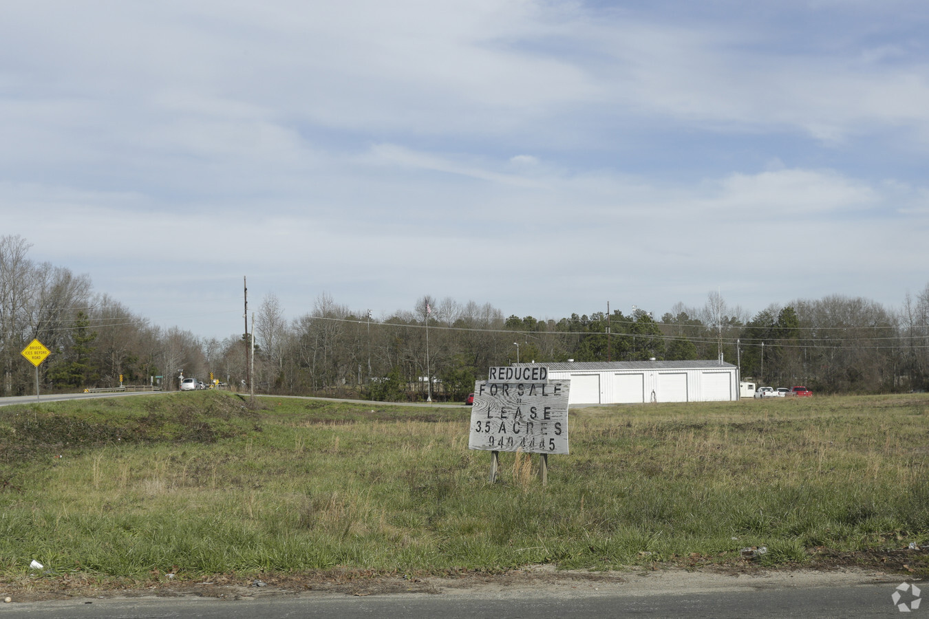
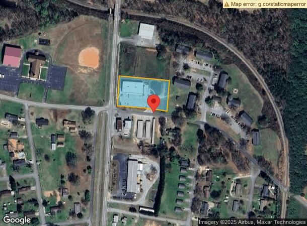
Property Record
625 Calhoun Rd, Belton, SC 29627
NEARBY LISTINGS FOR SALE OR LEASE
Property Detail
625 Calhoun Rd
249-01-01-001
Fleetwood
Storebuilding
CP S 2759/7 PP 101/261 F285 D439 PP 068/017 HWY 20/CALHOUN RD 1.62.AC
X
Anderson
45045C0550E
South Carolina
2023
1.62 AC
2024
Anderson County
011402
Greenville/Spartanburg
8,988 SF
Greenville-Anderson-Mauldin, SC
DEMOGRAPHICS near 625 Calhoun Rd
1 Mile
3 Mile
5 Mile
2024 Total Population
1,949
8,985
16,864
2029 Population
2,080
9,600
18,066
Pop Growth 2024-2029
+ 6.72%
+ 6.84%
+ 7.13%
Average Age
41
41
41
2024 Total Households
820
3,690
6,716
HH Growth 2024-2029
+ 6.83%
+ 6.94%
+ 7.18%
Median Household Inc
$34,204
$50,646
$56,744
Avg Household Size
2.40
2.40
2.50
2024 Avg HH Vehicles
2.00
2.00
2.00
Median Home Value
$113,915
$134,134
$136,883
Median Year Built
1973
1973
1981
Nearby Places
- Restaurants
- Banks
- Shops
- Fitness
- Groceries
PUBLIC TRANSPORTATION
AIRPORT
Greenville Spartanburg International
DRIVE
WALK
Distance
Greenville Spartanburg International
53 min
37.2 mi
Freight Ports
North Charleston Terminal
DRIVE
WALK
Distance
North Charleston Terminal
239 min
206.9 mi
Nearby Properties
Address
Land Use
TOTAL SIZE
Lot Size
Zoning
Address
Land Use
TOTAL SIZE
Lot Size
Zoning
230,048 SF
16.62 AC
Address
Land Use
TOTAL SIZE
Lot Size
Zoning
53,387 SF
2.57 AC
Address
Land Use
TOTAL SIZE
Lot Size
Zoning
696 SF
4.57 AC
Address
Land Use
TOTAL SIZE
Lot Size
Zoning
20.30 AC
UNZONED
Address
Land Use
TOTAL SIZE
Lot Size
Zoning
720 SF
23.35 AC
Address
Land Use
TOTAL SIZE
Lot Size
Zoning
8,425 SF
1.37 AC
Address
Land Use
TOTAL SIZE
Lot Size
Zoning
59,545 SF
15.42 AC
Address
Land Use
TOTAL SIZE
Lot Size
Zoning
6,722 SF
5.02 AC
Address
Land Use
TOTAL SIZE
Lot Size
Zoning
12,276 SF
1.97 AC
Address
Land Use
TOTAL SIZE
Lot Size
Zoning
720 SF
15.48 AC
Address
Land Use
TOTAL SIZE
Lot Size
Zoning
158,791 SF
54.55 AC
Address
Land Use
TOTAL SIZE
Lot Size
Zoning
6,231 SF
4.05 AC
Address
Land Use
TOTAL SIZE
Lot Size
Zoning
8,312 SF
7.50 AC
Address
Land Use
TOTAL SIZE
Lot Size
Zoning
2,347 SF
1.38 AC
Address
Land Use
TOTAL SIZE
Lot Size
Zoning
50,849 SF
7.07 AC
Address
Land Use
TOTAL SIZE
Lot Size
Zoning
2,482 SF
5.93 AC
Address
Land Use
TOTAL SIZE
Lot Size
Zoning
2,619 SF
1.03 AC
Address
Land Use
TOTAL SIZE
Lot Size
Zoning
1,679 SF
1.67 AC
Address
Land Use
TOTAL SIZE
Lot Size
Zoning
3,421 SF
1.18 AC
Address
Land Use
TOTAL SIZE
Lot Size
Zoning
42,248 SF
2.22 AC
Address
Land Use
TOTAL SIZE
Lot Size
Zoning
2,905 SF
1.19 AC
Address
Land Use
TOTAL SIZE
Lot Size
Zoning
2,774 SF
2.12 AC
Address
Land Use
TOTAL SIZE
Lot Size
Zoning
14,970 SF
3.86 AC
Address
Land Use
TOTAL SIZE
Lot Size
Zoning
9,760 SF
2.92 AC
Address
Land Use
TOTAL SIZE
Lot Size
Zoning
54,666 SF
3.26 AC
Address
Land Use
TOTAL SIZE
Lot Size
Zoning
9 AC
UNZONED
Address
Land Use
TOTAL SIZE
Lot Size
Zoning
7,723 SF
12.98 AC
The World's #1 Commercial Real Estate Marketplace
Connect with us
© 2025 CoStar Group
The information above has been obtained from sources believed reliable. While we do not doubt its accuracy we have not verified it and make no guarantee, warranty or representation about it. It is your responsibility to independently confirm its accuracy and completeness. Any projections, opinions, assumptions, or estimates used are for example only and do not represent the current or future performance of the property. The value of this transaction to you depends on tax and other factors which should be evaluated by your tax, financial, and legal advisors. You and your advisors should conduct a careful, independent investigation of the property to determine to your satisfaction the suitability of the property for your needs.