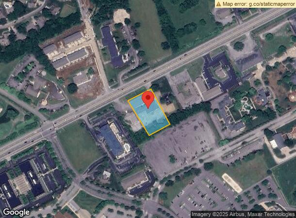
Property Record
625 E Main St, Hendersonville, TN 37075


NEARBY LISTINGS FOR SALE OR LEASE
Property Detail
625 E Main St
Nashville-Davidson--Murfreesboro--Franklin, TN
Bluegrass Profession
158A-A-003.00
PLAT: 10 PAGE: 5 BLOCK: LOT: 1 SUBD: BLUEGRASS PROFESSIONAL
Medicalbuilding
Sumner
X
Tennessee
47165C0404G
1
2024
1 AC
2024
Rivergate/Hendersonville
021204
Nashville
14,436 SF
DEMOGRAPHICS near 625 E Main St
1 Mile
3 Mile
5 Mile
2024 Total Population
5,199
38,304
92,505
2029 Population
5,806
42,898
103,753
Pop Growth 2024-2029
+ 11.68%
+ 11.99%
+ 12.16%
Average Age
43
40
41
2024 Total Households
1,967
14,159
35,602
HH Growth 2024-2029
+ 11.85%
+ 12.11%
+ 12.35%
Median Household Inc
$100,310
$91,376
$84,013
Avg Household Size
2.60
2.70
2.60
2024 Avg HH Vehicles
2.00
2.00
2.00
Median Home Value
$407,616
$390,991
$379,049
Median Year Built
1995
1996
1995
Nearby Places
- Restaurants
- Banks
- Shops
- Fitness
- Groceries
PUBLIC TRANSPORTATION
AIRPORT
Nashville International
DRIVE
WALK
Distance
Nashville International
36 min
29.2 mi
Freight Ports
Port of Mobile
DRIVE
WALK
Distance
Port of Mobile
509 min
466.8 mi
SALE & LEASE HISTORY
LISTING DATE
SALE/LEASE

Sep 25, 2016
For Lease
Oct 16, 2019
For Sale
Oct 15, 2020
For Lease
Aug 17, 2017
For Lease
Apr 02, 2019
For Lease
Nearby Properties
Address
Land Use
TOTAL SIZE
Lot Size
Zoning
Address
Land Use
TOTAL SIZE
Lot Size
Zoning
31,163 SF
24.37 AC
Address
Land Use
TOTAL SIZE
Lot Size
Zoning
56,782 SF
11.37 AC
Address
Land Use
TOTAL SIZE
Lot Size
Zoning
46,650 SF
17.41 AC
MRO
Address
Land Use
TOTAL SIZE
Lot Size
Zoning
84,210 SF
8.05 AC
GCS
Address
Land Use
TOTAL SIZE
Lot Size
Zoning
86,086 SF
8 AC
OPS
Address
Land Use
TOTAL SIZE
Lot Size
Zoning
32,481 SF
9.42 AC
GCS
Address
Land Use
TOTAL SIZE
Lot Size
Zoning
8,336 SF
18.34 AC
GCS
Address
Land Use
TOTAL SIZE
Lot Size
Zoning
185,553 SF
5.29 AC
GCS
Address
Land Use
TOTAL SIZE
Lot Size
Zoning
218,472 SF
27.08 AC
GCS
Address
Land Use
TOTAL SIZE
Lot Size
Zoning
105,942 SF
14.80 AC
GCS
Address
Land Use
TOTAL SIZE
Lot Size
Zoning
78,930 SF
12.78 AC
GCS
Address
Land Use
TOTAL SIZE
Lot Size
Zoning
18,342 SF
8.40 AC
RM1
Address
Land Use
TOTAL SIZE
Lot Size
Zoning
99,333 SF
1.73 AC
ESTATEA
Address
Land Use
TOTAL SIZE
Lot Size
Zoning
142,403 SF
18.78 AC
NCS
Address
Land Use
TOTAL SIZE
Lot Size
Zoning
105,542 SF
9.09 AC
GCS
Address
Land Use
TOTAL SIZE
Lot Size
Zoning
131,339 SF
18.22 AC
Address
Land Use
TOTAL SIZE
Lot Size
Zoning
63,662 SF
3.79 AC
GCS
Address
Land Use
TOTAL SIZE
Lot Size
Zoning
52,364 SF
5.78 AC
OPS
Address
Land Use
TOTAL SIZE
Lot Size
Zoning
15,105 SF
13.35 AC
Address
Land Use
TOTAL SIZE
Lot Size
Zoning
27,038 SF
4.05 AC
Address
Land Use
TOTAL SIZE
Lot Size
Zoning
67,473 SF
2.92 AC
Address
Land Use
TOTAL SIZE
Lot Size
Zoning
120,846 SF
15.03 AC
GCS
Address
Land Use
TOTAL SIZE
Lot Size
Zoning
154,556 SF
16.26 AC
Address
Land Use
TOTAL SIZE
Lot Size
Zoning
11,274 SF
15.30 AC
Address
Land Use
TOTAL SIZE
Lot Size
Zoning
26,848 SF
21.70 AC
OPS
Address
Land Use
TOTAL SIZE
Lot Size
Zoning
17,504 SF
1.68 AC
GCS
Address
Land Use
TOTAL SIZE
Lot Size
Zoning
19,264 SF
12.38 AC
Address
Land Use
TOTAL SIZE
Lot Size
Zoning
61,399 SF
2.97 AC
GCS
Address
Land Use
TOTAL SIZE
Lot Size
Zoning
317,625 SF
30.98 AC
Address
Land Use
TOTAL SIZE
Lot Size
Zoning
102,765 SF
2.26 AC
GCS
The World's #1 Commercial Real Estate Marketplace
Connect with us
© 2025 CoStar Group
The information above has been obtained from sources believed reliable. While we do not doubt its accuracy we have not verified it and make no guarantee, warranty or representation about it. It is your responsibility to independently confirm its accuracy and completeness. Any projections, opinions, assumptions, or estimates used are for example only and do not represent the current or future performance of the property. The value of this transaction to you depends on tax and other factors which should be evaluated by your tax, financial, and legal advisors. You and your advisors should conduct a careful, independent investigation of the property to determine to your satisfaction the suitability of the property for your needs.