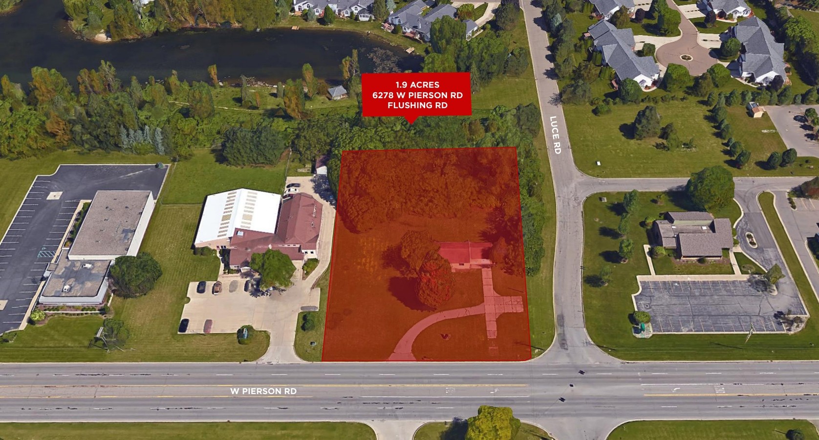
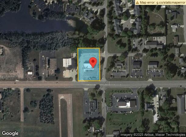
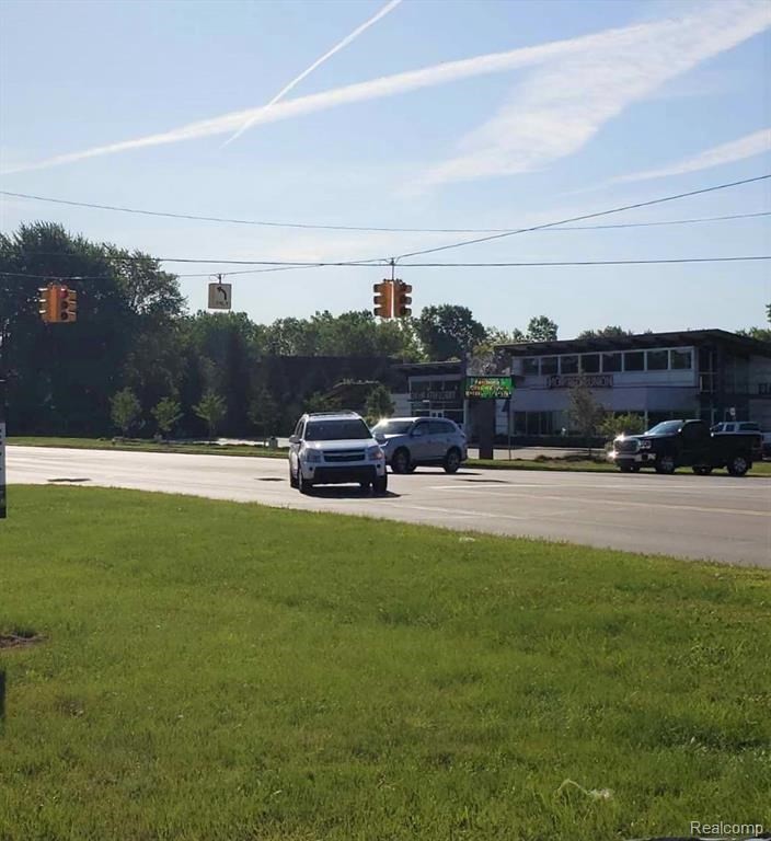
Property Record
6278 W Pierson Rd, Flushing, MI 48433
NEARBY LISTINGS FOR SALE OR LEASE
-
-
-
No Photo
-
View all Flushing listings for sale on LoopNet.com
Property Detail
6278 W Pierson Rd
14-30-300-043
W 200 FT OF E 233 FT OF S 350 FT OF SW 1/4 SEC 30 T8N R6E 1.60 A
Commercialnec
Genesee
X
Michigan
26049C0166D
1.38 AC
2024
Flint
2024
Detroit
010502
Flint, MI
DEMOGRAPHICS near 6278 W Pierson Rd
1 Mile
3 Mile
5 Mile
2024 Total Population
2,543
22,521
76,155
2029 Population
2,458
21,867
75,689
Pop Growth 2024-2029
(3.34%)
(2.90%)
(0.61%)
Average Age
42
43
41
2024 Total Households
1,071
9,242
31,219
HH Growth 2024-2029
(3.45%)
(2.95%)
(0.64%)
Median Household Inc
$59,586
$66,092
$48,733
Avg Household Size
2.30
2.40
2.30
2024 Avg HH Vehicles
2.00
2.00
2.00
Median Home Value
$147,667
$175,332
$122,972
Median Year Built
1965
1972
1966
Nearby Places
- Restaurants
- Banks
- Shops
- Fitness
- Groceries
PUBLIC TRANSPORTATION
AIRPORT
Bishop International
DRIVE
WALK
Distance
Bishop International
26 min
11.5 mi
Freight Ports
Port of Toledo
DRIVE
WALK
Distance
Port of Toledo
140 min
118.3 mi
SALE & LEASE HISTORY
LISTING DATE
SALE/LEASE

Sep 24, 2016
For Sale
Oct 27, 2017
For Lease
Nov 06, 2017
For Lease
Nov 06, 2017
For Sale
Dec 21, 2016
For Lease
Dec 20, 2019
For Sale
Nearby Properties
Address
Land Use
TOTAL SIZE
Lot Size
Zoning
Address
Land Use
TOTAL SIZE
Lot Size
Zoning
106,551 SF
11.44 AC
R3-B (HDR)
Address
Land Use
TOTAL SIZE
Lot Size
Zoning
72,367 SF
10.60 AC
R3-B (HDR)
Address
Land Use
TOTAL SIZE
Lot Size
Zoning
11.97 AC
Address
Land Use
TOTAL SIZE
Lot Size
Zoning
41,298 SF
9.49 AC
Address
Land Use
TOTAL SIZE
Lot Size
Zoning
10.30 AC
Address
Land Use
TOTAL SIZE
Lot Size
Zoning
Address
Land Use
TOTAL SIZE
Lot Size
Zoning
133,008 SF
7.46 AC
RES R-3 A
Address
Land Use
TOTAL SIZE
Lot Size
Zoning
67,266 SF
8.11 AC
CBD CENTL
Address
Land Use
TOTAL SIZE
Lot Size
Zoning
11.12 AC
Address
Land Use
TOTAL SIZE
Lot Size
Zoning
9.46 AC
Address
Land Use
TOTAL SIZE
Lot Size
Zoning
Address
Land Use
TOTAL SIZE
Lot Size
Zoning
5.10 AC
Address
Land Use
TOTAL SIZE
Lot Size
Zoning
2.45 AC
Address
Land Use
TOTAL SIZE
Lot Size
Zoning
62,121 SF
6.23 AC
B-2 CC GEN
Address
Land Use
TOTAL SIZE
Lot Size
Zoning
13.20 AC
Address
Land Use
TOTAL SIZE
Lot Size
Zoning
5.70 AC
Address
Land Use
TOTAL SIZE
Lot Size
Zoning
2.02 AC
Address
Land Use
TOTAL SIZE
Lot Size
Zoning
1.41 AC
Address
Land Use
TOTAL SIZE
Lot Size
Zoning
100,022 SF
92 AC
Address
Land Use
TOTAL SIZE
Lot Size
Zoning
Address
Land Use
TOTAL SIZE
Lot Size
Zoning
31.55 AC
Address
Land Use
TOTAL SIZE
Lot Size
Zoning
21,763 SF
4.36 AC
B-2 CC GEN
Address
Land Use
TOTAL SIZE
Lot Size
Zoning
31,008 SF
6.14 AC
R3-B (HDR)
Address
Land Use
TOTAL SIZE
Lot Size
Zoning
3.32 AC
Address
Land Use
TOTAL SIZE
Lot Size
Zoning
3.52 AC
Address
Land Use
TOTAL SIZE
Lot Size
Zoning
Address
Land Use
TOTAL SIZE
Lot Size
Zoning
18.66 AC
Address
Land Use
TOTAL SIZE
Lot Size
Zoning
34,708 SF
5.05 AC
B-2 CC GEN
Address
Land Use
TOTAL SIZE
Lot Size
Zoning
12,500 SF
6.84 AC
Address
Land Use
TOTAL SIZE
Lot Size
Zoning
0.64 AC
The World's #1 Commercial Real Estate Marketplace
Connect with us
© 2025 CoStar Group
The information above has been obtained from sources believed reliable. While we do not doubt its accuracy we have not verified it and make no guarantee, warranty or representation about it. It is your responsibility to independently confirm its accuracy and completeness. Any projections, opinions, assumptions, or estimates used are for example only and do not represent the current or future performance of the property. The value of this transaction to you depends on tax and other factors which should be evaluated by your tax, financial, and legal advisors. You and your advisors should conduct a careful, independent investigation of the property to determine to your satisfaction the suitability of the property for your needs.