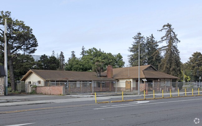
Property Record
630 Donohoe St, East Palo Alto, CA 94303

NEARBY LISTINGS FOR SALE OR LEASE
Property Detail
630 Donohoe St
San Francisco-Redwood City-South San Francisco, CA
Woodland Place
063-311-050
PTN OF LOTS 7 & 8 BLK 7 WOODLAND PLACE RSM 7/24
Officebuilding
San Mateo
X
California
06081C0309F
7,8
2024
0.08 AC
2025
Menlo Park
611901
San Francisco
DEMOGRAPHICS near 630 Donohoe St
1 Mile
3 Mile
5 Mile
2024 Total Population
31,211
116,822
243,433
2029 Population
29,554
112,407
235,166
Pop Growth 2024-2029
(5.31%)
(3.78%)
(3.40%)
Average Age
37
39
39
2024 Total Households
8,679
39,730
84,330
HH Growth 2024-2029
(5.43%)
(3.60%)
(3.29%)
Median Household Inc
$116,795
$146,409
$147,137
Avg Household Size
3.40
2.60
2.60
2024 Avg HH Vehicles
2.00
2.00
2.00
Median Home Value
$1,099,066
$1,132,472
$1,129,986
Median Year Built
1962
1963
1967
Nearby Places
Map Layers
Map Styles
 Street
 Aerial
- Restaurants
- Banks
- Shops
- Fitness
- Groceries
PUBLIC TRANSPORTATION
COMMUTER RAIL
Palo Alto (Caltrain - Caltrain (Caltrain))
DRIVE
WALK
Distance
Palo Alto (Caltrain - Caltrain (Caltrain))
8 min
2.5 mi
California Avenue (Caltrain - Caltrain (Caltrain))
DRIVE
WALK
Distance
California Avenue (Caltrain - Caltrain (Caltrain))
9 min
4.1 mi
AIRPORT
Norman Y Mineta San Jose International
DRIVE
WALK
Distance
Norman Y Mineta San Jose International
20 min
14.8 mi
San Francisco International
DRIVE
WALK
Distance
San Francisco International
25 min
19.0 mi
Metro Oakland International
DRIVE
WALK
Distance
Metro Oakland International
38 min
27.8 mi
Freight Ports
Port of Redwood City
DRIVE
WALK
Distance
Port of Redwood City
10 min
5.9 mi
Nearby Properties
Address
Land Use
TOTAL SIZE
Lot Size
Zoning
Address
Land Use
TOTAL SIZE
Lot Size
Zoning
719,052 SF
56.03 AC
Address
Land Use
TOTAL SIZE
Lot Size
Zoning
999,999 SF
56.91 AC
Address
Land Use
TOTAL SIZE
Lot Size
Zoning
1,395,540 SF
51.72 AC
C3
Address
Land Use
TOTAL SIZE
Lot Size
Zoning
22.07 AC
Address
Land Use
TOTAL SIZE
Lot Size
Zoning
Address
Land Use
TOTAL SIZE
Lot Size
Zoning
520,988 SF
8.88 AC
Address
Land Use
TOTAL SIZE
Lot Size
Zoning
265,341 SF
13.53 AC
RP
Address
Land Use
TOTAL SIZE
Lot Size
Zoning
918,926 SF
17.54 AC
PC442
Address
Land Use
TOTAL SIZE
Lot Size
Zoning
Address
Land Use
TOTAL SIZE
Lot Size
Zoning
528,437 SF
9.69 AC
Address
Land Use
TOTAL SIZE
Lot Size
Zoning
210,000 SF
10.79 AC
Address
Land Use
TOTAL SIZE
Lot Size
Zoning
247,567 SF
3.52 AC
Address
Land Use
TOTAL SIZE
Lot Size
Zoning
212,924 SF
1.83 AC
Address
Land Use
TOTAL SIZE
Lot Size
Zoning
164,853 SF
3.89 AC
Address
Land Use
TOTAL SIZE
Lot Size
Zoning
145,617 SF
8.24 AC
EA00C1
Address
Land Use
TOTAL SIZE
Lot Size
Zoning
190,389 SF
11.20 AC
M20000
Address
Land Use
TOTAL SIZE
Lot Size
Zoning
143,429 SF
2.12 AC
Address
Land Use
TOTAL SIZE
Lot Size
Zoning
149,700 SF
2.28 AC
Address
Land Use
TOTAL SIZE
Lot Size
Zoning
113,964 SF
6.28 AC
RP
Address
Land Use
TOTAL SIZE
Lot Size
Zoning
222,234 SF
6.39 AC
Address
Land Use
TOTAL SIZE
Lot Size
Zoning
184,142 SF
10.29 AC
RP
Address
Land Use
TOTAL SIZE
Lot Size
Zoning
Address
Land Use
TOTAL SIZE
Lot Size
Zoning
16.43 AC
Address
Land Use
TOTAL SIZE
Lot Size
Zoning
190,000 SF
3.37 AC
Address
Land Use
TOTAL SIZE
Lot Size
Zoning
171,563 SF
3.57 AC
Address
Land Use
TOTAL SIZE
Lot Size
Zoning
2,024 SF
1.38 AC
Address
Land Use
TOTAL SIZE
Lot Size
Zoning
68,488 SF
1.38 AC
M20000
Address
Land Use
TOTAL SIZE
Lot Size
Zoning
224,852 SF
9.86 AC
GMB
Address
Land Use
TOTAL SIZE
Lot Size
Zoning
97,203 SF
5.91 AC
RP
Address
Land Use
TOTAL SIZE
Lot Size
Zoning
259,586 SF
17.92 AC
LMD
The World's #1 Commercial Real Estate Marketplace
Connect with us
© 2026 CoStar Group
The information above has been obtained from sources believed reliable. While we do not doubt its accuracy we have not verified it and make no guarantee, warranty or representation about it. It is your responsibility to independently confirm its accuracy and completeness. Any projections, opinions, assumptions, or estimates used are for example only and do not represent the current or future performance of the property. The value of this transaction to you depends on tax and other factors which should be evaluated by your tax, financial, and legal advisors. You and your advisors should conduct a careful, independent investigation of the property to determine to your satisfaction the suitability of the property for your needs.