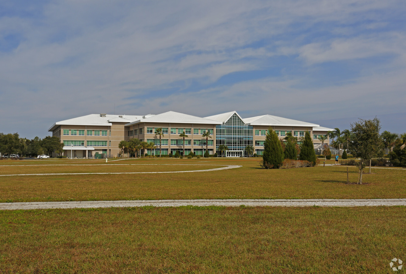
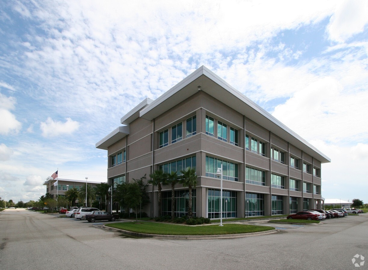
Property Record
6300 University Pky, Sarasota, FL 34240
NEARBY LISTINGS FOR SALE OR LEASE
Property Detail
6300 University Pky
North Port-Sarasota-Bradenton, FL
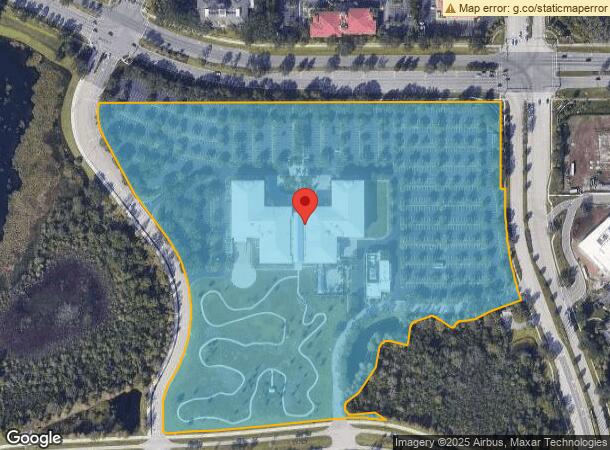
Lakewood Ranch Corporate Park, Unit 4
0189-01-0008
LOT 1 LAKEWOOD RANCH CORPORATE PARK UNIT 4
Officebuilding
Sarasota
X
Florida
12115C0070F
1
2023
27.48 AC
2024
Sarasota
002725
Tampa/St Petersburg
204,843 SF
DEMOGRAPHICS near 6300 University Pky
1 Mile
3 Mile
5 Mile
2024 Total Population
2,313
33,057
110,907
2029 Population
2,666
38,531
128,830
Pop Growth 2024-2029
+ 15.26%
+ 16.56%
+ 16.16%
Average Age
54
52
49
2024 Total Households
1,190
15,606
49,697
HH Growth 2024-2029
+ 14.29%
+ 15.95%
+ 15.68%
Median Household Inc
$71,779
$88,806
$85,407
Avg Household Size
1.80
2.00
2.20
2024 Avg HH Vehicles
1.00
2.00
2.00
Median Home Value
$482,421
$424,777
$381,056
Median Year Built
2005
2000
1998
Nearby Places
- Restaurants
- Banks
- Shops
- Fitness
- Groceries
PUBLIC TRANSPORTATION
AIRPORT
Sarasota/Bradenton International
DRIVE
WALK
Distance
Sarasota/Bradenton International
18 min
9.1 mi
Freight Ports
Port Manatee
DRIVE
WALK
Distance
Port Manatee
31 min
21.5 mi
Nearby Properties
Address
Land Use
TOTAL SIZE
Lot Size
Zoning
Address
Land Use
TOTAL SIZE
Lot Size
Zoning
668,194 SF
45.91 AC
CG
Address
Land Use
TOTAL SIZE
Lot Size
Zoning
343,370 SF
10.77 AC
VPD
Address
Land Use
TOTAL SIZE
Lot Size
Zoning
343,100 SF
13.67 AC
VPD
Address
Land Use
TOTAL SIZE
Lot Size
Zoning
434,419 SF
49.04 AC
CG
Address
Land Use
TOTAL SIZE
Lot Size
Zoning
617,341 SF
76.40 AC
PD-MU
Address
Land Use
TOTAL SIZE
Lot Size
Zoning
486,203 SF
40.94 AC
RMF3
Address
Land Use
TOTAL SIZE
Lot Size
Zoning
349,363 SF
22.58 AC
VPD
Address
Land Use
TOTAL SIZE
Lot Size
Zoning
334,284 SF
30.55 AC
RMF3
Address
Land Use
TOTAL SIZE
Lot Size
Zoning
353,888 SF
22.83 AC
PD-MU
Address
Land Use
TOTAL SIZE
Lot Size
Zoning
326,645 SF
17.96 AC
RMF3
Address
Land Use
TOTAL SIZE
Lot Size
Zoning
358,441 SF
31.80 AC
PD-R
Address
Land Use
TOTAL SIZE
Lot Size
Zoning
228,240 SF
23.48 AC
Address
Land Use
TOTAL SIZE
Lot Size
Zoning
332,686 SF
37.78 AC
VPD
Address
Land Use
TOTAL SIZE
Lot Size
Zoning
313,441 SF
26.91 AC
RSF2
Address
Land Use
TOTAL SIZE
Lot Size
Zoning
206,326 SF
5.01 AC
VPD
Address
Land Use
TOTAL SIZE
Lot Size
Zoning
207,583 SF
9.48 AC
Address
Land Use
TOTAL SIZE
Lot Size
Zoning
121,295 SF
26.49 AC
VPD
Address
Land Use
TOTAL SIZE
Lot Size
Zoning
120,140 SF
5.09 AC
VPD
Address
Land Use
TOTAL SIZE
Lot Size
Zoning
223,054 SF
21.72 AC
Address
Land Use
TOTAL SIZE
Lot Size
Zoning
222,774 SF
71.44 AC
PD-MU
Address
Land Use
TOTAL SIZE
Lot Size
Zoning
128,638 SF
59.54 AC
PCD
Address
Land Use
TOTAL SIZE
Lot Size
Zoning
76,844 SF
6.79 AC
PCD
Address
Land Use
TOTAL SIZE
Lot Size
Zoning
63,064 SF
33.29 AC
GU
Address
Land Use
TOTAL SIZE
Lot Size
Zoning
11,248 SF
541.47 AC
GU
Address
Land Use
TOTAL SIZE
Lot Size
Zoning
180,574 SF
22 AC
A GENERAL
Address
Land Use
TOTAL SIZE
Lot Size
Zoning
115,731 SF
11.86 AC
PD-MU
Address
Land Use
TOTAL SIZE
Lot Size
Zoning
72,213 SF
48.65 AC
CG
Address
Land Use
TOTAL SIZE
Lot Size
Zoning
101,467 SF
11.28 AC
PD-MU
Address
Land Use
TOTAL SIZE
Lot Size
Zoning
190,299 SF
4.43 AC
PD-MU
The World's #1 Commercial Real Estate Marketplace
Connect with us
© 2025 CoStar Group
The information above has been obtained from sources believed reliable. While we do not doubt its accuracy we have not verified it and make no guarantee, warranty or representation about it. It is your responsibility to independently confirm its accuracy and completeness. Any projections, opinions, assumptions, or estimates used are for example only and do not represent the current or future performance of the property. The value of this transaction to you depends on tax and other factors which should be evaluated by your tax, financial, and legal advisors. You and your advisors should conduct a careful, independent investigation of the property to determine to your satisfaction the suitability of the property for your needs.