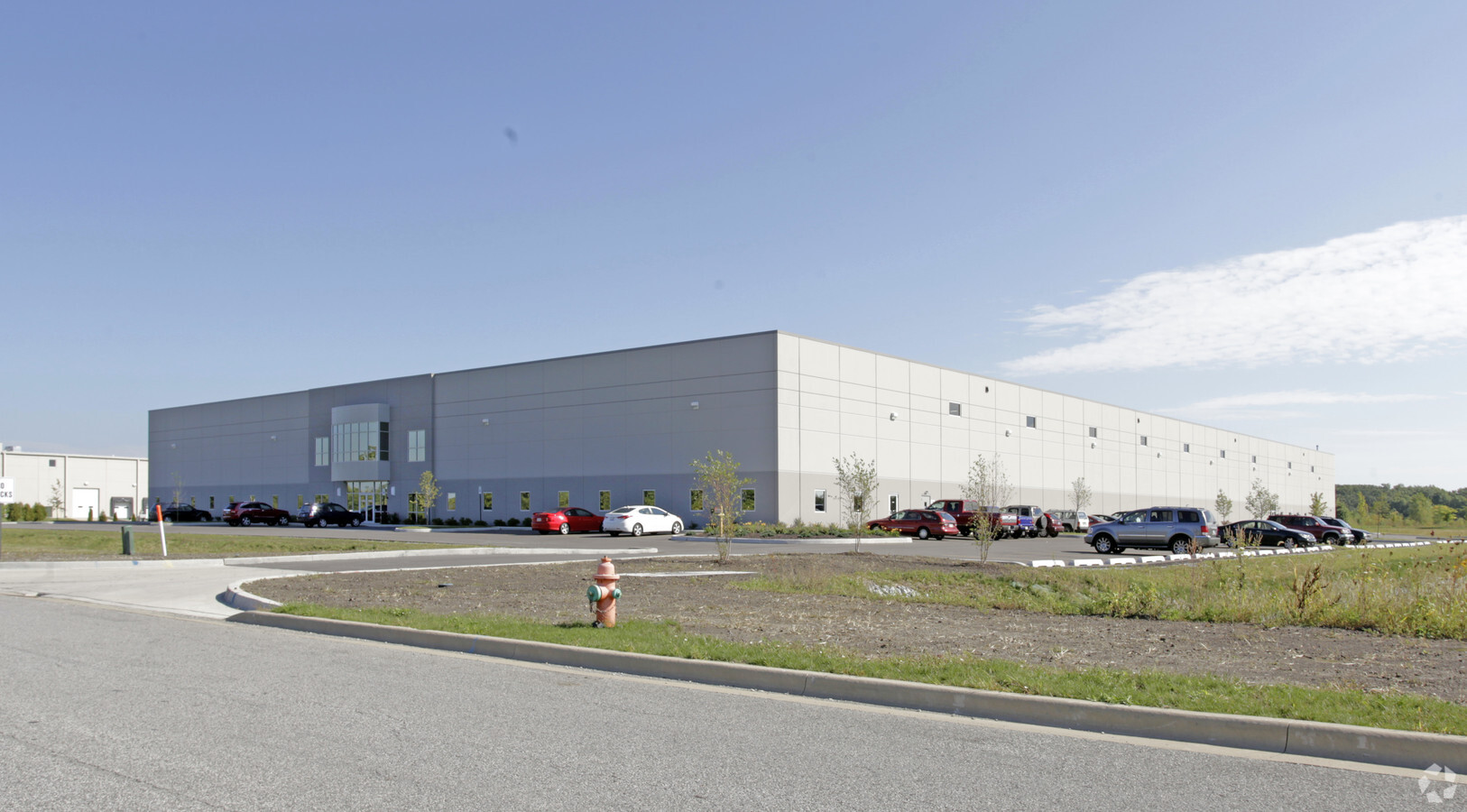
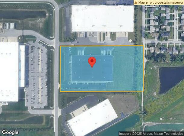
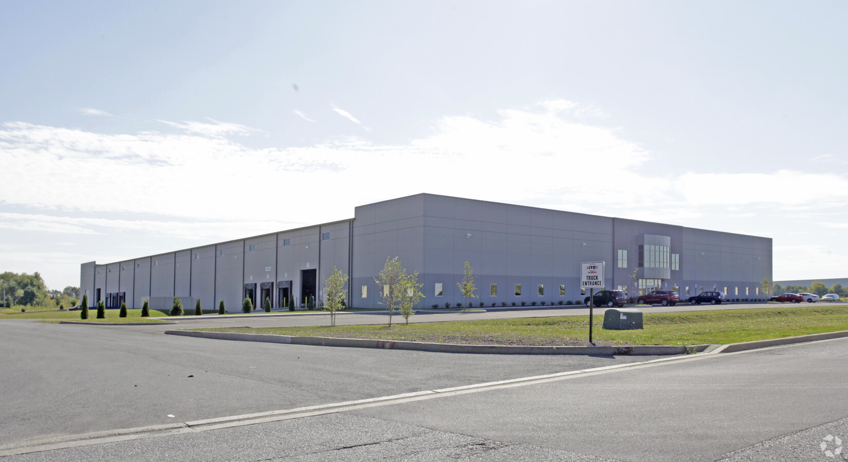
Property Record
6301 Northwind Pky, Hobart, IN 46342
NEARBY LISTINGS FOR SALE OR LEASE
Property Detail
6301 Northwind Pky
Chicago-Naperville-Elgin, IL-IN-WI
North Wind Crossings Unit 2
45-12-11-177-002.000-046
NORTH WIND CROSSINGS UNIT 2 REPLAT #1 LOT 3A
Warehouse
Lake
X
Indiana
18089C0168E
3a
2023
8.19 AC
2024
Indiana
042302
Chicago
100,052 SF
DEMOGRAPHICS near 6301 Northwind Pky
1 Mile
3 Mile
5 Mile
2024 Total Population
2,297
39,896
105,298
2029 Population
2,287
40,411
106,538
Pop Growth 2024-2029
(0.44%)
+ 1.29%
+ 1.18%
Average Age
41
40
40
2024 Total Households
844
15,659
41,808
HH Growth 2024-2029
(0.59%)
+ 1.18%
+ 1.13%
Median Household Inc
$98,760
$53,330
$54,681
Avg Household Size
2.60
2.50
2.40
2024 Avg HH Vehicles
2.00
2.00
2.00
Median Home Value
$228,784
$156,156
$159,904
Median Year Built
1970
1966
1968
Nearby Places
- Restaurants
- Banks
- Shops
- Fitness
- Groceries
PUBLIC TRANSPORTATION
COMMUTER RAIL
Miller (Gary) Station (South Shore Line - Northern Indiana Commuter Transportation District (South Shore Line))
DRIVE
WALK
Distance
Miller (Gary) Station (South Shore Line - Northern Indiana Commuter Transportation District (South Shore Line))
16 min
9.7 mi
Freight Ports
Port Milwaukee
DRIVE
WALK
Distance
Port Milwaukee
159 min
124.3 mi
Nearby Properties
Address
Land Use
TOTAL SIZE
Lot Size
Zoning
Address
Land Use
TOTAL SIZE
Lot Size
Zoning
713,953 SF
39.61 AC
Address
Land Use
TOTAL SIZE
Lot Size
Zoning
722,810 SF
64.65 AC
R33
Address
Land Use
TOTAL SIZE
Lot Size
Zoning
590,274 SF
48.18 AC
Address
Land Use
TOTAL SIZE
Lot Size
Zoning
862,805 SF
36.93 AC
R33
Address
Land Use
TOTAL SIZE
Lot Size
Zoning
321,432 SF
44.38 AC
Address
Land Use
TOTAL SIZE
Lot Size
Zoning
159,548 SF
16.18 AC
Address
Land Use
TOTAL SIZE
Lot Size
Zoning
194,027 SF
13.55 AC
Address
Land Use
TOTAL SIZE
Lot Size
Zoning
171,546 SF
19 AC
Address
Land Use
TOTAL SIZE
Lot Size
Zoning
237,204 SF
28.82 AC
Address
Land Use
TOTAL SIZE
Lot Size
Zoning
108,193 SF
2.42 AC
Address
Land Use
TOTAL SIZE
Lot Size
Zoning
190,352 SF
12.36 AC
Address
Land Use
TOTAL SIZE
Lot Size
Zoning
177,628 SF
12.95 AC
R3
Address
Land Use
TOTAL SIZE
Lot Size
Zoning
126,603 SF
8.81 AC
Address
Land Use
TOTAL SIZE
Lot Size
Zoning
153,602 SF
15.81 AC
R33
Address
Land Use
TOTAL SIZE
Lot Size
Zoning
102,255 SF
3.96 AC
R33
Address
Land Use
TOTAL SIZE
Lot Size
Zoning
199,154 SF
15.70 AC
Address
Land Use
TOTAL SIZE
Lot Size
Zoning
159,117 SF
14.85 AC
R33
Address
Land Use
TOTAL SIZE
Lot Size
Zoning
62,076 SF
6.23 AC
Address
Land Use
TOTAL SIZE
Lot Size
Zoning
185,876 SF
11.60 AC
R33
Address
Land Use
TOTAL SIZE
Lot Size
Zoning
77,383 SF
2.92 AC
Address
Land Use
TOTAL SIZE
Lot Size
Zoning
34,306 SF
9.56 AC
Address
Land Use
TOTAL SIZE
Lot Size
Zoning
159,134 SF
22 AC
Address
Land Use
TOTAL SIZE
Lot Size
Zoning
109,220 SF
6.42 AC
Address
Land Use
TOTAL SIZE
Lot Size
Zoning
149,808 SF
15.07 AC
Address
Land Use
TOTAL SIZE
Lot Size
Zoning
150,000 SF
9.02 AC
R3
Address
Land Use
TOTAL SIZE
Lot Size
Zoning
147,033 SF
13.28 AC
R33
Address
Land Use
TOTAL SIZE
Lot Size
Zoning
181,849 SF
11.50 AC
Address
Land Use
TOTAL SIZE
Lot Size
Zoning
41,015 SF
4.87 AC
Address
Land Use
TOTAL SIZE
Lot Size
Zoning
138,047 SF
13.17 AC
The World's #1 Commercial Real Estate Marketplace
Connect with us
© 2025 CoStar Group
The information above has been obtained from sources believed reliable. While we do not doubt its accuracy we have not verified it and make no guarantee, warranty or representation about it. It is your responsibility to independently confirm its accuracy and completeness. Any projections, opinions, assumptions, or estimates used are for example only and do not represent the current or future performance of the property. The value of this transaction to you depends on tax and other factors which should be evaluated by your tax, financial, and legal advisors. You and your advisors should conduct a careful, independent investigation of the property to determine to your satisfaction the suitability of the property for your needs.