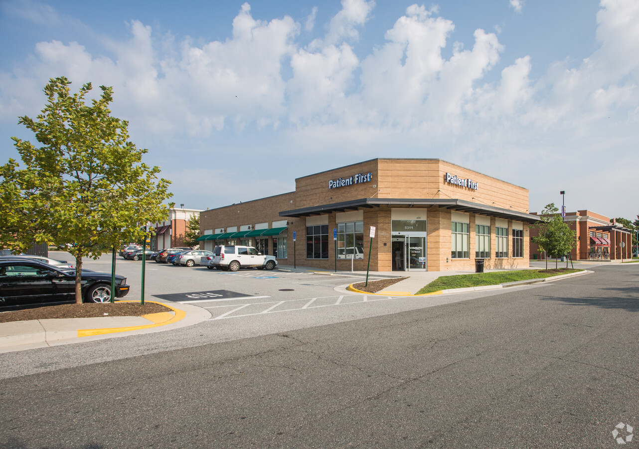
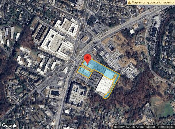
Property Record
6301 Richmond Hwy, Alexandria, VA 22306


NEARBY LISTINGS FOR SALE OR LEASE
Property Detail
6301 Richmond Hwy
Washington-Arlington-Alexandria, DC-VA-MD-WV
Kings Crossing Land Condominium
0833-40-0002A
KINGS CROSSING LAND CONDOMINIUM LAND UNIT B1
Regionalshoppingcenterormallwithanchorstore
Fairfax
X
Virginia
5155190040F
2a
2024
4.81 AC
2024
Huntington/Mt Vernon
415100
Washington, DC
48,053 SF
DEMOGRAPHICS near 6301 Richmond Hwy
1 Mile
3 Mile
5 Mile
2024 Total Population
22,805
137,638
395,977
2029 Population
22,691
135,129
387,819
Pop Growth 2024-2029
(0.50%)
(1.82%)
(2.06%)
Average Age
39
40
39
2024 Total Households
9,383
59,064
167,777
HH Growth 2024-2029
(0.51%)
(1.92%)
(2.14%)
Median Household Inc
$107,195
$118,963
$110,539
Avg Household Size
2.40
2.30
2.30
2024 Avg HH Vehicles
2.00
2.00
2.00
Median Home Value
$585,626
$675,966
$592,769
Median Year Built
1978
1974
1975
Nearby Places
- Restaurants
- Banks
- Shops
- Fitness
- Groceries
Nearby Properties
Address
Land Use
TOTAL SIZE
Lot Size
Zoning
Address
Land Use
TOTAL SIZE
Lot Size
Zoning
75.49 AC
RA
Address
Land Use
TOTAL SIZE
Lot Size
Zoning
989,384 SF
5.17 AC
CDD#2
Address
Land Use
TOTAL SIZE
Lot Size
Zoning
1,563,434 SF
75.24 AC
R-20
Address
Land Use
TOTAL SIZE
Lot Size
Zoning
336,904 SF
2.12 AC
CDD#15
Address
Land Use
TOTAL SIZE
Lot Size
Zoning
1,278,930 SF
28.17 AC
PRM
Address
Land Use
TOTAL SIZE
Lot Size
Zoning
875,565 SF
CDD#20
Address
Land Use
TOTAL SIZE
Lot Size
Zoning
564,765 SF
38.72 AC
PDH-5
Address
Land Use
TOTAL SIZE
Lot Size
Zoning
360,007 SF
35.80 AC
UT
Address
Land Use
TOTAL SIZE
Lot Size
Zoning
1,178,900 SF
4.67 AC
CDD#1
Address
Land Use
TOTAL SIZE
Lot Size
Zoning
4,324 SF
1,261.53 AC
R-1
Address
Land Use
TOTAL SIZE
Lot Size
Zoning
608,495 SF
1.50 AC
CDD#2
Address
Land Use
TOTAL SIZE
Lot Size
Zoning
559,357 SF
2.26 AC
CDD#2
Address
Land Use
TOTAL SIZE
Lot Size
Zoning
445,727 SF
12.82 AC
RC
Address
Land Use
TOTAL SIZE
Lot Size
Zoning
166,800 SF
2.72 AC
CDD#1
Address
Land Use
TOTAL SIZE
Lot Size
Zoning
203,000 SF
1.55 AC
OCH
Address
Land Use
TOTAL SIZE
Lot Size
Zoning
7.04 AC
CDD#3
Address
Land Use
TOTAL SIZE
Lot Size
Zoning
608,362 SF
19.89 AC
R 20
Address
Land Use
TOTAL SIZE
Lot Size
Zoning
288,675 SF
2 AC
RM
Address
Land Use
TOTAL SIZE
Lot Size
Zoning
360,524 SF
2.59 AC
CRMU/H
Address
Land Use
TOTAL SIZE
Lot Size
Zoning
358,188 SF
2.44 AC
CDD#1
Address
Land Use
TOTAL SIZE
Lot Size
Zoning
365,777 SF
4.79 AC
PRM
Address
Land Use
TOTAL SIZE
Lot Size
Zoning
1.43 AC
CDD#1
Address
Land Use
TOTAL SIZE
Lot Size
Zoning
516,508 SF
3.35 AC
CDD#3
Address
Land Use
TOTAL SIZE
Lot Size
Zoning
455,148 SF
6.60 AC
PDH-40
Address
Land Use
TOTAL SIZE
Lot Size
Zoning
1.31 AC
CDD#2
Address
Land Use
TOTAL SIZE
Lot Size
Zoning
270,335 SF
1.46 AC
CDD#2
Address
Land Use
TOTAL SIZE
Lot Size
Zoning
54,000 SF
24.50 AC
PRM
Address
Land Use
TOTAL SIZE
Lot Size
Zoning
499,532 SF
3.04 AC
Address
Land Use
TOTAL SIZE
Lot Size
Zoning
7.72 AC
OCM(100)
Address
Land Use
TOTAL SIZE
Lot Size
Zoning
454,720 SF
11.52 AC
RC
The World's #1 Commercial Real Estate Marketplace
Connect with us
© 2025 CoStar Group
The information above has been obtained from sources believed reliable. While we do not doubt its accuracy we have not verified it and make no guarantee, warranty or representation about it. It is your responsibility to independently confirm its accuracy and completeness. Any projections, opinions, assumptions, or estimates used are for example only and do not represent the current or future performance of the property. The value of this transaction to you depends on tax and other factors which should be evaluated by your tax, financial, and legal advisors. You and your advisors should conduct a careful, independent investigation of the property to determine to your satisfaction the suitability of the property for your needs.