Property Record
6313 Chester Ave, Philadelphia, PA 19142


NEARBY LISTINGS FOR SALE OR LEASE
Property Detail
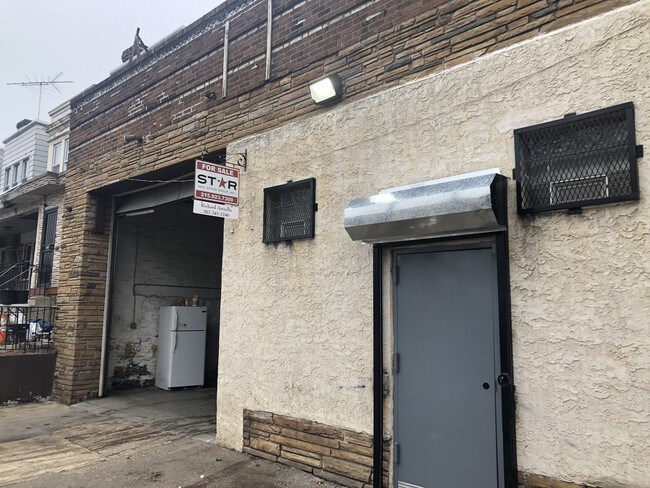
6313 Chester Ave
Philadelphia-Camden-Wilmington, PA-NJ-DE-MD
Survey & Plan Made George T Shegog
882970025
13211 1/4 W OF
Warehouse
Philadelphia
X
Pennsylvania
4207570186H
72
2024
0.48 AC
2026
Southwest Philly
006400
Philadelphia
2,508 SF
DEMOGRAPHICS near 6313 Chester Ave
1 Mile
3 Mile
5 Mile
2024 Total Population
46,247
318,900
789,038
2029 Population
44,861
311,828
770,574
Pop Growth 2024-2029
(3.00%)
(2.22%)
(2.34%)
Average Age
37
37
38
2024 Total Households
16,932
123,337
330,934
HH Growth 2024-2029
(3.05%)
(2.39%)
(2.62%)
Median Household Inc
$40,406
$43,170
$61,526
Avg Household Size
2.60
2.40
2.20
2024 Avg HH Vehicles
1.00
1.00
1.00
Median Home Value
$100,743
$147,422
$235,674
Median Year Built
1947
1948
1948
Nearby Places
Map Layers
Map Styles
 Street
 Aerial
- Restaurants
- Banks
- Shops
- Fitness
- Groceries
PUBLIC TRANSPORTATION
TRANSIT/SUBWAY
65Th Street And Chester Street (Route 13 - Southeastern Pennsylvania Transportation Authority Rapid Transit (SEPTA Subway & Trolley))
DRIVE
WALK
Distance
65Th Street And Chester Street (Route 13 - Southeastern Pennsylvania Transportation Authority Rapid Transit (SEPTA Subway & Trolley))
0 min
2 min
0.1 mi
65Th Street And Belmar Avenue (Route 13 - Southeastern Pennsylvania Transportation Authority Rapid Transit (SEPTA Subway & Trolley))
DRIVE
WALK
Distance
65Th Street And Belmar Avenue (Route 13 - Southeastern Pennsylvania Transportation Authority Rapid Transit (SEPTA Subway & Trolley))
1 min
3 min
0.2 mi
65Th Street And Cobbs Creek Parkway (Route 13 - Southeastern Pennsylvania Transportation Authority Rapid Transit (SEPTA Subway & Trolley))
DRIVE
WALK
Distance
65Th Street And Cobbs Creek Parkway (Route 13 - Southeastern Pennsylvania Transportation Authority Rapid Transit (SEPTA Subway & Trolley))
1 min
4 min
0.2 mi
Kingsessing Avenue And 65Th Street (Route 13 - Southeastern Pennsylvania Transportation Authority Rapid Transit (SEPTA Subway & Trolley))
DRIVE
WALK
Distance
Kingsessing Avenue And 65Th Street (Route 13 - Southeastern Pennsylvania Transportation Authority Rapid Transit (SEPTA Subway & Trolley))
1 min
4 min
0.3 mi
Kingsessing Avenue And Cemetary-Mt Moriah (Route 13 - Southeastern Pennsylvania Transportation Authority Rapid Transit (SEPTA Subway & Trolley))
DRIVE
WALK
Distance
Kingsessing Avenue And Cemetary-Mt Moriah (Route 13 - Southeastern Pennsylvania Transportation Authority Rapid Transit (SEPTA Subway & Trolley))
1 min
5 min
0.3 mi
COMMUTER RAIL
Fernwood-Yeadon (R3 - Southeastern Pennsylvania Transportation Authority Regional Rail (SEPTA Regional Rail))
DRIVE
WALK
Distance
Fernwood-Yeadon (R3 - Southeastern Pennsylvania Transportation Authority Regional Rail (SEPTA Regional Rail))
6 min
1.8 mi
Angora (R3 - Southeastern Pennsylvania Transportation Authority Regional Rail (SEPTA Regional Rail))
DRIVE
WALK
Distance
Angora (R3 - Southeastern Pennsylvania Transportation Authority Regional Rail (SEPTA Regional Rail))
5 min
1.9 mi
AIRPORT
Philadelphia International
DRIVE
WALK
Distance
Philadelphia International
13 min
5.6 mi
Freight Ports
South Jersey Port
DRIVE
WALK
Distance
South Jersey Port
22 min
9.9 mi
SALE & LEASE HISTORY
LISTING DATE
SALE/LEASE

Jan 13, 2020
For Sale
Nearby Properties
Address
Land Use
TOTAL SIZE
Lot Size
Zoning
Address
Land Use
TOTAL SIZE
Lot Size
Zoning
696,920 SF
10.55 AC
SPINS
Address
Land Use
TOTAL SIZE
Lot Size
Zoning
700,000 SF
7.88 AC
CMX5
Address
Land Use
TOTAL SIZE
Lot Size
Zoning
391,440 SF
1.72 AC
SPINS
Address
Land Use
TOTAL SIZE
Lot Size
Zoning
385,000 SF
2.49 AC
SPINS
Address
Land Use
TOTAL SIZE
Lot Size
Zoning
376,874 SF
3.14 AC
SPINS
Address
Land Use
TOTAL SIZE
Lot Size
Zoning
375,500 SF
1.40 AC
CMX5
Address
Land Use
TOTAL SIZE
Lot Size
Zoning
373,040 SF
4.17 AC
SPINS
Address
Land Use
TOTAL SIZE
Lot Size
Zoning
400,000 SF
3.32 AC
CMX5
Address
Land Use
TOTAL SIZE
Lot Size
Zoning
685,000 SF
47.69 AC
CMX3
Address
Land Use
TOTAL SIZE
Lot Size
Zoning
1,588,163 SF
7.28 AC
SPINS
Address
Land Use
TOTAL SIZE
Lot Size
Zoning
303,750 SF
1.36 AC
SPINS
Address
Land Use
TOTAL SIZE
Lot Size
Zoning
239,760 SF
5.51 AC
SPINS
Address
Land Use
TOTAL SIZE
Lot Size
Zoning
Address
Land Use
TOTAL SIZE
Lot Size
Zoning
698,358 SF
16.79 AC
SPINS
Address
Land Use
TOTAL SIZE
Lot Size
Zoning
354,372 SF
1 AC
CMX4
Address
Land Use
TOTAL SIZE
Lot Size
Zoning
158,496 SF
Address
Land Use
TOTAL SIZE
Lot Size
Zoning
226,650 SF
4.51 AC
CMX5
Address
Land Use
TOTAL SIZE
Lot Size
Zoning
269,171 SF
2.64 AC
SPINS
Address
Land Use
TOTAL SIZE
Lot Size
Zoning
910,000 SF
70 AC
I2
Address
Land Use
TOTAL SIZE
Lot Size
Zoning
525,469 SF
2.57 AC
CMX4
Address
Land Use
TOTAL SIZE
Lot Size
Zoning
500,000 SF
5.81 AC
CMX5
Address
Land Use
TOTAL SIZE
Lot Size
Zoning
295,293 SF
0.72 AC
CMX4
Address
Land Use
TOTAL SIZE
Lot Size
Zoning
415,239 SF
0.03 AC
CMX4
Address
Land Use
TOTAL SIZE
Lot Size
Zoning
Address
Land Use
TOTAL SIZE
Lot Size
Zoning
251,000 SF
0.78 AC
SPINS
Address
Land Use
TOTAL SIZE
Lot Size
Zoning
413,808 SF
0.76 AC
RM4
Address
Land Use
TOTAL SIZE
Lot Size
Zoning
374,706 SF
21.26 AC
CMX3
Address
Land Use
TOTAL SIZE
Lot Size
Zoning
300,000 SF
0.37 AC
CMX4
Address
Land Use
TOTAL SIZE
Lot Size
Zoning
175,069 SF
2.20 AC
CMX3
Address
Land Use
TOTAL SIZE
Lot Size
Zoning
378,140 SF
1.94 AC
CMX5
The World's #1 Commercial Real Estate Marketplace
Connect with us
© 2025 CoStar Group
The information above has been obtained from sources believed reliable. While we do not doubt its accuracy we have not verified it and make no guarantee, warranty or representation about it. It is your responsibility to independently confirm its accuracy and completeness. Any projections, opinions, assumptions, or estimates used are for example only and do not represent the current or future performance of the property. The value of this transaction to you depends on tax and other factors which should be evaluated by your tax, financial, and legal advisors. You and your advisors should conduct a careful, independent investigation of the property to determine to your satisfaction the suitability of the property for your needs.