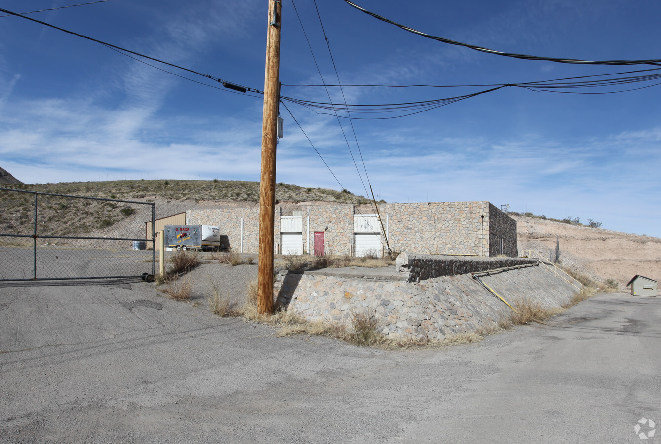
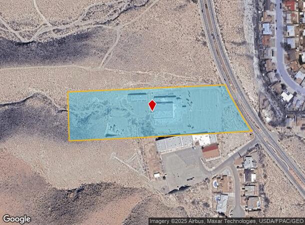
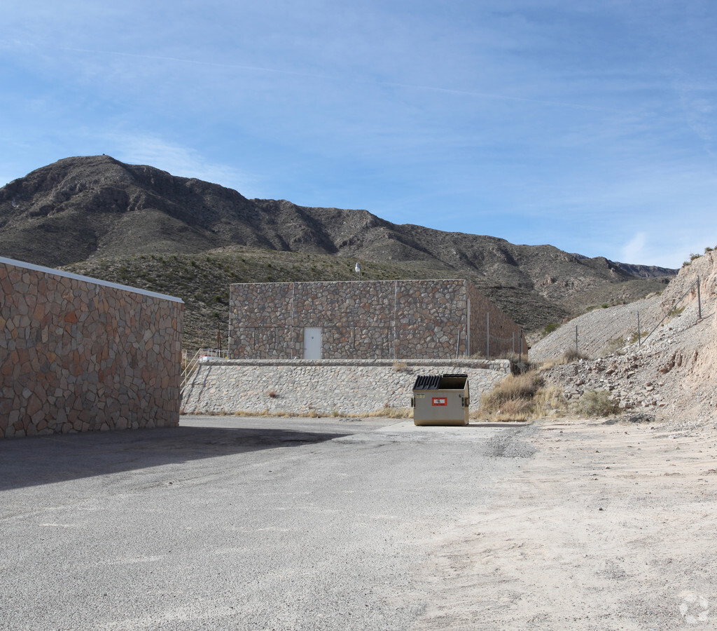
Property Record
6331 Alabama St, El Paso, TX 79904
NEARBY LISTINGS FOR SALE OR LEASE
-
-
View all El Paso listings for sale on LoopNet.com
Property Detail
6331 Alabama St
El Paso, TX
Tsp 2 Sec 10 T & P Surv
X581-999-2150-0900
81 TSP 2 SEC 15 T & P SURV TR 8 (7.918 AC)
Governmentalpublicusegeneral
El Paso
2023
Texas
2023
7.92 AC
000401
Outlying El Paso County
35,949 SF
El Paso
DEMOGRAPHICS near 6331 Alabama St
1 Mile
3 Mile
5 Mile
2024 Total Population
7,180
59,180
181,098
2029 Population
7,260
60,613
184,329
Pop Growth 2024-2029
+ 1.11%
+ 2.42%
+ 1.78%
Average Age
36
36
38
2024 Total Households
2,680
22,549
68,860
HH Growth 2024-2029
+ 1.08%
+ 2.45%
+ 1.77%
Median Household Inc
$41,268
$37,587
$42,380
Avg Household Size
2.60
2.60
2.50
2024 Avg HH Vehicles
2.00
2.00
2.00
Median Home Value
$144,029
$131,431
$157,681
Median Year Built
1973
1969
1970
Nearby Places
- Restaurants
- Banks
- Shops
- Fitness
- Groceries
PUBLIC TRANSPORTATION
AIRPORT
El Paso International
DRIVE
WALK
Distance
El Paso International
18 min
8.8 mi
Freight Ports
Port of Corpus Christi
DRIVE
WALK
Distance
Port of Corpus Christi
686 min
697.3 mi
Nearby Properties
Address
Land Use
TOTAL SIZE
Lot Size
Zoning
Address
Land Use
TOTAL SIZE
Lot Size
Zoning
89,935 SF
7.01 AC
PMD
Address
Land Use
TOTAL SIZE
Lot Size
Zoning
289,146 SF
11.87 AC
C1S
Address
Land Use
TOTAL SIZE
Lot Size
Zoning
142,858 SF
0.17 AC
R3H
Address
Land Use
TOTAL SIZE
Lot Size
Zoning
88,806 SF
9.41 AC
C1S
Address
Land Use
TOTAL SIZE
Lot Size
Zoning
127.04 AC
M1
Address
Land Use
TOTAL SIZE
Lot Size
Zoning
229,821 SF
10.18 AC
A2
Address
Land Use
TOTAL SIZE
Lot Size
Zoning
139,428 SF
3.51 AC
R4
Address
Land Use
TOTAL SIZE
Lot Size
Zoning
164,884 SF
14.65 AC
C4
Address
Land Use
TOTAL SIZE
Lot Size
Zoning
75,000 SF
6.15 AC
R4H
Address
Land Use
TOTAL SIZE
Lot Size
Zoning
44,178 SF
1 AC
A1C
Address
Land Use
TOTAL SIZE
Lot Size
Zoning
254,768 SF
10.11 AC
A2
Address
Land Use
TOTAL SIZE
Lot Size
Zoning
135,566 SF
8.92 AC
C3
Address
Land Use
TOTAL SIZE
Lot Size
Zoning
41,412 SF
6.36 AC
AM
Address
Land Use
TOTAL SIZE
Lot Size
Zoning
154,597 SF
5.41 AC
A2
Address
Land Use
TOTAL SIZE
Lot Size
Zoning
280.63 AC
R3
Address
Land Use
TOTAL SIZE
Lot Size
Zoning
62,270 SF
10.80 AC
R4
Address
Land Use
TOTAL SIZE
Lot Size
Zoning
41,030 SF
663.85 AC
PMD
Address
Land Use
TOTAL SIZE
Lot Size
Zoning
68,259 SF
27.73 AC
R3S
Address
Land Use
TOTAL SIZE
Lot Size
Zoning
194,012 SF
14.94 AC
C3
Address
Land Use
TOTAL SIZE
Lot Size
Zoning
21,652 SF
3.69 AC
Address
Land Use
TOTAL SIZE
Lot Size
Zoning
27,079 SF
3 AC
C4S
Address
Land Use
TOTAL SIZE
Lot Size
Zoning
54,232 SF
4.98 AC
C3
Address
Land Use
TOTAL SIZE
Lot Size
Zoning
40,752 SF
4.33 AC
PMD
Address
Land Use
TOTAL SIZE
Lot Size
Zoning
86,907 SF
4.35 AC
A2S
Address
Land Use
TOTAL SIZE
Lot Size
Zoning
152,200 SF
M1
Address
Land Use
TOTAL SIZE
Lot Size
Zoning
152.57 AC
A2
Address
Land Use
TOTAL SIZE
Lot Size
Zoning
31,063 SF
0.92 AC
R4S
Address
Land Use
TOTAL SIZE
Lot Size
Zoning
124,800 SF
M1
Address
Land Use
TOTAL SIZE
Lot Size
Zoning
33,764 SF
1.43 AC
R4
The World's #1 Commercial Real Estate Marketplace
Connect with us
© 2025 CoStar Group
The information above has been obtained from sources believed reliable. While we do not doubt its accuracy we have not verified it and make no guarantee, warranty or representation about it. It is your responsibility to independently confirm its accuracy and completeness. Any projections, opinions, assumptions, or estimates used are for example only and do not represent the current or future performance of the property. The value of this transaction to you depends on tax and other factors which should be evaluated by your tax, financial, and legal advisors. You and your advisors should conduct a careful, independent investigation of the property to determine to your satisfaction the suitability of the property for your needs.