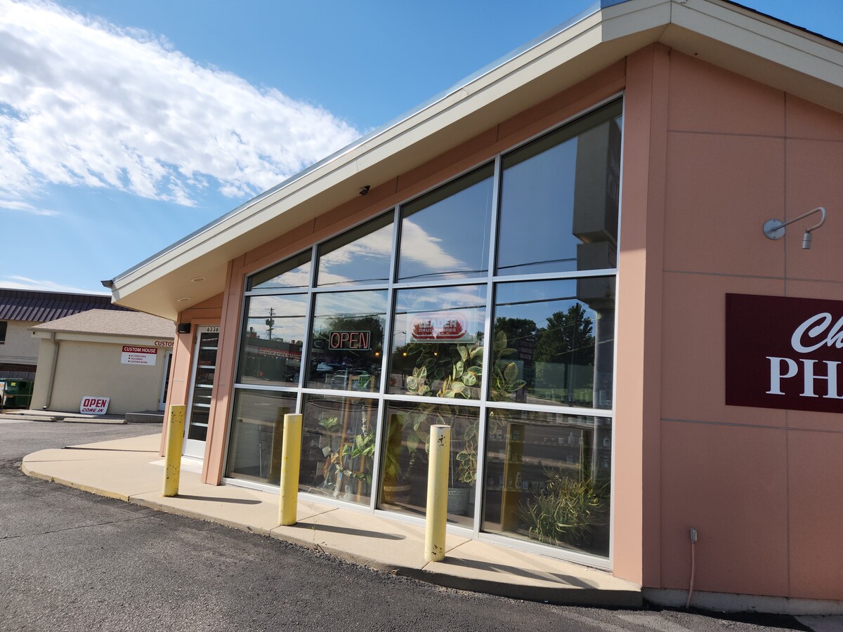
Property Record
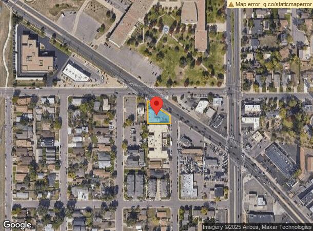
6336 Leetsdale Dr, Denver, CO 80224
Current Lease Availabilities
NEARBY LISTINGS FOR SALE OR LEASE
Property Detail
6336 Leetsdale Dr
Denver-Aurora-Lakewood, CO
Capitol Hill Terrace
6173-02-048
CAPITOL HILL TERRACE B9 L43 & PT OF L44 TO 48 LYG S OF LEETSDALE DR EXC THAT PT TO CITY PER ORD #541-1990
Commercialbuilding
Denver
X
Colorado
0800460208H
43
2023
0.24 AC
2023
Colorado Bl/Cherry Ck
0050011002
Denver
5,422 SF
DEMOGRAPHICS near 6336 Leetsdale Dr
1 Mile
3 Mile
5 Mile
2024 Total Population
23,389
199,551
538,998
2029 Population
23,753
202,806
546,054
Pop Growth 2024-2029
+ 1.56%
+ 1.63%
+ 1.31%
Average Age
38
40
38
2024 Total Households
10,958
92,632
248,808
HH Growth 2024-2029
+ 1.41%
+ 1.58%
+ 1.29%
Median Household Inc
$66,047
$77,036
$76,590
Avg Household Size
2.10
2.10
2.10
2024 Avg HH Vehicles
2.00
2.00
2.00
Median Home Value
$567,611
$659,650
$602,736
Median Year Built
1974
1977
1973
Nearby Places
- Restaurants
- Banks
- Shops
- Fitness
- Groceries
PUBLIC TRANSPORTATION
COMMUTER RAIL
Central Park Station Track 1 (Union Station to Denver Airport Station - Regional Transportation District)
DRIVE
WALK
Distance
Central Park Station Track 1 (Union Station to Denver Airport Station - Regional Transportation District)
14 min
6.3 mi
Central Park Station Track 2 (Union Station to Denver Airport Station - Regional Transportation District)
DRIVE
WALK
Distance
Central Park Station Track 2 (Union Station to Denver Airport Station - Regional Transportation District)
14 min
6.4 mi
AIRPORT
Denver International
DRIVE
WALK
Distance
Denver International
32 min
22.7 mi
Freight Ports
Tulsa Port Of Catoosa
DRIVE
WALK
Distance
Tulsa Port Of Catoosa
729 min
705.4 mi
Nearby Properties
Address
Land Use
TOTAL SIZE
Lot Size
Zoning
Address
Land Use
TOTAL SIZE
Lot Size
Zoning
859,638 SF
10.04 AC
B-3
Address
Land Use
TOTAL SIZE
Lot Size
Zoning
252,992 SF
11.76 AC
B-3
Address
Land Use
TOTAL SIZE
Lot Size
Zoning
579,102 SF
7.47 AC
H-1-A
Address
Land Use
TOTAL SIZE
Lot Size
Zoning
285,478 SF
0.56 AC
C-CCN-5
Address
Land Use
TOTAL SIZE
Lot Size
Zoning
584,643 SF
13.43 AC
CMP-EI
Address
Land Use
TOTAL SIZE
Lot Size
Zoning
850,232 SF
9.25 AC
H-1-A
Address
Land Use
TOTAL SIZE
Lot Size
Zoning
349,226 SF
1.09 AC
C-CCN-12
Address
Land Use
TOTAL SIZE
Lot Size
Zoning
869,166 SF
5.44 AC
B-4
Address
Land Use
TOTAL SIZE
Lot Size
Zoning
686,647 SF
5.20 AC
C-MX-20
Address
Land Use
TOTAL SIZE
Lot Size
Zoning
405,667 SF
2.35 AC
C-MX-20
Address
Land Use
TOTAL SIZE
Lot Size
Zoning
267,087 SF
36.55 AC
R-5
Address
Land Use
TOTAL SIZE
Lot Size
Zoning
185,689 SF
2.50 AC
C-CCN-8
Address
Land Use
TOTAL SIZE
Lot Size
Zoning
103,096 SF
0.42 AC
C-CCN-7
Address
Land Use
TOTAL SIZE
Lot Size
Zoning
174,244 SF
17.26 AC
E-SU-DX
Address
Land Use
TOTAL SIZE
Lot Size
Zoning
208,177 SF
0.47 AC
C-CCN-8
Address
Land Use
TOTAL SIZE
Lot Size
Zoning
346,917 SF
2.28 AC
C-CCN-8
Address
Land Use
TOTAL SIZE
Lot Size
Zoning
191,192 SF
10.16 AC
E-SU-D
Address
Land Use
TOTAL SIZE
Lot Size
Zoning
1,054,198 SF
6.62 AC
PUD
Address
Land Use
TOTAL SIZE
Lot Size
Zoning
379,927 SF
8.06 AC
PUD
Address
Land Use
TOTAL SIZE
Lot Size
Zoning
157,800 SF
2.12 AC
C-CCN-8
Address
Land Use
TOTAL SIZE
Lot Size
Zoning
285,683 SF
2.76 AC
C-CCN-8
Address
Land Use
TOTAL SIZE
Lot Size
Zoning
289,759 SF
1.54 AC
C-MX-5
Address
Land Use
TOTAL SIZE
Lot Size
Zoning
194,259 SF
6.58 AC
E-SU-D
Address
Land Use
TOTAL SIZE
Lot Size
Zoning
107,976 SF
0.28 AC
C-CCN-8
Address
Land Use
TOTAL SIZE
Lot Size
Zoning
192,716 SF
0.48 AC
C-MX-8
Address
Land Use
TOTAL SIZE
Lot Size
Zoning
217,834 SF
1.02 AC
C-MX-5
Address
Land Use
TOTAL SIZE
Lot Size
Zoning
85,381 SF
0.54 AC
C-MX-8
Address
Land Use
TOTAL SIZE
Lot Size
Zoning
201,569 SF
1.41 AC
C-CCN-8
Address
Land Use
TOTAL SIZE
Lot Size
Zoning
173,295 SF
3.59 AC
H-1-A
Address
Land Use
TOTAL SIZE
Lot Size
Zoning
178,765 SF
0.49 AC
C-MX-5
The World's #1 Commercial Real Estate Marketplace
Connect with us
© 2025 CoStar Group
The information above has been obtained from sources believed reliable. While we do not doubt its accuracy we have not verified it and make no guarantee, warranty or representation about it. It is your responsibility to independently confirm its accuracy and completeness. Any projections, opinions, assumptions, or estimates used are for example only and do not represent the current or future performance of the property. The value of this transaction to you depends on tax and other factors which should be evaluated by your tax, financial, and legal advisors. You and your advisors should conduct a careful, independent investigation of the property to determine to your satisfaction the suitability of the property for your needs.