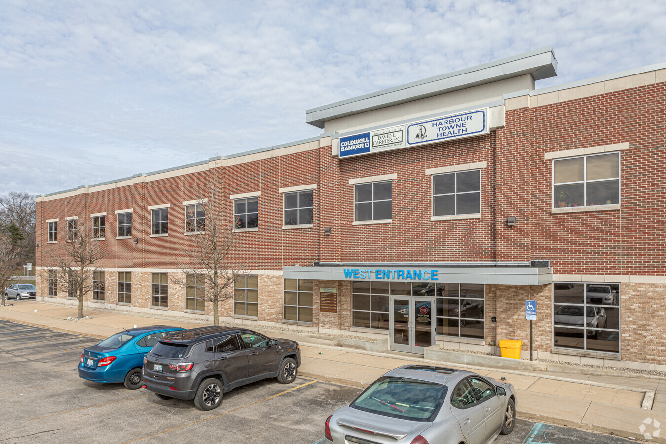
Property Record
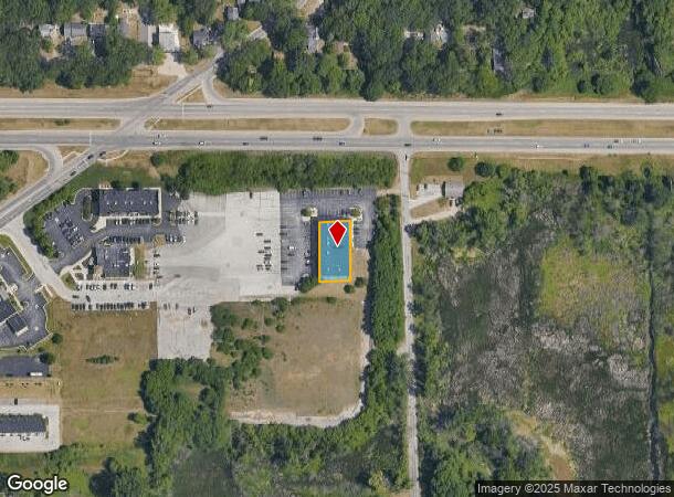
131 W Seaway Dr, Norton Shores, MI 49444
NEARBY LISTINGS FOR SALE OR LEASE
Property Detail
131 W Seaway Dr
27-265-000-0009-00
Eastowne Of Norton Shores
Commercialnec
CITY OF NORTON SHORESEASTOWNE OF NORTON SHORES UNIT 9
X
Muskegon
26121C0278E
Michigan
2023
0.29 AC
2024
Muskegon Heights
002400
West Michigan
24,320 SF
Muskegon, MI
DEMOGRAPHICS near 131 W Seaway Dr
1 Mile
3 Mile
5 Mile
2024 Total Population
6,736
59,681
96,831
2029 Population
6,873
60,248
97,667
Pop Growth 2024-2029
+ 2.03%
+ 0.95%
+ 0.86%
Average Age
39
40
40
2024 Total Households
2,830
22,773
38,340
HH Growth 2024-2029
+ 1.94%
+ 0.90%
+ 0.85%
Median Household Inc
$44,527
$48,564
$49,628
Avg Household Size
2.30
2.40
2.30
2024 Avg HH Vehicles
1.00
2.00
2.00
Median Home Value
$85,322
$133,624
$143,853
Median Year Built
1954
1956
1960
Nearby Places
- Restaurants
- Banks
- Shops
- Fitness
- Groceries
SALE & LEASE HISTORY
LISTING DATE
SALE/LEASE

Sep 27, 2023
For Sale
Mar 03, 2017
For Lease
Aug 07, 2024
For Lease
Nearby Properties
Address
Land Use
TOTAL SIZE
Lot Size
Zoning
Address
Land Use
TOTAL SIZE
Lot Size
Zoning
490,693 SF
22.70 AC
Address
Land Use
TOTAL SIZE
Lot Size
Zoning
82,643 SF
5.20 AC
MC
Address
Land Use
TOTAL SIZE
Lot Size
Zoning
350,077 SF
41.42 AC
PUD
Address
Land Use
TOTAL SIZE
Lot Size
Zoning
273,059 SF
30.59 AC
PUD
Address
Land Use
TOTAL SIZE
Lot Size
Zoning
248,456 SF
19.18 AC
MFR
Address
Land Use
TOTAL SIZE
Lot Size
Zoning
41,382 SF
6.20 AC
PUD
Address
Land Use
TOTAL SIZE
Lot Size
Zoning
223,802 SF
22.02 AC
SC-1
Address
Land Use
TOTAL SIZE
Lot Size
Zoning
388,172 SF
21.50 AC
GI
Address
Land Use
TOTAL SIZE
Lot Size
Zoning
203,874 SF
18.55 AC
C-SE
Address
Land Use
TOTAL SIZE
Lot Size
Zoning
194,708 SF
15.59 AC
C-2
Address
Land Use
TOTAL SIZE
Lot Size
Zoning
19,171 SF
6.55 AC
MC
Address
Land Use
TOTAL SIZE
Lot Size
Zoning
193,750 SF
23.22 AC
GI
Address
Land Use
TOTAL SIZE
Lot Size
Zoning
82,895 SF
13.09 AC
SC-1
Address
Land Use
TOTAL SIZE
Lot Size
Zoning
125,059 SF
10.47 AC
PUD
Address
Land Use
TOTAL SIZE
Lot Size
Zoning
85,577 SF
8.72 AC
PUD
Address
Land Use
TOTAL SIZE
Lot Size
Zoning
184,786 SF
24.10 AC
SUD
Address
Land Use
TOTAL SIZE
Lot Size
Zoning
50,252 SF
6.94 AC
C-2
Address
Land Use
TOTAL SIZE
Lot Size
Zoning
122.75 AC
R-2
Address
Land Use
TOTAL SIZE
Lot Size
Zoning
68,782 SF
10.52 AC
C-2
Address
Land Use
TOTAL SIZE
Lot Size
Zoning
121,466 SF
11.65 AC
SC-1
Address
Land Use
TOTAL SIZE
Lot Size
Zoning
143,193 SF
13.82 AC
SC-1
Address
Land Use
TOTAL SIZE
Lot Size
Zoning
124,416 SF
7.41 AC
MFR
Address
Land Use
TOTAL SIZE
Lot Size
Zoning
125,478 SF
7.90 AC
WM
Address
Land Use
TOTAL SIZE
Lot Size
Zoning
60,658 SF
4.42 AC
RM-2
Address
Land Use
TOTAL SIZE
Lot Size
Zoning
179,172 SF
20.72 AC
I-2
Address
Land Use
TOTAL SIZE
Lot Size
Zoning
171,361 SF
12.26 AC
AR-8
Address
Land Use
TOTAL SIZE
Lot Size
Zoning
6.82 AC
PUD
Address
Land Use
TOTAL SIZE
Lot Size
Zoning
158,430 SF
9.23 AC
GI
Address
Land Use
TOTAL SIZE
Lot Size
Zoning
399,872 SF
16.99 AC
I-2
Address
Land Use
TOTAL SIZE
Lot Size
Zoning
32,811 SF
5.87 AC
B-4
The World's #1 Commercial Real Estate Marketplace
Connect with us
© 2025 CoStar Group
The information above has been obtained from sources believed reliable. While we do not doubt its accuracy we have not verified it and make no guarantee, warranty or representation about it. It is your responsibility to independently confirm its accuracy and completeness. Any projections, opinions, assumptions, or estimates used are for example only and do not represent the current or future performance of the property. The value of this transaction to you depends on tax and other factors which should be evaluated by your tax, financial, and legal advisors. You and your advisors should conduct a careful, independent investigation of the property to determine to your satisfaction the suitability of the property for your needs.