Property Record
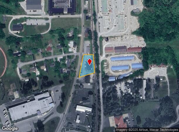
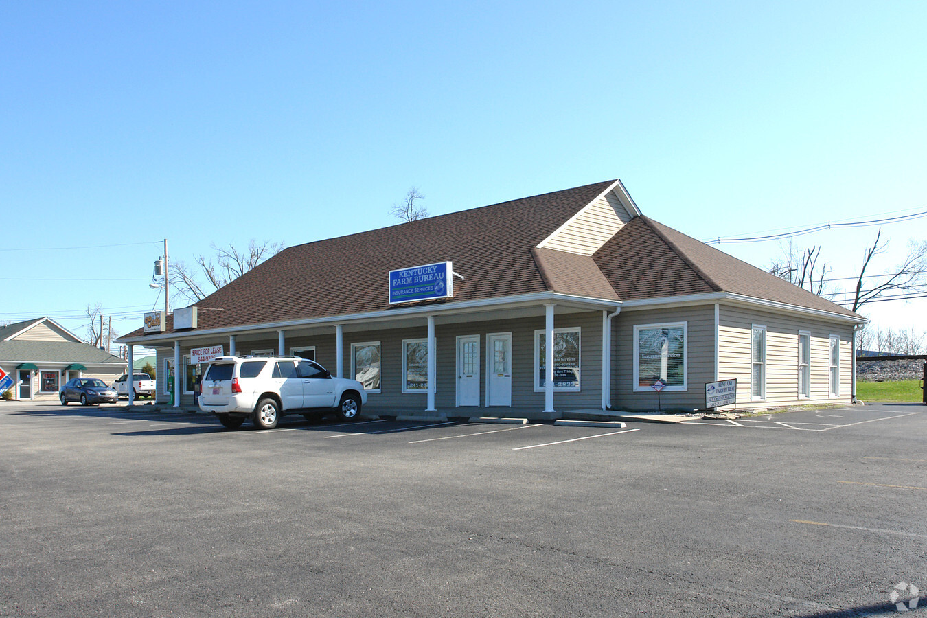
6334 W Highway 146, Crestwood, KY 40014

NEARBY LISTINGS FOR SALE OR LEASE
-
-
View all Crestwood listings for sale on LoopNet.com
Property Detail
6334 W Highway 146
Louisville-Jefferson County, KY-IN
Sw
23-00-00-25D
OFFICE/RET RENTAL UNITS & .471AC
Officebuilding
Oldham
X
Kentucky
21185C0205D
25d
2023
0.47 AC
2023
Oldham County
030602
Louisville
DEMOGRAPHICS near 6334 W Highway 146
1 Mile
3 Mile
5 Mile
2024 Total Population
3,089
19,500
62,681
2029 Population
3,238
20,564
64,640
Pop Growth 2024-2029
+ 4.82%
+ 5.46%
+ 3.13%
Average Age
38
40
40
2024 Total Households
1,148
6,837
21,900
HH Growth 2024-2029
+ 4.88%
+ 5.50%
+ 3.01%
Median Household Inc
$96,693
$109,183
$110,182
Avg Household Size
2.70
2.80
2.70
2024 Avg HH Vehicles
2.00
2.00
2.00
Median Home Value
$288,209
$355,444
$349,625
Median Year Built
1999
1991
1997
Nearby Places
- Restaurants
- Banks
- Shops
- Fitness
- Groceries
PUBLIC TRANSPORTATION
AIRPORT
Louisville Muhammad Ali International
DRIVE
WALK
Distance
Louisville Muhammad Ali International
37 min
25.6 mi
Freight Ports
Port of Toledo
DRIVE
WALK
Distance
Port of Toledo
334 min
288.2 mi
Nearby Properties
Address
Land Use
TOTAL SIZE
Lot Size
Zoning
Address
Land Use
TOTAL SIZE
Lot Size
Zoning
0.67 AC
Address
Land Use
TOTAL SIZE
Lot Size
Zoning
19.95 AC
Address
Land Use
TOTAL SIZE
Lot Size
Zoning
Address
Land Use
TOTAL SIZE
Lot Size
Zoning
88,872 SF
7.98 AC
Address
Land Use
TOTAL SIZE
Lot Size
Zoning
Address
Land Use
TOTAL SIZE
Lot Size
Zoning
Address
Land Use
TOTAL SIZE
Lot Size
Zoning
Address
Land Use
TOTAL SIZE
Lot Size
Zoning
5.25 AC
Address
Land Use
TOTAL SIZE
Lot Size
Zoning
Address
Land Use
TOTAL SIZE
Lot Size
Zoning
1.41 AC
Address
Land Use
TOTAL SIZE
Lot Size
Zoning
Address
Land Use
TOTAL SIZE
Lot Size
Zoning
3.39 AC
Address
Land Use
TOTAL SIZE
Lot Size
Zoning
Address
Land Use
TOTAL SIZE
Lot Size
Zoning
Address
Land Use
TOTAL SIZE
Lot Size
Zoning
Address
Land Use
TOTAL SIZE
Lot Size
Zoning
Address
Land Use
TOTAL SIZE
Lot Size
Zoning
Address
Land Use
TOTAL SIZE
Lot Size
Zoning
Address
Land Use
TOTAL SIZE
Lot Size
Zoning
Address
Land Use
TOTAL SIZE
Lot Size
Zoning
1.46 AC
Address
Land Use
TOTAL SIZE
Lot Size
Zoning
Address
Land Use
TOTAL SIZE
Lot Size
Zoning
56.03 AC
COM
Address
Land Use
TOTAL SIZE
Lot Size
Zoning
Address
Land Use
TOTAL SIZE
Lot Size
Zoning
Address
Land Use
TOTAL SIZE
Lot Size
Zoning
176.02 AC
Address
Land Use
TOTAL SIZE
Lot Size
Zoning
Address
Land Use
TOTAL SIZE
Lot Size
Zoning
Address
Land Use
TOTAL SIZE
Lot Size
Zoning
2.07 AC
Address
Land Use
TOTAL SIZE
Lot Size
Zoning
168 AC
The World's #1 Commercial Real Estate Marketplace
Connect with us
© 2025 CoStar Group
The information above has been obtained from sources believed reliable. While we do not doubt its accuracy we have not verified it and make no guarantee, warranty or representation about it. It is your responsibility to independently confirm its accuracy and completeness. Any projections, opinions, assumptions, or estimates used are for example only and do not represent the current or future performance of the property. The value of this transaction to you depends on tax and other factors which should be evaluated by your tax, financial, and legal advisors. You and your advisors should conduct a careful, independent investigation of the property to determine to your satisfaction the suitability of the property for your needs.