Property Record
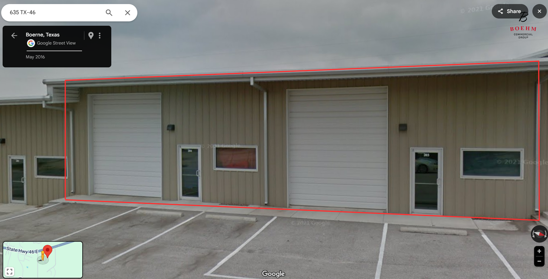
635 State Highway 46 E, Boerne, TX 78006
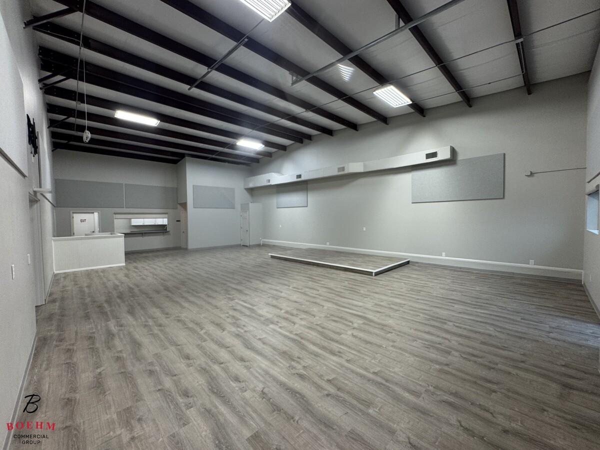

Current Lease Availabilities
NEARBY LISTINGS FOR SALE OR LEASE
Property Detail
635 State Highway 46 E
287384
Survey 824 Epi Co
Commercialbuilding
A10163 - SURVEY 824 EPI CO 1.0 ACRES
X
Kendall
48259C0450F
Texas
2023
5.80 AC
2024
Kendall County
970406
San Antonio
47,590 SF
San Antonio-New Braunfels, TX
DEMOGRAPHICS near 635 State Highway 46 E
1 Mile
3 Mile
5 Mile
2024 Total Population
524
3,673
10,551
2029 Population
650
4,618
13,398
Pop Growth 2024-2029
+ 24.05%
+ 25.73%
+ 26.98%
Average Age
48
46
44
2024 Total Households
199
1,327
3,809
HH Growth 2024-2029
+ 24.12%
+ 26.15%
+ 27.36%
Median Household Inc
$164,706
$140,794
$136,774
Avg Household Size
2.60
2.70
2.80
2024 Avg HH Vehicles
3.00
3.00
3.00
Median Home Value
$868,852
$705,240
$657,307
Median Year Built
2005
2005
2006
Nearby Places
- Restaurants
- Banks
- Shops
- Fitness
- Groceries
PUBLIC TRANSPORTATION
AIRPORT
San Antonio International
DRIVE
WALK
Distance
San Antonio International
41 min
33.0 mi
Freight Ports
Calhoun Port
DRIVE
WALK
Distance
Calhoun Port
219 min
179.0 mi
Nearby Properties
Address
Land Use
TOTAL SIZE
Lot Size
Zoning
Address
Land Use
TOTAL SIZE
Lot Size
Zoning
157,537 SF
83.94 AC
Address
Land Use
TOTAL SIZE
Lot Size
Zoning
43,173 SF
91.99 AC
Address
Land Use
TOTAL SIZE
Lot Size
Zoning
46,506 SF
11.40 AC
Address
Land Use
TOTAL SIZE
Lot Size
Zoning
10,800 SF
13.12 AC
Address
Land Use
TOTAL SIZE
Lot Size
Zoning
13,041 SF
10.44 AC
Address
Land Use
TOTAL SIZE
Lot Size
Zoning
8,952 SF
6.49 AC
Address
Land Use
TOTAL SIZE
Lot Size
Zoning
18,338 SF
4.50 AC
Address
Land Use
TOTAL SIZE
Lot Size
Zoning
28,705 SF
1.51 AC
Address
Land Use
TOTAL SIZE
Lot Size
Zoning
193.44 AC
Address
Land Use
TOTAL SIZE
Lot Size
Zoning
11,460 SF
3.01 AC
Address
Land Use
TOTAL SIZE
Lot Size
Zoning
10,500 SF
1.23 AC
Address
Land Use
TOTAL SIZE
Lot Size
Zoning
6,000 SF
3 AC
Address
Land Use
TOTAL SIZE
Lot Size
Zoning
16,700 SF
1.71 AC
Address
Land Use
TOTAL SIZE
Lot Size
Zoning
31,504 SF
2.10 AC
Address
Land Use
TOTAL SIZE
Lot Size
Zoning
12,128 SF
3.88 AC
Address
Land Use
TOTAL SIZE
Lot Size
Zoning
9,076 SF
2.94 AC
Address
Land Use
TOTAL SIZE
Lot Size
Zoning
5,508 SF
1.53 AC
Address
Land Use
TOTAL SIZE
Lot Size
Zoning
7,165 SF
23.34 AC
Address
Land Use
TOTAL SIZE
Lot Size
Zoning
13,864 SF
4.81 AC
Address
Land Use
TOTAL SIZE
Lot Size
Zoning
5,190 SF
1.16 AC
Address
Land Use
TOTAL SIZE
Lot Size
Zoning
6,429 SF
5.84 AC
Address
Land Use
TOTAL SIZE
Lot Size
Zoning
7,950 SF
74.80 AC
Address
Land Use
TOTAL SIZE
Lot Size
Zoning
12,056 SF
1.03 AC
Address
Land Use
TOTAL SIZE
Lot Size
Zoning
32.21 AC
Address
Land Use
TOTAL SIZE
Lot Size
Zoning
13,857 SF
2.49 AC
Address
Land Use
TOTAL SIZE
Lot Size
Zoning
9,372 SF
1.17 AC
Address
Land Use
TOTAL SIZE
Lot Size
Zoning
3.09 AC
Address
Land Use
TOTAL SIZE
Lot Size
Zoning
1,902 SF
5.70 AC
Address
Land Use
TOTAL SIZE
Lot Size
Zoning
5.18 AC
The World's #1 Commercial Real Estate Marketplace
Connect with us
© 2025 CoStar Group
The information above has been obtained from sources believed reliable. While we do not doubt its accuracy we have not verified it and make no guarantee, warranty or representation about it. It is your responsibility to independently confirm its accuracy and completeness. Any projections, opinions, assumptions, or estimates used are for example only and do not represent the current or future performance of the property. The value of this transaction to you depends on tax and other factors which should be evaluated by your tax, financial, and legal advisors. You and your advisors should conduct a careful, independent investigation of the property to determine to your satisfaction the suitability of the property for your needs.