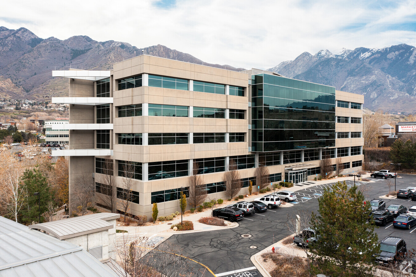
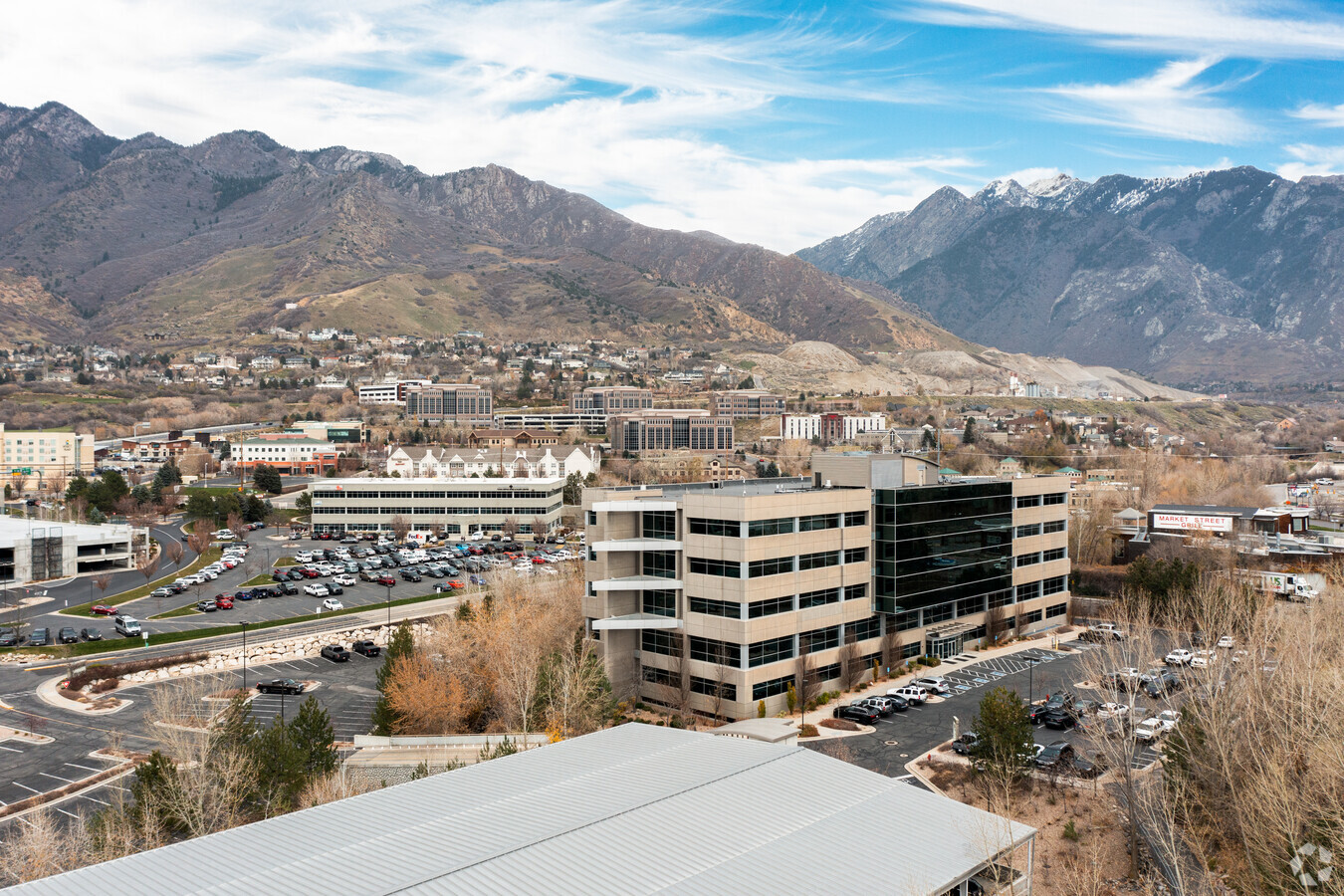
Property Record
6350 S 3000 E, Salt Lake City, UT 84121
NEARBY LISTINGS FOR SALE OR LEASE
Property Detail
6350 S 3000 E
22-23-177-011-0000
Bonneville West 03
Officebuilding
BEG N 0^0851 E 651.91 FT & E 1714.99 FT FR W 1/4 COR SEC 23, T 2S, R 1E, SLM; N 43^2149 E 330.41 FT; S 43^1845 E 6.84 FT; S 26^0424 E 24.01 FT; S 15^5935 E 58.37 FT; N 89^0201 W 5.19 FT; S 10^5932 E 143.47 FT; S 57^5355 W 100.26 FT; S 79^1242 W 119 F
AE
Salt Lake
49035C0318G
Utah
2023
1.01 AC
2023
Cottonwood
111002
Salt Lake City
188,750 SF
Salt Lake City, UT
DEMOGRAPHICS near 6350 S 3000 E
1 Mile
3 Mile
5 Mile
2024 Total Population
6,855
72,087
216,535
2029 Population
6,895
72,657
217,921
Pop Growth 2024-2029
+ 0.58%
+ 0.79%
+ 0.64%
Average Age
42
42
40
2024 Total Households
2,469
27,588
82,238
HH Growth 2024-2029
+ 0.36%
+ 0.67%
+ 0.56%
Median Household Inc
$113,561
$97,430
$88,195
Avg Household Size
2.70
2.60
2.60
2024 Avg HH Vehicles
2.00
2.00
2.00
Median Home Value
$698,387
$671,482
$548,940
Median Year Built
1978
1976
1976
Nearby Places
- Restaurants
- Banks
- Shops
- Fitness
- Groceries
PUBLIC TRANSPORTATION
AIRPORT
Salt Lake City International
DRIVE
WALK
Distance
Salt Lake City International
25 min
19.7 mi
Provo Municipal
DRIVE
WALK
Distance
Provo Municipal
56 min
42.8 mi
Freight Ports
Port of Stockton
DRIVE
WALK
Distance
Port of Stockton
726 min
710.1 mi
Nearby Properties
Address
Land Use
TOTAL SIZE
Lot Size
Zoning
Address
Land Use
TOTAL SIZE
Lot Size
Zoning
257,906 SF
36.42 AC
1110
Address
Land Use
TOTAL SIZE
Lot Size
Zoning
186,717 SF
21.58 AC
RM
Address
Land Use
TOTAL SIZE
Lot Size
Zoning
524,108 SF
34.46 AC
RM
Address
Land Use
TOTAL SIZE
Lot Size
Zoning
133,669 SF
19.81 AC
R-M
Address
Land Use
TOTAL SIZE
Lot Size
Zoning
397,526 SF
10.77 AC
A-1
Address
Land Use
TOTAL SIZE
Lot Size
Zoning
241,418 SF
8.84 AC
ORD
Address
Land Use
TOTAL SIZE
Lot Size
Zoning
21,057 SF
17.96 AC
RM20
Address
Land Use
TOTAL SIZE
Lot Size
Zoning
225,849 SF
16.36 AC
RM-ZC
Address
Land Use
TOTAL SIZE
Lot Size
Zoning
327,940 SF
3.95 AC
SD
Address
Land Use
TOTAL SIZE
Lot Size
Zoning
327,940 SF
3.37 AC
SD
Address
Land Use
TOTAL SIZE
Lot Size
Zoning
317,495 SF
2.75 AC
O-R-D
Address
Land Use
TOTAL SIZE
Lot Size
Zoning
106,016 SF
32.73 AC
1108
Address
Land Use
TOTAL SIZE
Lot Size
Zoning
151,587 SF
12.76 AC
ORD
Address
Land Use
TOTAL SIZE
Lot Size
Zoning
77,051 SF
8.34 AC
RM/ZC
Address
Land Use
TOTAL SIZE
Lot Size
Zoning
95,950 SF
9.56 AC
RM-25
Address
Land Use
TOTAL SIZE
Lot Size
Zoning
99,676 SF
5 AC
1108
Address
Land Use
TOTAL SIZE
Lot Size
Zoning
71,504 SF
7.11 AC
A-1
Address
Land Use
TOTAL SIZE
Lot Size
Zoning
151,789 SF
9.45 AC
RC
Address
Land Use
TOTAL SIZE
Lot Size
Zoning
424,042 SF
3.64 AC
R/M-U
Address
Land Use
TOTAL SIZE
Lot Size
Zoning
152,184 SF
4.40 AC
ORD
Address
Land Use
TOTAL SIZE
Lot Size
Zoning
176,372 SF
3.68 AC
ORD
Address
Land Use
TOTAL SIZE
Lot Size
Zoning
105,015 SF
3.91 AC
O R D
Address
Land Use
TOTAL SIZE
Lot Size
Zoning
206,860 SF
3.57 AC
O-R-D
Address
Land Use
TOTAL SIZE
Lot Size
Zoning
171,805 SF
3.95 AC
ORD
Address
Land Use
TOTAL SIZE
Lot Size
Zoning
78,330 SF
3 AC
O-R-D
Address
Land Use
TOTAL SIZE
Lot Size
Zoning
49,722 SF
7.59 AC
RM-ZC
Address
Land Use
TOTAL SIZE
Lot Size
Zoning
74,394 SF
9.27 AC
C2
Address
Land Use
TOTAL SIZE
Lot Size
Zoning
149,477 SF
0.01 AC
SD
Address
Land Use
TOTAL SIZE
Lot Size
Zoning
177,585 SF
4.65 AC
O-R-D
The World's #1 Commercial Real Estate Marketplace
Connect with us
© 2025 CoStar Group
The information above has been obtained from sources believed reliable. While we do not doubt its accuracy we have not verified it and make no guarantee, warranty or representation about it. It is your responsibility to independently confirm its accuracy and completeness. Any projections, opinions, assumptions, or estimates used are for example only and do not represent the current or future performance of the property. The value of this transaction to you depends on tax and other factors which should be evaluated by your tax, financial, and legal advisors. You and your advisors should conduct a careful, independent investigation of the property to determine to your satisfaction the suitability of the property for your needs.