Property Record
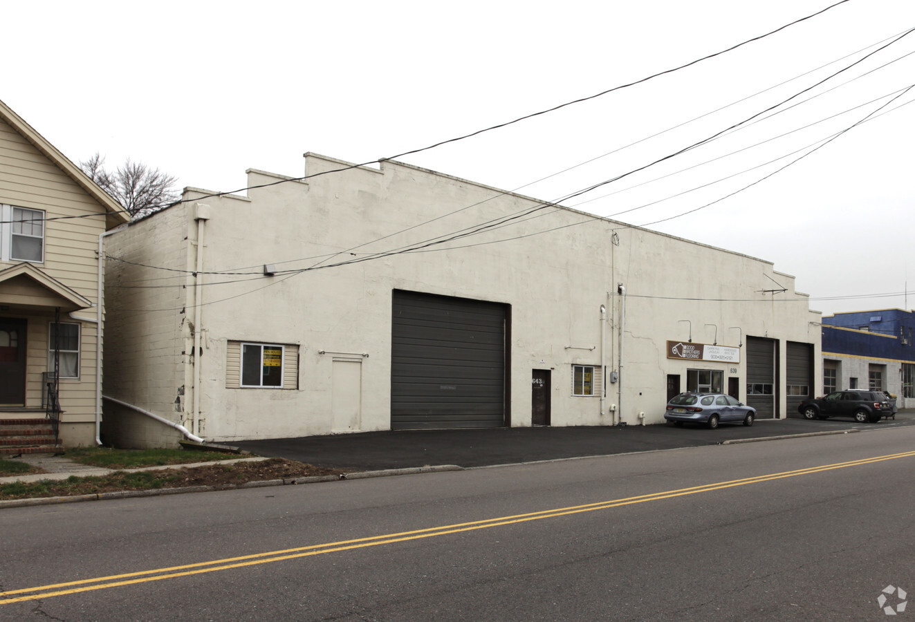
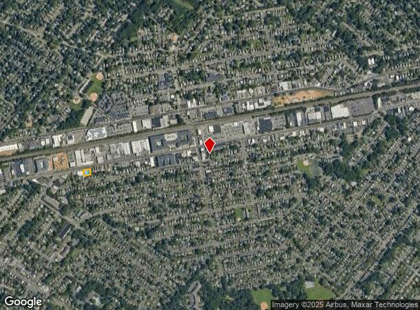
639 South Ave, Garwood, NJ 07027

This Property Is For Sale
NEARBY LISTINGS FOR SALE OR LEASE
Property Detail
639 South Ave
06-00302-0000-00002
Union
Commercialnec
New Jersey
X
2
34013C0150F
0.28 AC
2023
Central Union
2024
Northern New Jersey
036900
Newark, NJ-PA
10,620 SF
DEMOGRAPHICS near 639 South Ave
1 Mile
3 Mile
5 Mile
2024 Total Population
20,084
124,641
386,407
2029 Population
19,897
123,673
382,985
Pop Growth 2024-2029
(0.93%)
(0.78%)
(0.89%)
Average Age
41
41
41
2024 Total Households
7,598
45,121
137,736
HH Growth 2024-2029
(1.03%)
(0.92%)
(0.99%)
Median Household Inc
$133,797
$136,639
$111,839
Avg Household Size
2.60
2.70
2.70
2024 Avg HH Vehicles
2.00
2.00
2.00
Median Home Value
$706,034
$633,470
$478,131
Median Year Built
1952
1956
1957
Nearby Places
- Restaurants
- Banks
- Shops
- Fitness
- Groceries
PUBLIC TRANSPORTATION
COMMUTER RAIL
Garwood (Raritan Valley Line - NJ Transit Commuter Rail (NJ Transit))
DRIVE
WALK
Distance
Garwood (Raritan Valley Line - NJ Transit Commuter Rail (NJ Transit))
2 min
5 min
0.3 mi
Cranford (Raritan Valley Line - NJ Transit Commuter Rail (NJ Transit))
DRIVE
WALK
Distance
Cranford (Raritan Valley Line - NJ Transit Commuter Rail (NJ Transit))
3 min
1.3 mi
AIRPORT
Newark Liberty International
DRIVE
WALK
Distance
Newark Liberty International
20 min
12.9 mi
Laguardia
DRIVE
WALK
Distance
Laguardia
54 min
32.2 mi
John F Kennedy International
DRIVE
WALK
Distance
John F Kennedy International
58 min
38.3 mi
Freight Ports
New York Container Terminal
DRIVE
WALK
Distance
New York Container Terminal
20 min
11.0 mi
Nearby Properties
Address
Land Use
TOTAL SIZE
Lot Size
Zoning
Address
Land Use
TOTAL SIZE
Lot Size
Zoning
Address
Land Use
TOTAL SIZE
Lot Size
Zoning
Address
Land Use
TOTAL SIZE
Lot Size
Zoning
10.11 AC
Address
Land Use
TOTAL SIZE
Lot Size
Zoning
29.03 AC
IL
Address
Land Use
TOTAL SIZE
Lot Size
Zoning
8.43 AC
Address
Land Use
TOTAL SIZE
Lot Size
Zoning
151.20 AC
P
Address
Land Use
TOTAL SIZE
Lot Size
Zoning
3,538 SF
112 AC
Address
Land Use
TOTAL SIZE
Lot Size
Zoning
10.82 AC
H
Address
Land Use
TOTAL SIZE
Lot Size
Zoning
9.42 AC
Address
Land Use
TOTAL SIZE
Lot Size
Zoning
19.90 AC
R-75
Address
Land Use
TOTAL SIZE
Lot Size
Zoning
182 SF
13.80 AC
Address
Land Use
TOTAL SIZE
Lot Size
Zoning
38,083 SF
19.42 AC
Address
Land Use
TOTAL SIZE
Lot Size
Zoning
141.63 AC
Address
Land Use
TOTAL SIZE
Lot Size
Zoning
9.04 AC
CG
Address
Land Use
TOTAL SIZE
Lot Size
Zoning
Address
Land Use
TOTAL SIZE
Lot Size
Zoning
31,002 SF
3.64 AC
Address
Land Use
TOTAL SIZE
Lot Size
Zoning
Address
Land Use
TOTAL SIZE
Lot Size
Zoning
8.84 AC
Address
Land Use
TOTAL SIZE
Lot Size
Zoning
10.16 AC
Address
Land Use
TOTAL SIZE
Lot Size
Zoning
Address
Land Use
TOTAL SIZE
Lot Size
Zoning
5.61 AC
Address
Land Use
TOTAL SIZE
Lot Size
Zoning
8.40 AC
Address
Land Use
TOTAL SIZE
Lot Size
Zoning
20,130 SF
1.84 AC
Address
Land Use
TOTAL SIZE
Lot Size
Zoning
6.58 AC
Address
Land Use
TOTAL SIZE
Lot Size
Zoning
4.36 AC
OB
Address
Land Use
TOTAL SIZE
Lot Size
Zoning
Address
Land Use
TOTAL SIZE
Lot Size
Zoning
122,350 SF
7.75 AC
R-1
Address
Land Use
TOTAL SIZE
Lot Size
Zoning
9.98 AC
RA
Address
Land Use
TOTAL SIZE
Lot Size
Zoning
102,200 SF
6.68 AC
RA
Address
Land Use
TOTAL SIZE
Lot Size
Zoning
400,000 SF
1.50 AC
The World's #1 Commercial Real Estate Marketplace
Connect with us
© 2025 CoStar Group
The information above has been obtained from sources believed reliable. While we do not doubt its accuracy we have not verified it and make no guarantee, warranty or representation about it. It is your responsibility to independently confirm its accuracy and completeness. Any projections, opinions, assumptions, or estimates used are for example only and do not represent the current or future performance of the property. The value of this transaction to you depends on tax and other factors which should be evaluated by your tax, financial, and legal advisors. You and your advisors should conduct a careful, independent investigation of the property to determine to your satisfaction the suitability of the property for your needs.