Property Record
6380 N Decatur Blvd, North Las Vegas, NV 89084


NEARBY LISTINGS FOR SALE OR LEASE
Property Detail
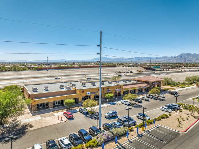
6380 N Decatur Blvd
Las Vegas-Henderson-North Las Vegas, NV
Cross Roads Towne Center
124-30-112-001
CROSS ROADS TOWNE CENTER PLAT BOOK 140 PAGE 46 LOT 1-4
Storebuilding
Clark
X
Nevada
32003C1765F
1-4
2025
3.58 AC
2025
North Las Vegas
003620
Las Vegas
30,135 SF
DEMOGRAPHICS near 6380 N Decatur Blvd
1 Mile
3 Mile
5 Mile
2024 Total Population
20,462
143,690
326,618
2029 Population
21,850
154,506
351,608
Pop Growth 2024-2029
+ 6.78%
+ 7.53%
+ 7.65%
Average Age
38
40
39
2024 Total Households
7,179
48,996
112,058
HH Growth 2024-2029
+ 6.80%
+ 7.44%
+ 7.60%
Median Household Inc
$78,920
$84,466
$76,188
Avg Household Size
2.80
2.90
2.90
2024 Avg HH Vehicles
2.00
2.00
2.00
Median Home Value
$371,216
$369,969
$359,168
Median Year Built
2004
2002
2001
Nearby Places
Map Layers
Map Styles
 Street
 Aerial
- Restaurants
- Banks
- Shops
- Fitness
- Groceries
PUBLIC TRANSPORTATION
AIRPORT
Harry Reid International
DRIVE
WALK
Distance
Harry Reid International
30 min
24.8 mi
Freight Ports
Port of Long Beach
DRIVE
WALK
Distance
Port of Long Beach
1 min
242.0 mi
SALE & LEASE HISTORY
LISTING DATE
SALE/LEASE

Sep 25, 2016
For Lease
Oct 18, 2022
For Lease
Mar 30, 2017
For Lease
Jul 21, 2017
For Lease
Nearby Properties
Address
Land Use
TOTAL SIZE
Lot Size
Zoning
Address
Land Use
TOTAL SIZE
Lot Size
Zoning
515,219 SF
40.68 AC
MPCPUD
Address
Land Use
TOTAL SIZE
Lot Size
Zoning
647,754 SF
38.57 AC
C2
Address
Land Use
TOTAL SIZE
Lot Size
Zoning
602,356 SF
23.37 AC
R3
Address
Land Use
TOTAL SIZE
Lot Size
Zoning
6,386 SF
15.82 AC
Address
Land Use
TOTAL SIZE
Lot Size
Zoning
35.67 AC
CV
Address
Land Use
TOTAL SIZE
Lot Size
Zoning
5,156 SF
9.46 AC
Address
Land Use
TOTAL SIZE
Lot Size
Zoning
19.10 AC
PF
Address
Land Use
TOTAL SIZE
Lot Size
Zoning
201,255 SF
20.95 AC
C1
Address
Land Use
TOTAL SIZE
Lot Size
Zoning
17.02 AC
OL
Address
Land Use
TOTAL SIZE
Lot Size
Zoning
Address
Land Use
TOTAL SIZE
Lot Size
Zoning
14.18 AC
MPCPSP
Address
Land Use
TOTAL SIZE
Lot Size
Zoning
17.97 AC
RE
Address
Land Use
TOTAL SIZE
Lot Size
Zoning
15.02 AC
CV
Address
Land Use
TOTAL SIZE
Lot Size
Zoning
4,273 SF
16.04 AC
Address
Land Use
TOTAL SIZE
Lot Size
Zoning
129,339 SF
13.43 AC
C2
Address
Land Use
TOTAL SIZE
Lot Size
Zoning
18.93 AC
CV
Address
Land Use
TOTAL SIZE
Lot Size
Zoning
267,271 SF
22.36 AC
C1
Address
Land Use
TOTAL SIZE
Lot Size
Zoning
13.45 AC
MPCPSP
Address
Land Use
TOTAL SIZE
Lot Size
Zoning
10.47 AC
RE
Address
Land Use
TOTAL SIZE
Lot Size
Zoning
118,977 SF
13.67 AC
Address
Land Use
TOTAL SIZE
Lot Size
Zoning
17.26 AC
RE
Address
Land Use
TOTAL SIZE
Lot Size
Zoning
40.87 AC
OL
Address
Land Use
TOTAL SIZE
Lot Size
Zoning
12.41 AC
CV
Address
Land Use
TOTAL SIZE
Lot Size
Zoning
80,778 SF
8.67 AC
Address
Land Use
TOTAL SIZE
Lot Size
Zoning
154,772 SF
14.05 AC
C1
Address
Land Use
TOTAL SIZE
Lot Size
Zoning
93,991 SF
9.10 AC
Address
Land Use
TOTAL SIZE
Lot Size
Zoning
93,631 SF
9.86 AC
OLDA
Address
Land Use
TOTAL SIZE
Lot Size
Zoning
202,210 SF
18.82 AC
C2
Address
Land Use
TOTAL SIZE
Lot Size
Zoning
81,105 SF
10.06 AC
The World's #1 Commercial Real Estate Marketplace
Connect with us
© 2026 CoStar Group
The information above has been obtained from sources believed reliable. While we do not doubt its accuracy we have not verified it and make no guarantee, warranty or representation about it. It is your responsibility to independently confirm its accuracy and completeness. Any projections, opinions, assumptions, or estimates used are for example only and do not represent the current or future performance of the property. The value of this transaction to you depends on tax and other factors which should be evaluated by your tax, financial, and legal advisors. You and your advisors should conduct a careful, independent investigation of the property to determine to your satisfaction the suitability of the property for your needs.