Property Record
682 Paul Huff Pkwy Nw, Cleveland, TN 37312
NEARBY LISTINGS FOR SALE OR LEASE
Property Detail
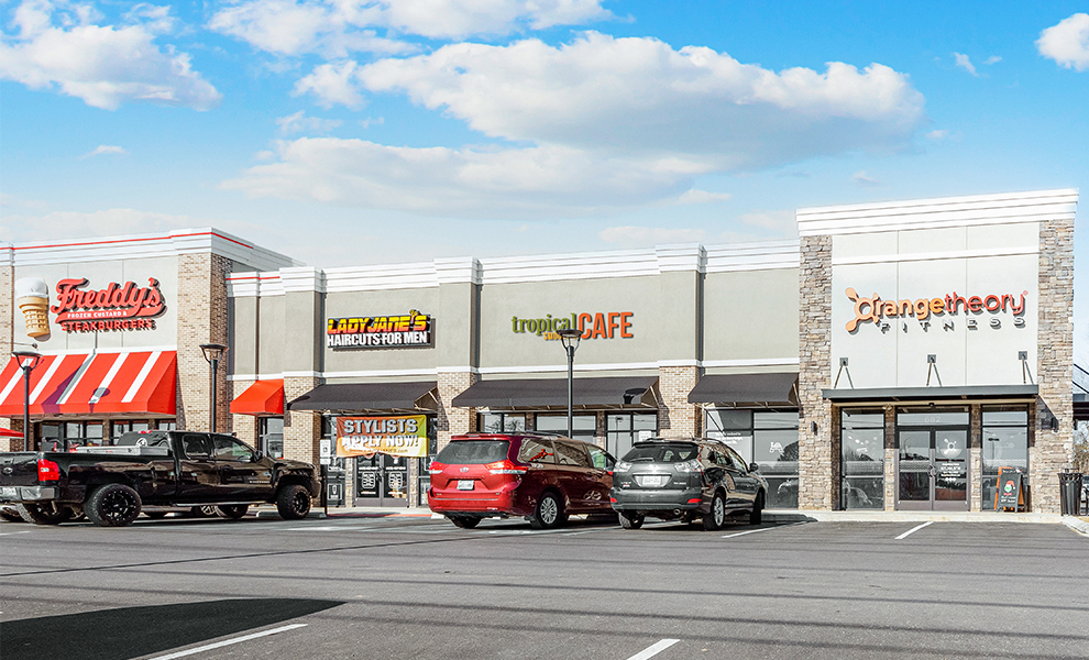
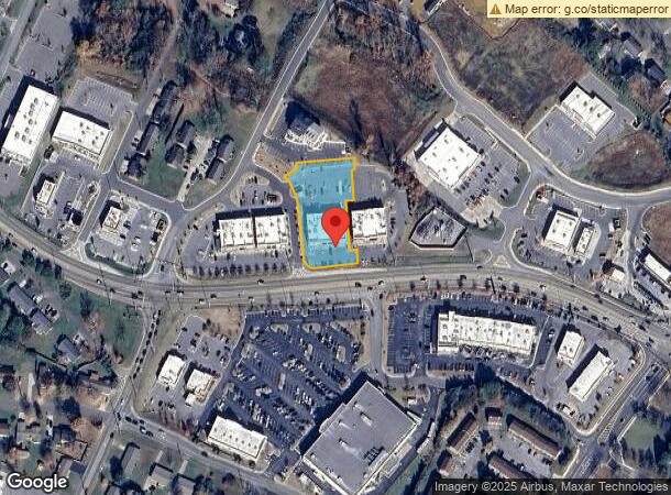
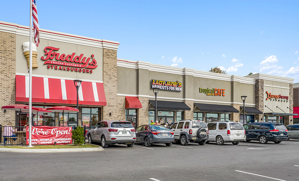
682 Paul Huff Pkwy Nw
Cleveland, TN
Paul Huff Corners
034I-F-003.00
PAUL HUFF CORNERS PB: 36 PG: 44 LOT: 3 PAUL HUFF CORNERS BLDG 300
Commercialnec
Bradley
X
Tennessee
47011C0128E
3
2024
1.08 AC
2024
Tennessee East Area
011204
Other Market Areas
8,938 SF
DEMOGRAPHICS near 682 Paul Huff Pkwy Nw
1 Mile
3 Mile
5 Mile
2024 Total Population
5,723
36,170
66,579
2029 Population
5,996
38,105
70,263
Pop Growth 2024-2029
+ 4.77%
+ 5.35%
+ 5.53%
Average Age
41
41
40
2024 Total Households
2,242
14,240
26,044
HH Growth 2024-2029
+ 4.86%
+ 5.55%
+ 5.71%
Median Household Inc
$69,027
$60,036
$55,640
Avg Household Size
2.50
2.40
2.50
2024 Avg HH Vehicles
2.00
2.00
2.00
Median Home Value
$218,740
$237,071
$229,582
Median Year Built
1980
1986
1984
Nearby Places
- Restaurants
- Banks
- Shops
- Fitness
- Groceries
PUBLIC TRANSPORTATION
AIRPORT
Lovell Field
DRIVE
WALK
Distance
Lovell Field
36 min
26.5 mi
Freight Ports
Georgia Ports - Savannah
DRIVE
WALK
Distance
Georgia Ports - Savannah
428 min
371.5 mi
SALE & LEASE HISTORY
LISTING DATE
SALE/LEASE

May 21, 2020
For Sale
Nearby Properties
Address
Land Use
TOTAL SIZE
Lot Size
Zoning
Address
Land Use
TOTAL SIZE
Lot Size
Zoning
267,460 SF
8.30 AC
IL
Address
Land Use
TOTAL SIZE
Lot Size
Zoning
400,562 SF
15.26 AC
PI
Address
Land Use
TOTAL SIZE
Lot Size
Zoning
118,230 SF
37 AC
FAR
Address
Land Use
TOTAL SIZE
Lot Size
Zoning
88,644 SF
51.19 AC
R1
Address
Land Use
TOTAL SIZE
Lot Size
Zoning
68,425 SF
76.31 AC
MU
Address
Land Use
TOTAL SIZE
Lot Size
Zoning
68,785 SF
8.70 AC
R1
Address
Land Use
TOTAL SIZE
Lot Size
Zoning
356,920 SF
26.42 AC
IL
Address
Land Use
TOTAL SIZE
Lot Size
Zoning
93,264 SF
17.60 AC
CH
Address
Land Use
TOTAL SIZE
Lot Size
Zoning
74,392 SF
17.39 AC
MU
Address
Land Use
TOTAL SIZE
Lot Size
Zoning
620,857 SF
34.28 AC
IH
Address
Land Use
TOTAL SIZE
Lot Size
Zoning
170,518 SF
4.96 AC
CH
Address
Land Use
TOTAL SIZE
Lot Size
Zoning
153,044 SF
16.85 AC
PUD
Address
Land Use
TOTAL SIZE
Lot Size
Zoning
213,240 SF
19.10 AC
R3
Address
Land Use
TOTAL SIZE
Lot Size
Zoning
203,778 SF
13.46 AC
R3
Address
Land Use
TOTAL SIZE
Lot Size
Zoning
416,503 SF
61.92 AC
CH
Address
Land Use
TOTAL SIZE
Lot Size
Zoning
96,527 SF
5.15 AC
CH
Address
Land Use
TOTAL SIZE
Lot Size
Zoning
203,751 SF
19.34 AC
CH
Address
Land Use
TOTAL SIZE
Lot Size
Zoning
132,758 SF
12.30 AC
PUD
Address
Land Use
TOTAL SIZE
Lot Size
Zoning
56,725 SF
13.06 AC
R1
Address
Land Use
TOTAL SIZE
Lot Size
Zoning
265,226 SF
25.90 AC
CH
Address
Land Use
TOTAL SIZE
Lot Size
Zoning
36.78 AC
PI
Address
Land Use
TOTAL SIZE
Lot Size
Zoning
141,489 SF
10.40 AC
R3
Address
Land Use
TOTAL SIZE
Lot Size
Zoning
86,435 SF
7.68 AC
CH
Address
Land Use
TOTAL SIZE
Lot Size
Zoning
37,430 SF
5.75 AC
CH
Address
Land Use
TOTAL SIZE
Lot Size
Zoning
15,044 SF
93.90 AC
IH
Address
Land Use
TOTAL SIZE
Lot Size
Zoning
43,812 SF
9.80 AC
CH
Address
Land Use
TOTAL SIZE
Lot Size
Zoning
44.30 AC
IH
Address
Land Use
TOTAL SIZE
Lot Size
Zoning
82,190 SF
6.53 AC
PI
Address
Land Use
TOTAL SIZE
Lot Size
Zoning
122,596 SF
5.98 AC
PUD
Address
Land Use
TOTAL SIZE
Lot Size
Zoning
27.47 AC
RA
The World's #1 Commercial Real Estate Marketplace
Connect with us
© 2025 CoStar Group
The information above has been obtained from sources believed reliable. While we do not doubt its accuracy we have not verified it and make no guarantee, warranty or representation about it. It is your responsibility to independently confirm its accuracy and completeness. Any projections, opinions, assumptions, or estimates used are for example only and do not represent the current or future performance of the property. The value of this transaction to you depends on tax and other factors which should be evaluated by your tax, financial, and legal advisors. You and your advisors should conduct a careful, independent investigation of the property to determine to your satisfaction the suitability of the property for your needs.