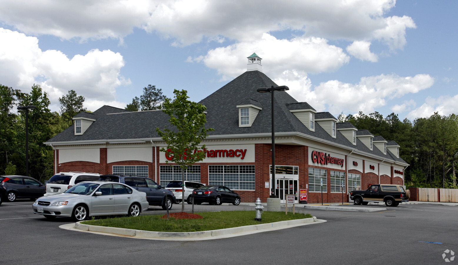
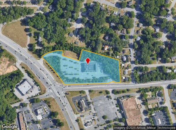
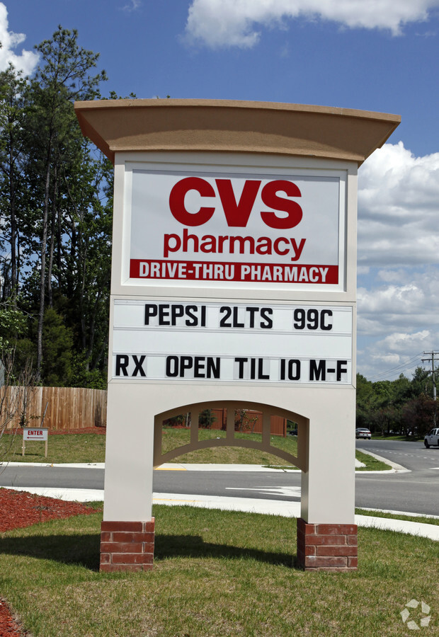
Property Record
6400 Centralia Rd, Chesterfield, VA 23832
NEARBY LISTINGS FOR SALE OR LEASE
Property Detail
6400 Centralia Rd
773-66-11-93-400-000
Iron Bridge & Centralia Par A
Commercialnec
IRON BRIDGE & CENTRALIA PAR A
X
Chesterfield
51041C0307E
Virginia
2024
5.14 AC
2024
South Chesterfield
100817
Richmond VA
13,600 SF
Richmond, VA
DEMOGRAPHICS near 6400 Centralia Rd
1 Mile
3 Mile
5 Mile
2024 Total Population
4,778
31,689
89,884
2029 Population
5,210
34,757
98,646
Pop Growth 2024-2029
+ 9.04%
+ 9.68%
+ 9.75%
Average Age
41
41
40
2024 Total Households
1,839
11,935
33,468
HH Growth 2024-2029
+ 9.30%
+ 9.88%
+ 9.92%
Median Household Inc
$55,632
$80,794
$77,845
Avg Household Size
2.40
2.60
2.60
2024 Avg HH Vehicles
2.00
2.00
2.00
Median Home Value
$244,171
$284,718
$278,910
Median Year Built
1987
1988
1989
Nearby Places
- Restaurants
- Banks
- Shops
- Fitness
- Groceries
PUBLIC TRANSPORTATION
AIRPORT
Richmond International
Drive
Walk
Distance
Richmond International
32 min
19.3 mi
Freight Ports
Virginia Port Authority - Richmond
Drive
Walk
Distance
Virginia Port Authority - Richmond
22 min
11.8 mi
Nearby Properties
Address
Land Use
TOTAL SIZE
Lot Size
Zoning
Address
Land Use
TOTAL SIZE
Lot Size
Zoning
21.01 AC
RMF - RES,
Address
Land Use
TOTAL SIZE
Lot Size
Zoning
121974
33.25 AC
RMF - RES,
Address
Land Use
TOTAL SIZE
Lot Size
Zoning
5.60 AC
A - AGRICU
Address
Land Use
TOTAL SIZE
Lot Size
Zoning
66118
22.07 AC
A - AGRICU
Address
Land Use
TOTAL SIZE
Lot Size
Zoning
278193
74.49 AC
A - AGRICU
Address
Land Use
TOTAL SIZE
Lot Size
Zoning
95419
21.13 AC
RMF - RES,
Address
Land Use
TOTAL SIZE
Lot Size
Zoning
100
21.30 AC
R7 - SINGL
Address
Land Use
TOTAL SIZE
Lot Size
Zoning
613315
12.94 AC
I1 - LT IN
Address
Land Use
TOTAL SIZE
Lot Size
Zoning
16052
552.02 AC
I1 - LT IN
Address
Land Use
TOTAL SIZE
Lot Size
Zoning
99934
27.15 AC
A - AGRICU
Address
Land Use
TOTAL SIZE
Lot Size
Zoning
100
10.98 AC
R7 - SINGL
Address
Land Use
TOTAL SIZE
Lot Size
Zoning
65261
64.31 AC
A - AGRICU
Address
Land Use
TOTAL SIZE
Lot Size
Zoning
70882
20.08 AC
C3 - COMMU
Address
Land Use
TOTAL SIZE
Lot Size
Zoning
10107
16.21 AC
A - AGRICU
Address
Land Use
TOTAL SIZE
Lot Size
Zoning
119527
14.89 AC
C5 - GEN B
Address
Land Use
TOTAL SIZE
Lot Size
Zoning
78429
23.53 AC
RMF - RES,
Address
Land Use
TOTAL SIZE
Lot Size
Zoning
40729
22.64 AC
A - AGRICU
Address
Land Use
TOTAL SIZE
Lot Size
Zoning
100
10.21 AC
R7 - SINGL
Address
Land Use
TOTAL SIZE
Lot Size
Zoning
138787
21.46 AC
A - AGRICU
Address
Land Use
TOTAL SIZE
Lot Size
Zoning
193838
12.66 AC
C3 - COMMU
Address
Land Use
TOTAL SIZE
Lot Size
Zoning
91100
18.74 AC
A - AGRICU
Address
Land Use
TOTAL SIZE
Lot Size
Zoning
792
534.39 AC
A - AGRICU
Address
Land Use
TOTAL SIZE
Lot Size
Zoning
24562
48.28 AC
A - AGRICU
Address
Land Use
TOTAL SIZE
Lot Size
Zoning
99471
19.26 AC
A - AGRICU
Address
Land Use
TOTAL SIZE
Lot Size
Zoning
37266
9.40 AC
R7 - SINGL
Address
Land Use
TOTAL SIZE
Lot Size
Zoning
157604
0.85 AC
I1 - LT IN
Address
Land Use
TOTAL SIZE
Lot Size
Zoning
73969
27.42 AC
A - AGRICU
Address
Land Use
TOTAL SIZE
Lot Size
Zoning
20312
12.76 AC
A - AGRICU
Address
Land Use
TOTAL SIZE
Lot Size
Zoning
92000
5.41 AC
C5 - GEN B
Address
Land Use
TOTAL SIZE
Lot Size
Zoning
78948
0.63 AC
A - AGRICU
Start a new search to find other properties for sale or lease
Connect with us
© 2024 CoStar Group
The information above has been obtained from sources believed reliable. While we do not doubt its accuracy we have not verified it and make no guarantee, warranty or representation about it. It is your responsibility to independently confirm its accuracy and completeness. Any projections, opinions, assumptions, or estimates used are for example only and do not represent the current or future performance of the property. The value of this transaction to you depends on tax and other factors which should be evaluated by your tax, financial, and legal advisors. You and your advisors should conduct a careful, independent investigation of the property to determine to your satisfaction the suitability of the property for your needs.