Property Record
6400 State Road 544, Winter Haven, FL 33881

NEARBY LISTINGS FOR SALE OR LEASE
-
-
View all Winter Haven listings for sale on LoopNet.com
Property Detail
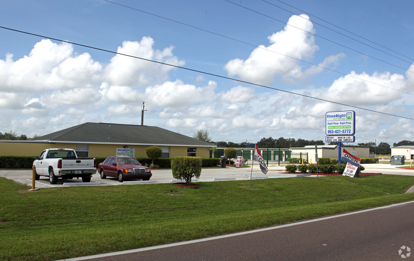
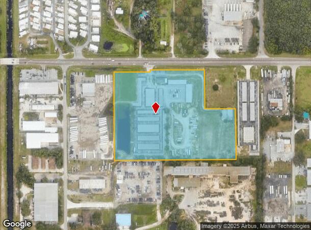
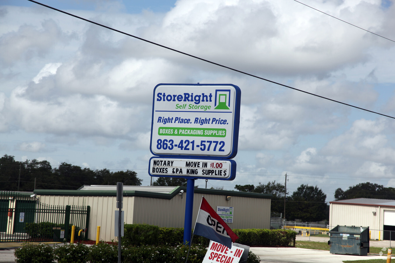
6400 State Road 544
27-28-06-000000-034030
Sargent Prop
Publicstorage
COMM AT NW COR OF SW1/4 OF NW1/4 RUN E 332 FT S 50 FT TO SLY R/W OF SR 544 TO POB E ALONG R/W 620.08 FT S 260 FT E 208 FT S 349.16 FT W 831.2 FT N 610.03 FT TO POB LESS R/W FOR SR 544 AS DESC IN OR BOOK 4531-1715
AE
Polk
12105C0358G
Florida
2023
10.15 AC
2023
Polk County
012802
Tampa/St Petersburg
49,415 SF
Lakeland-Winter Haven, FL
DEMOGRAPHICS near 6400 State Road 544
1 Mile
3 Mile
5 Mile
2024 Total Population
4,046
28,928
88,397
2029 Population
4,989
35,420
107,636
Pop Growth 2024-2029
+ 23.31%
+ 22.44%
+ 21.76%
Average Age
45
46
42
2024 Total Households
1,622
11,774
33,355
HH Growth 2024-2029
+ 23.37%
+ 22.41%
+ 21.77%
Median Household Inc
$42,083
$48,098
$51,981
Avg Household Size
2.40
2.40
2.60
2024 Avg HH Vehicles
1.00
1.00
2.00
Median Home Value
$91,780
$118,541
$191,286
Median Year Built
1985
1991
1993
Nearby Places
- Restaurants
- Banks
- Shops
- Fitness
- Groceries
PUBLIC TRANSPORTATION
COMMUTER RAIL
Winter Haven (Silver Meteor - Amtrak, Silver Star - Amtrak)
DRIVE
WALK
Distance
Winter Haven (Silver Meteor - Amtrak, Silver Star - Amtrak)
16 min
9.1 mi
Freight Ports
Port of Tampa Bay
DRIVE
WALK
Distance
Port of Tampa Bay
79 min
54.2 mi
Nearby Properties
Address
Land Use
TOTAL SIZE
Lot Size
Zoning
Address
Land Use
TOTAL SIZE
Lot Size
Zoning
807,937 SF
72.45 AC
Address
Land Use
TOTAL SIZE
Lot Size
Zoning
919,224 SF
103.84 AC
IM
Address
Land Use
TOTAL SIZE
Lot Size
Zoning
386,137 SF
39.91 AC
Address
Land Use
TOTAL SIZE
Lot Size
Zoning
175,423 SF
47.09 AC
XX
Address
Land Use
TOTAL SIZE
Lot Size
Zoning
200,000 SF
22.75 AC
Address
Land Use
TOTAL SIZE
Lot Size
Zoning
379,597 SF
40.77 AC
OUA
Address
Land Use
TOTAL SIZE
Lot Size
Zoning
181,804 SF
52.32 AC
XX
Address
Land Use
TOTAL SIZE
Lot Size
Zoning
127,559 SF
9.87 AC
Address
Land Use
TOTAL SIZE
Lot Size
Zoning
92,502 SF
15.22 AC
Address
Land Use
TOTAL SIZE
Lot Size
Zoning
78,344 SF
17.46 AC
Address
Land Use
TOTAL SIZE
Lot Size
Zoning
147,825 SF
10.23 AC
Address
Land Use
TOTAL SIZE
Lot Size
Zoning
61,597 SF
11.34 AC
OUA
Address
Land Use
TOTAL SIZE
Lot Size
Zoning
34,063 SF
21.84 AC
R1A
Address
Land Use
TOTAL SIZE
Lot Size
Zoning
72,928 SF
4.73 AC
Address
Land Use
TOTAL SIZE
Lot Size
Zoning
37,176 SF
15.29 AC
Address
Land Use
TOTAL SIZE
Lot Size
Zoning
91,044 SF
8.91 AC
Address
Land Use
TOTAL SIZE
Lot Size
Zoning
49,456 SF
3.50 AC
RM
Address
Land Use
TOTAL SIZE
Lot Size
Zoning
35,695 SF
3.38 AC
R3
Address
Land Use
TOTAL SIZE
Lot Size
Zoning
107,850 SF
15.16 AC
Address
Land Use
TOTAL SIZE
Lot Size
Zoning
54,000 SF
12.08 AC
Address
Land Use
TOTAL SIZE
Lot Size
Zoning
186,101 SF
10.97 AC
R3
Address
Land Use
TOTAL SIZE
Lot Size
Zoning
179,084 SF
7.92 AC
IH
Address
Land Use
TOTAL SIZE
Lot Size
Zoning
17,441 SF
119.40 AC
RC
Address
Land Use
TOTAL SIZE
Lot Size
Zoning
44,752 SF
4.40 AC
R3
Address
Land Use
TOTAL SIZE
Lot Size
Zoning
12,729 SF
5.40 AC
Address
Land Use
TOTAL SIZE
Lot Size
Zoning
68,760 SF
12.20 AC
XX
Address
Land Use
TOTAL SIZE
Lot Size
Zoning
68,650 SF
6.34 AC
XX
Address
Land Use
TOTAL SIZE
Lot Size
Zoning
176,355 SF
9.59 AC
IH
Address
Land Use
TOTAL SIZE
Lot Size
Zoning
615.28 AC
RC
Address
Land Use
TOTAL SIZE
Lot Size
Zoning
112.61 AC
XX
The World's #1 Commercial Real Estate Marketplace
Connect with us
© 2025 CoStar Group
The information above has been obtained from sources believed reliable. While we do not doubt its accuracy we have not verified it and make no guarantee, warranty or representation about it. It is your responsibility to independently confirm its accuracy and completeness. Any projections, opinions, assumptions, or estimates used are for example only and do not represent the current or future performance of the property. The value of this transaction to you depends on tax and other factors which should be evaluated by your tax, financial, and legal advisors. You and your advisors should conduct a careful, independent investigation of the property to determine to your satisfaction the suitability of the property for your needs.