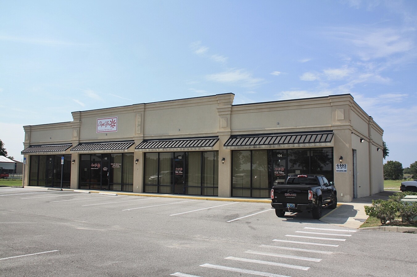
Property Record
6405 Sw 38Th St, Ocala, FL 34474
This Property Is For Sale
Current Lease Availabilities
NEARBY LISTINGS FOR SALE OR LEASE
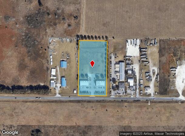
Property Detail
6405 Sw 38Th St
Ocala, FL
441 Comm
23820-011-02
SEC 29 TWP 15 RGE 21 E 329.92 FT OF W 659.84 FT OF S 1/2 OF SW 1/4 OF SE 1/4
Regionalshoppingcenterormallwithanchorstore
Marion
AE
Florida
12083C0513E
d
2023
4.83 AC
2023
Greater Ocala
002506
Ocala
12,528 SF
DEMOGRAPHICS near 6405 Sw 38Th St
1 Mile
3 Mile
5 Mile
2024 Total Population
1,171
17,356
53,562
2029 Population
1,316
19,555
60,633
Pop Growth 2024-2029
+ 12.38%
+ 12.67%
+ 13.20%
Average Age
36
42
49
2024 Total Households
401
7,227
23,312
HH Growth 2024-2029
+ 12.22%
+ 12.61%
+ 13.29%
Median Household Inc
$77,809
$59,216
$55,784
Avg Household Size
2.80
2.30
2.20
2024 Avg HH Vehicles
2.00
2.00
1.00
Median Home Value
$228,846
$214,542
$232,538
Median Year Built
2003
1994
1997
Nearby Places
- Restaurants
- Banks
- Shops
- Fitness
- Groceries
Nearby Properties
Address
Land Use
TOTAL SIZE
Lot Size
Zoning
Address
Land Use
TOTAL SIZE
Lot Size
Zoning
2,015,469 SF
169.30 AC
M1
Address
Land Use
TOTAL SIZE
Lot Size
Zoning
156,201 SF
36.77 AC
INST
Address
Land Use
TOTAL SIZE
Lot Size
Zoning
493,261 SF
126.01 AC
R3
Address
Land Use
TOTAL SIZE
Lot Size
Zoning
283,913 SF
24.22 AC
B2
Address
Land Use
TOTAL SIZE
Lot Size
Zoning
612,196 SF
50.06 AC
M1
Address
Land Use
TOTAL SIZE
Lot Size
Zoning
164,363 SF
16.51 AC
R3
Address
Land Use
TOTAL SIZE
Lot Size
Zoning
324,262 SF
48.94 AC
SC
Address
Land Use
TOTAL SIZE
Lot Size
Zoning
322,193 SF
70.13 AC
INST
Address
Land Use
TOTAL SIZE
Lot Size
Zoning
444,381 SF
60 AC
M1
Address
Land Use
TOTAL SIZE
Lot Size
Zoning
189,662 SF
25.54 AC
B2
Address
Land Use
TOTAL SIZE
Lot Size
Zoning
152,355 SF
973.50 AC
GU
Address
Land Use
TOTAL SIZE
Lot Size
Zoning
421,243 SF
51.48 AC
M2
Address
Land Use
TOTAL SIZE
Lot Size
Zoning
59,706 SF
10.01 AC
PD
Address
Land Use
TOTAL SIZE
Lot Size
Zoning
194,275 SF
13.43 AC
M1
Address
Land Use
TOTAL SIZE
Lot Size
Zoning
43,905 SF
6.29 AC
B2
Address
Land Use
TOTAL SIZE
Lot Size
Zoning
186,474 SF
18.52 AC
SC
Address
Land Use
TOTAL SIZE
Lot Size
Zoning
113,501 SF
68.56 AC
INST
Address
Land Use
TOTAL SIZE
Lot Size
Zoning
115,495 SF
16.70 AC
PUD
Address
Land Use
TOTAL SIZE
Lot Size
Zoning
392,617 SF
23.83 AC
M1
Address
Land Use
TOTAL SIZE
Lot Size
Zoning
37,601 SF
3.71 AC
B2
Address
Land Use
TOTAL SIZE
Lot Size
Zoning
91,872 SF
216.43 AC
M1
Address
Land Use
TOTAL SIZE
Lot Size
Zoning
364,404 SF
31.83 AC
M1
Address
Land Use
TOTAL SIZE
Lot Size
Zoning
360,450 SF
20 AC
M1
Address
Land Use
TOTAL SIZE
Lot Size
Zoning
65,882 SF
13.34 AC
R3
Address
Land Use
TOTAL SIZE
Lot Size
Zoning
95,496 SF
25.25 AC
R3
Address
Land Use
TOTAL SIZE
Lot Size
Zoning
39,411 SF
3.35 AC
B2
Address
Land Use
TOTAL SIZE
Lot Size
Zoning
23,441 SF
2.33 AC
B2
Address
Land Use
TOTAL SIZE
Lot Size
Zoning
44,276 SF
5 AC
O1
Address
Land Use
TOTAL SIZE
Lot Size
Zoning
16,016 SF
2.63 AC
B2
Address
Land Use
TOTAL SIZE
Lot Size
Zoning
265,793 SF
30 AC
M1
The World's #1 Commercial Real Estate Marketplace
Connect with us
© 2025 CoStar Group
The information above has been obtained from sources believed reliable. While we do not doubt its accuracy we have not verified it and make no guarantee, warranty or representation about it. It is your responsibility to independently confirm its accuracy and completeness. Any projections, opinions, assumptions, or estimates used are for example only and do not represent the current or future performance of the property. The value of this transaction to you depends on tax and other factors which should be evaluated by your tax, financial, and legal advisors. You and your advisors should conduct a careful, independent investigation of the property to determine to your satisfaction the suitability of the property for your needs.