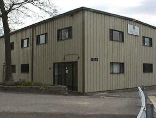
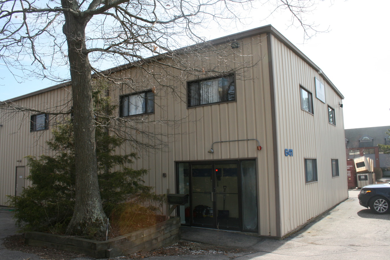
Property Record
641 Arnold Rd, Coventry, RI 02816
NEARBY LISTINGS FOR SALE OR LEASE
Property Detail
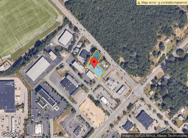
641 Arnold Rd
COVE-000007-000000-000021-000001
Kent
Industrialgeneral
Rhode Island
X
21-1
44003C0116H
0.50 AC
2024
Coventry/West Greenwich
2024
Providence
020603
Providence-Warwick, RI-MA
5,600 SF
DEMOGRAPHICS near 641 Arnold Rd
1 Mile
3 Mile
5 Mile
2024 Total Population
5,127
44,105
94,078
2029 Population
5,213
44,650
95,213
Pop Growth 2024-2029
+ 1.68%
+ 1.24%
+ 1.21%
Average Age
45
43
43
2024 Total Households
2,085
18,608
39,569
HH Growth 2024-2029
+ 1.82%
+ 1.21%
+ 1.19%
Median Household Inc
$73,492
$67,342
$75,086
Avg Household Size
2.40
2.30
2.30
2024 Avg HH Vehicles
2.00
2.00
2.00
Median Home Value
$295,857
$282,599
$334,765
Median Year Built
1976
1972
1970
Nearby Places
- Restaurants
- Banks
- Shops
- Fitness
- Groceries
PUBLIC TRANSPORTATION
COMMUTER RAIL
Tf Green Airport (Providence/Stoughton Line - MBTA)
DRIVE
WALK
Distance
Tf Green Airport (Providence/Stoughton Line - MBTA)
15 min
8.1 mi
AIRPORT
Rhode Island Tf Green International
DRIVE
WALK
Distance
Rhode Island Tf Green International
20 min
10.4 mi
Freight Ports
Port of Davisville, RI
DRIVE
WALK
Distance
Port of Davisville, RI
22 min
11.8 mi
SALE & LEASE HISTORY
LISTING DATE
SALE/LEASE

Apr 01, 2019
For Sale
Nearby Properties
Address
Land Use
TOTAL SIZE
Lot Size
Zoning
Address
Land Use
TOTAL SIZE
Lot Size
Zoning
71.87 AC
INDA
Address
Land Use
TOTAL SIZE
Lot Size
Zoning
251,633 SF
21.09 AC
RHF
Address
Land Use
TOTAL SIZE
Lot Size
Zoning
31,158 SF
20.36 AC
SMD
Address
Land Use
TOTAL SIZE
Lot Size
Zoning
171,576 SF
0.70 AC
O
Address
Land Use
TOTAL SIZE
Lot Size
Zoning
283,536 SF
97.97 AC
O
Address
Land Use
TOTAL SIZE
Lot Size
Zoning
3,743 SF
A15
Address
Land Use
TOTAL SIZE
Lot Size
Zoning
212,745 SF
19 AC
9239
Address
Land Use
TOTAL SIZE
Lot Size
Zoning
18,720 SF
15 AC
PDR
Address
Land Use
TOTAL SIZE
Lot Size
Zoning
283,451 SF
51 AC
R-20
Address
Land Use
TOTAL SIZE
Lot Size
Zoning
Address
Land Use
TOTAL SIZE
Lot Size
Zoning
25,632 SF
A15
Address
Land Use
TOTAL SIZE
Lot Size
Zoning
25,392 SF
26 AC
2000
Address
Land Use
TOTAL SIZE
Lot Size
Zoning
118,798 SF
25.61 AC
GB
Address
Land Use
TOTAL SIZE
Lot Size
Zoning
170,322 SF
10.82 AC
CZD
Address
Land Use
TOTAL SIZE
Lot Size
Zoning
19.65 AC
BP
Address
Land Use
TOTAL SIZE
Lot Size
Zoning
430,585 SF
33.42 AC
INDA
Address
Land Use
TOTAL SIZE
Lot Size
Zoning
169,035 SF
4 AC
6000
Address
Land Use
TOTAL SIZE
Lot Size
Zoning
541,370 SF
34.08 AC
CI
Address
Land Use
TOTAL SIZE
Lot Size
Zoning
103,712 SF
12.20 AC
5314
Address
Land Use
TOTAL SIZE
Lot Size
Zoning
123,035 SF
99 AC
R-20
Address
Land Use
TOTAL SIZE
Lot Size
Zoning
102,720 SF
4.10 AC
Address
Land Use
TOTAL SIZE
Lot Size
Zoning
112,360 SF
9.29 AC
4046
Address
Land Use
TOTAL SIZE
Lot Size
Zoning
137,511 SF
15.82 AC
GB
Address
Land Use
TOTAL SIZE
Lot Size
Zoning
118,269 SF
10.65 AC
5000
Address
Land Use
TOTAL SIZE
Lot Size
Zoning
113,436 SF
8.19 AC
2000
Address
Land Use
TOTAL SIZE
Lot Size
Zoning
77,198 SF
2.16 AC
SMD
Address
Land Use
TOTAL SIZE
Lot Size
Zoning
73,284 SF
11.88 AC
6500
Address
Land Use
TOTAL SIZE
Lot Size
Zoning
48,468 SF
4.50 AC
M/LI
Address
Land Use
TOTAL SIZE
Lot Size
Zoning
3,503 SF
65.88 AC
A15
Address
Land Use
TOTAL SIZE
Lot Size
Zoning
720 SF
543 AC
R-3A
The World's #1 Commercial Real Estate Marketplace
Connect with us
© 2025 CoStar Group
The information above has been obtained from sources believed reliable. While we do not doubt its accuracy we have not verified it and make no guarantee, warranty or representation about it. It is your responsibility to independently confirm its accuracy and completeness. Any projections, opinions, assumptions, or estimates used are for example only and do not represent the current or future performance of the property. The value of this transaction to you depends on tax and other factors which should be evaluated by your tax, financial, and legal advisors. You and your advisors should conduct a careful, independent investigation of the property to determine to your satisfaction the suitability of the property for your needs.