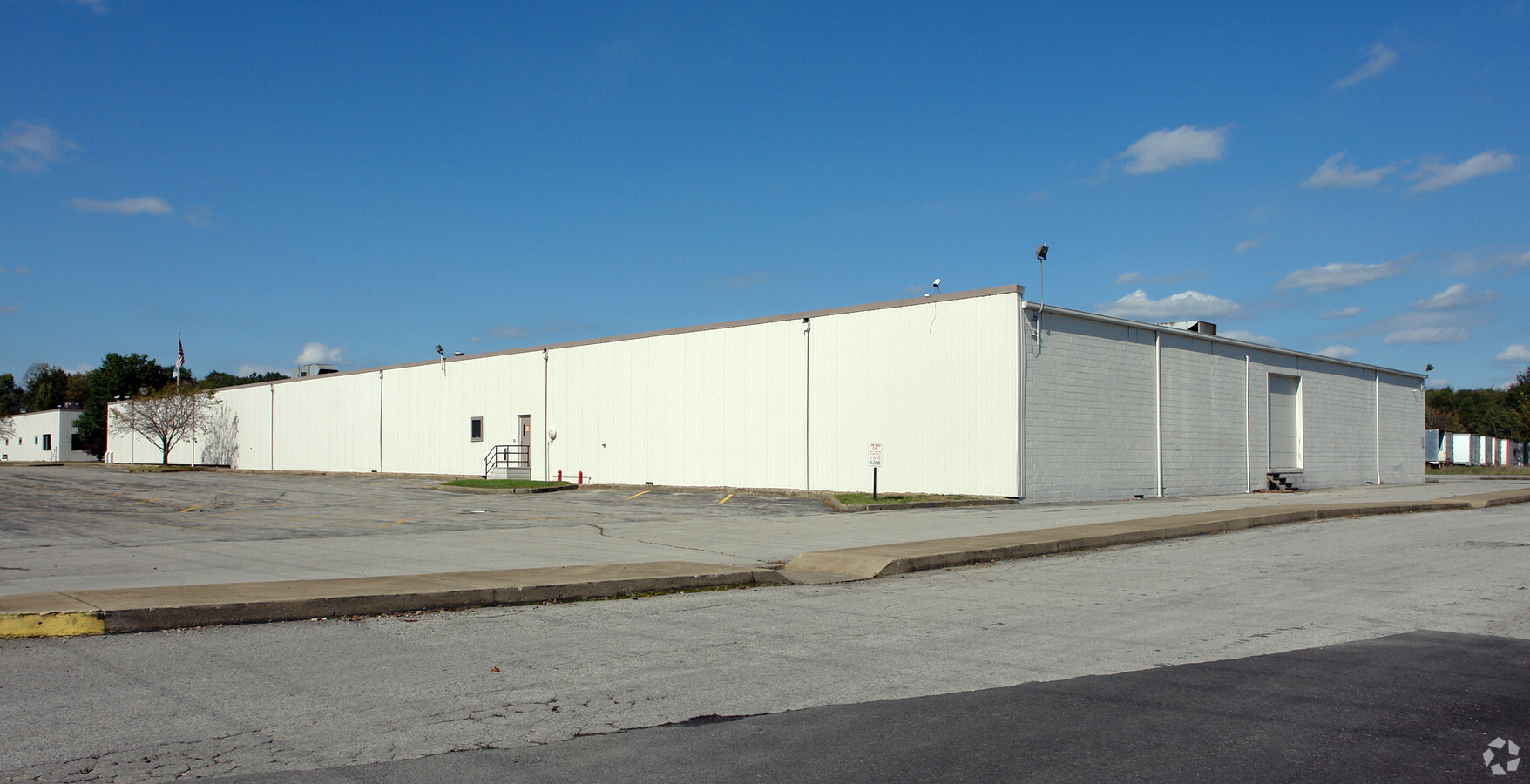
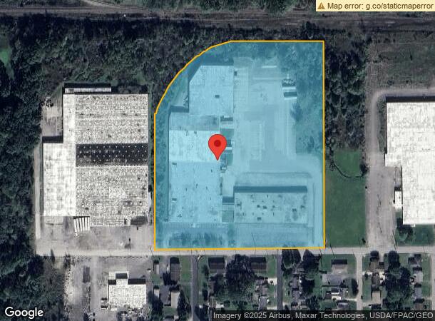
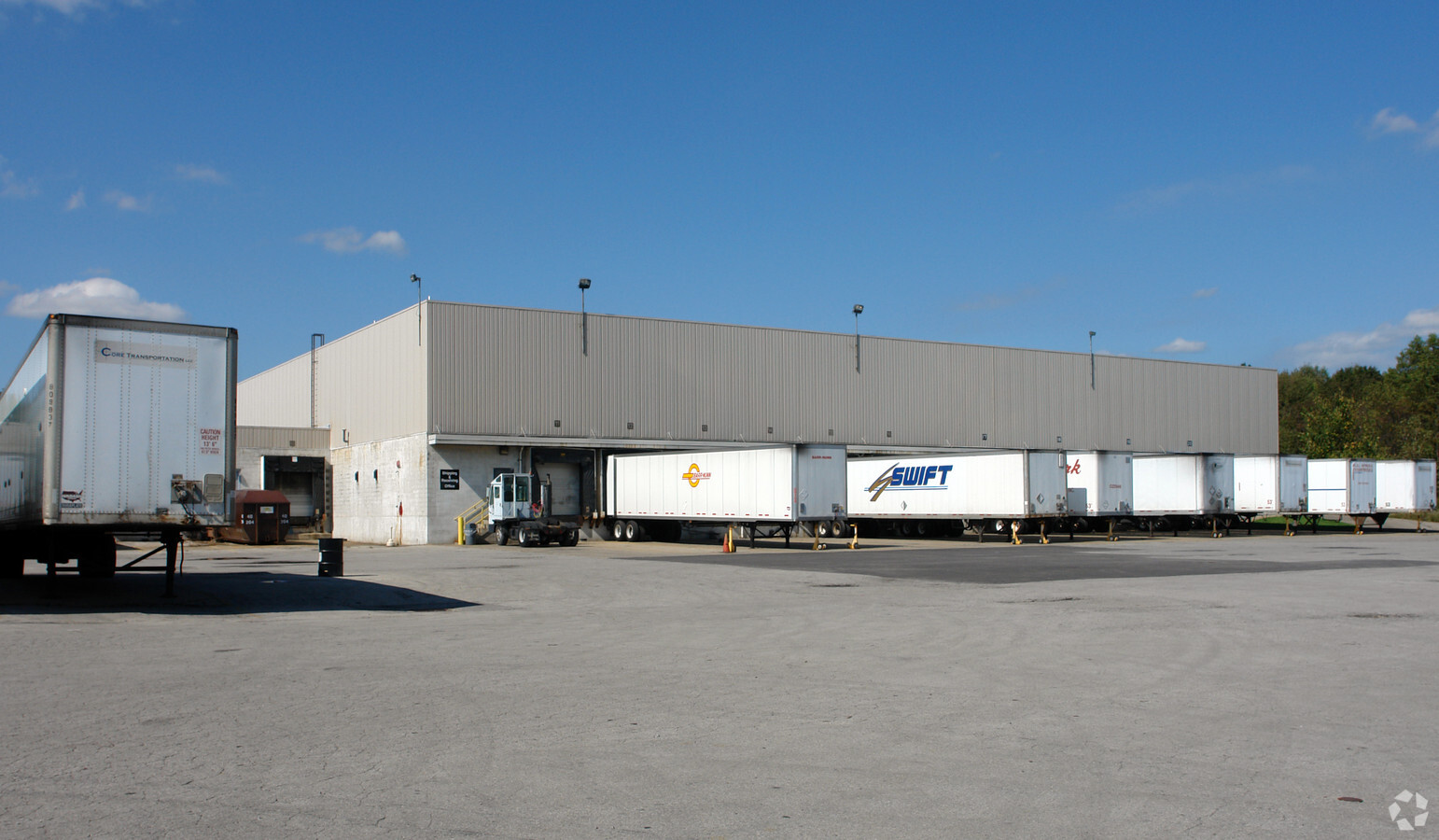
Property Record
644 Myron St, Hubbard, OH 44425
NEARBY LISTINGS FOR SALE OR LEASE
Property Detail
644 Myron St
02-302200
89 13.336A PT MYRON ST HUBBARD CITY
Manufacturinglight
Trumbull
X
Ohio
39155C0437D
13.34 AC
2024
Trumbull County
2023
Youngstown/Warren/Boardman
931601
Youngstown-Warren-Boardman, OH-PA
169,419 SF
DEMOGRAPHICS near 644 Myron St
1 Mile
3 Mile
5 Mile
2024 Total Population
4,237
15,182
43,531
2029 Population
4,173
14,998
43,259
Pop Growth 2024-2029
(1.51%)
(1.21%)
(0.62%)
Average Age
44
44
43
2024 Total Households
2,057
6,707
18,470
HH Growth 2024-2029
(1.51%)
(1.21%)
(0.64%)
Median Household Inc
$49,897
$55,248
$44,249
Avg Household Size
2.10
2.20
2.20
2024 Avg HH Vehicles
2.00
2.00
2.00
Median Home Value
$116,569
$126,740
$106,485
Median Year Built
1960
1964
1960
Nearby Places
- Restaurants
- Banks
- Shops
- Fitness
- Groceries
SALE & LEASE HISTORY
LISTING DATE
SALE/LEASE

May 01, 2018
For Sale
Nearby Properties
Address
Land Use
TOTAL SIZE
Lot Size
Zoning
Address
Land Use
TOTAL SIZE
Lot Size
Zoning
15,762 SF
23.14 AC
Address
Land Use
TOTAL SIZE
Lot Size
Zoning
4,045 SF
21.63 AC
Address
Land Use
TOTAL SIZE
Lot Size
Zoning
56.29 AC
Address
Land Use
TOTAL SIZE
Lot Size
Zoning
55,633 SF
8.75 AC
Address
Land Use
TOTAL SIZE
Lot Size
Zoning
36,544 SF
6.19 AC
Address
Land Use
TOTAL SIZE
Lot Size
Zoning
9,104 SF
4.50 AC
Address
Land Use
TOTAL SIZE
Lot Size
Zoning
17,767 SF
22.88 AC
Address
Land Use
TOTAL SIZE
Lot Size
Zoning
73,380 SF
3.74 AC
Address
Land Use
TOTAL SIZE
Lot Size
Zoning
4,200 SF
28.83 AC
Address
Land Use
TOTAL SIZE
Lot Size
Zoning
28,979 SF
6.17 AC
Address
Land Use
TOTAL SIZE
Lot Size
Zoning
21,018 SF
4.52 AC
Address
Land Use
TOTAL SIZE
Lot Size
Zoning
9,509 SF
14.35 AC
Address
Land Use
TOTAL SIZE
Lot Size
Zoning
14,260 SF
6.72 AC
Address
Land Use
TOTAL SIZE
Lot Size
Zoning
37,060 SF
3.03 AC
Address
Land Use
TOTAL SIZE
Lot Size
Zoning
14,736 SF
1.57 AC
Address
Land Use
TOTAL SIZE
Lot Size
Zoning
42,426 SF
7.19 AC
Address
Land Use
TOTAL SIZE
Lot Size
Zoning
43,560 SF
1.43 AC
Address
Land Use
TOTAL SIZE
Lot Size
Zoning
42,578 SF
6.22 AC
Address
Land Use
TOTAL SIZE
Lot Size
Zoning
11,547 SF
1.22 AC
Address
Land Use
TOTAL SIZE
Lot Size
Zoning
15,829 SF
10.70 AC
Address
Land Use
TOTAL SIZE
Lot Size
Zoning
3,050 SF
54.88 AC
Address
Land Use
TOTAL SIZE
Lot Size
Zoning
37,804 SF
3.60 AC
Address
Land Use
TOTAL SIZE
Lot Size
Zoning
8,450 SF
4.15 AC
Address
Land Use
TOTAL SIZE
Lot Size
Zoning
11,201 SF
1.11 AC
Address
Land Use
TOTAL SIZE
Lot Size
Zoning
2,923 SF
156.42 AC
Address
Land Use
TOTAL SIZE
Lot Size
Zoning
28,446 SF
2.62 AC
Address
Land Use
TOTAL SIZE
Lot Size
Zoning
16,360 SF
17.30 AC
Address
Land Use
TOTAL SIZE
Lot Size
Zoning
214,951 SF
10.14 AC
Address
Land Use
TOTAL SIZE
Lot Size
Zoning
62,098 SF
2 AC
The World's #1 Commercial Real Estate Marketplace
Connect with us
© 2025 CoStar Group
The information above has been obtained from sources believed reliable. While we do not doubt its accuracy we have not verified it and make no guarantee, warranty or representation about it. It is your responsibility to independently confirm its accuracy and completeness. Any projections, opinions, assumptions, or estimates used are for example only and do not represent the current or future performance of the property. The value of this transaction to you depends on tax and other factors which should be evaluated by your tax, financial, and legal advisors. You and your advisors should conduct a careful, independent investigation of the property to determine to your satisfaction the suitability of the property for your needs.