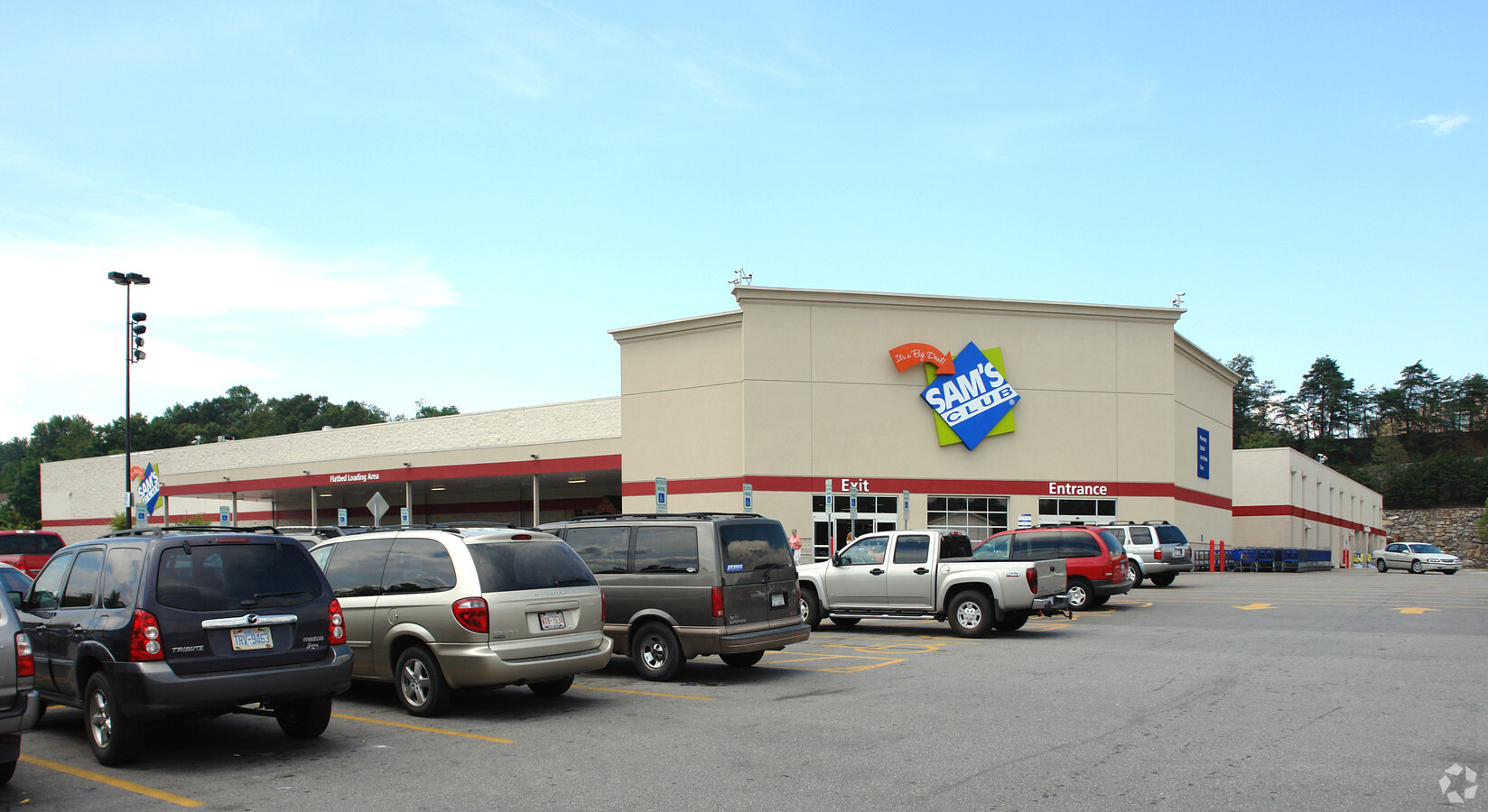
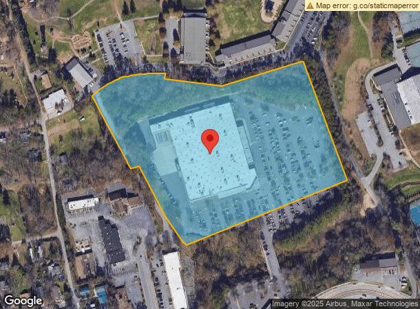
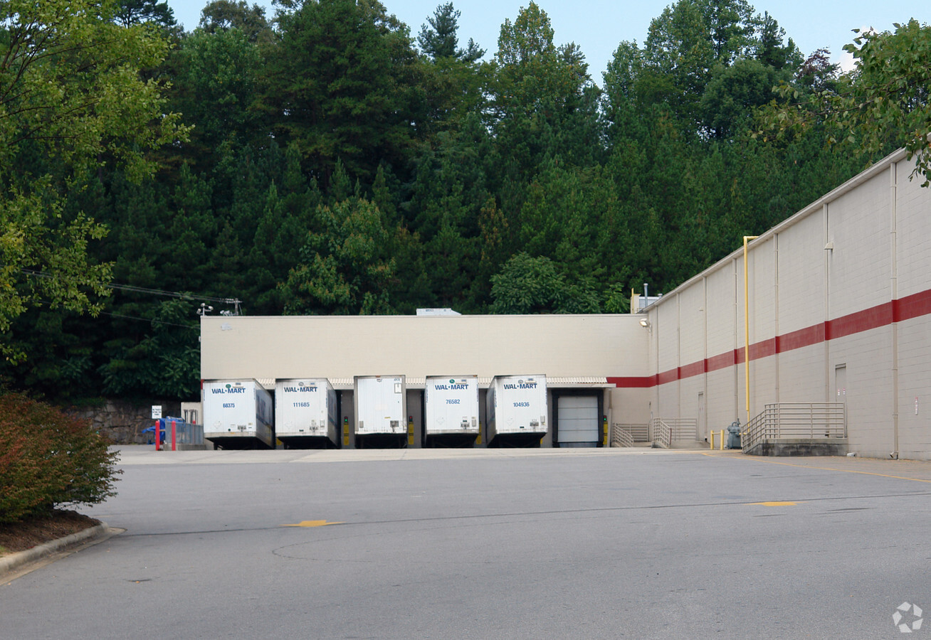
Property Record
645 Patton Ave, Asheville, NC 28806
NEARBY LISTINGS FOR SALE OR LEASE
Property Detail
645 Patton Ave
9638-59-5528-00000
Regent Park Boulevard
Storebuilding
SUBDIV: BLOCK: LOT: SECTION: PLAT: 0000-0000
AE
Buncombe
3700963800J
North Carolina
2023
18 AC
2023
West Asheville
001402
Asheville
131,300 SF
Asheville, NC
DEMOGRAPHICS near 645 Patton Ave
1 Mile
3 Mile
5 Mile
2024 Total Population
7,028
56,685
104,704
2029 Population
7,285
58,697
108,626
Pop Growth 2024-2029
+ 3.66%
+ 3.55%
+ 3.75%
Average Age
37
39
41
2024 Total Households
2,980
24,891
46,496
HH Growth 2024-2029
+ 3.09%
+ 3.10%
+ 3.27%
Median Household Inc
$57,723
$59,642
$62,535
Avg Household Size
2.30
2.10
2.10
2024 Avg HH Vehicles
2.00
2.00
2.00
Median Home Value
$338,727
$372,511
$357,535
Median Year Built
1978
1969
1978
Nearby Places
- Restaurants
- Banks
- Shops
- Fitness
- Groceries
PUBLIC TRANSPORTATION
AIRPORT
Asheville Regional
DRIVE
WALK
Distance
Asheville Regional
19 min
13.7 mi
Freight Ports
North Charleston Terminal
DRIVE
WALK
Distance
North Charleston Terminal
291 min
257.4 mi
Nearby Properties
Address
Land Use
TOTAL SIZE
Lot Size
Zoning
Address
Land Use
TOTAL SIZE
Lot Size
Zoning
1,663,129 SF
27.85 AC
INST
Address
Land Use
TOTAL SIZE
Lot Size
Zoning
1,004,424 SF
100 AC
EMP
Address
Land Use
TOTAL SIZE
Lot Size
Zoning
426,749 SF
2,485.30 AC
CS
Address
Land Use
TOTAL SIZE
Lot Size
Zoning
358,828 SF
137.57 AC
RESORT
Address
Land Use
TOTAL SIZE
Lot Size
Zoning
291,240 SF
86.10 AC
INST EXP
Address
Land Use
TOTAL SIZE
Lot Size
Zoning
496,200 SF
109.28 AC
INST
Address
Land Use
TOTAL SIZE
Lot Size
Zoning
13,459 SF
3.07 AC
CR
Address
Land Use
TOTAL SIZE
Lot Size
Zoning
40,152 SF
2.78 AC
CBD
Address
Land Use
TOTAL SIZE
Lot Size
Zoning
251,071 SF
280.55 AC
INST
Address
Land Use
TOTAL SIZE
Lot Size
Zoning
31,034 SF
1.12 AC
CBD
Address
Land Use
TOTAL SIZE
Lot Size
Zoning
94,776 SF
39.70 AC
INST
Address
Land Use
TOTAL SIZE
Lot Size
Zoning
109,294 SF
16.28 AC
RAD-IND
Address
Land Use
TOTAL SIZE
Lot Size
Zoning
94,004 SF
2.74 AC
CBD
Address
Land Use
TOTAL SIZE
Lot Size
Zoning
118,000 SF
0.17 AC
CBD
Address
Land Use
TOTAL SIZE
Lot Size
Zoning
166,747 SF
2,480.61 AC
CR
Address
Land Use
TOTAL SIZE
Lot Size
Zoning
64,634 SF
1.91 AC
CBD
Address
Land Use
TOTAL SIZE
Lot Size
Zoning
47,344 SF
0.71 AC
CBD
Address
Land Use
TOTAL SIZE
Lot Size
Zoning
100,712 SF
24.65 AC
CS
Address
Land Use
TOTAL SIZE
Lot Size
Zoning
51,476 SF
5.82 AC
CBD
Address
Land Use
TOTAL SIZE
Lot Size
Zoning
46,724 SF
2,480.61 AC
CR
Address
Land Use
TOTAL SIZE
Lot Size
Zoning
20,352 SF
0.67 AC
CBD
Address
Land Use
TOTAL SIZE
Lot Size
Zoning
50,248 SF
12.87 AC
INST
Address
Land Use
TOTAL SIZE
Lot Size
Zoning
88,817 SF
19.63 AC
R-2
Address
Land Use
TOTAL SIZE
Lot Size
Zoning
47,729 SF
5.50 AC
CBD
Address
Land Use
TOTAL SIZE
Lot Size
Zoning
75,342 SF
8.07 AC
HB
Address
Land Use
TOTAL SIZE
Lot Size
Zoning
18,444 SF
0.66 AC
CBD
Address
Land Use
TOTAL SIZE
Lot Size
Zoning
106,436 SF
22.02 AC
PS
Address
Land Use
TOTAL SIZE
Lot Size
Zoning
69,472 SF
0.99 AC
CBD
Address
Land Use
TOTAL SIZE
Lot Size
Zoning
97,263 SF
17.50 AC
INST
Address
Land Use
TOTAL SIZE
Lot Size
Zoning
30,000 SF
8.25 AC
INST
The World's #1 Commercial Real Estate Marketplace
Connect with us
© 2025 CoStar Group
The information above has been obtained from sources believed reliable. While we do not doubt its accuracy we have not verified it and make no guarantee, warranty or representation about it. It is your responsibility to independently confirm its accuracy and completeness. Any projections, opinions, assumptions, or estimates used are for example only and do not represent the current or future performance of the property. The value of this transaction to you depends on tax and other factors which should be evaluated by your tax, financial, and legal advisors. You and your advisors should conduct a careful, independent investigation of the property to determine to your satisfaction the suitability of the property for your needs.