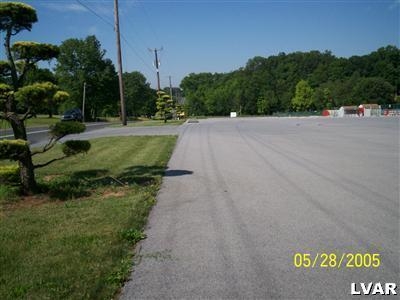
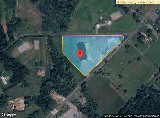
Property Record
6464 Chestnut St, Zionsville, PA 18092

NEARBY LISTINGS FOR SALE OR LEASE
Property Detail
6464 Chestnut St
548254767863-1
Calvin B Jacobs
Warehouse
Lehigh
A
Pennsylvania
42091C0010G
4.31 AC
2024
Lehigh Valley
2024
Philadelphia
006402
Allentown-Bethlehem-Easton, PA-NJ
16,000 SF
DEMOGRAPHICS near 6464 Chestnut St
1 Mile
3 Mile
5 Mile
2024 Total Population
1,203
10,667
48,840
2029 Population
1,208
10,722
49,009
Pop Growth 2024-2029
+ 0.42%
+ 0.52%
+ 0.35%
Average Age
44
43
42
2024 Total Households
452
4,281
19,486
HH Growth 2024-2029
+ 0.44%
+ 0.47%
+ 0.31%
Median Household Inc
$109,469
$89,261
$91,835
Avg Household Size
2.60
2.50
2.50
2024 Avg HH Vehicles
3.00
2.00
2.00
Median Home Value
$364,422
$334,635
$304,199
Median Year Built
1979
1978
1981
Nearby Places
- Restaurants
- Banks
- Shops
- Fitness
- Groceries
PUBLIC TRANSPORTATION
AIRPORT
Lehigh Valley International
DRIVE
WALK
Distance
Lehigh Valley International
31 min
16.2 mi
Freight Ports
Port of Philadelphia
DRIVE
WALK
Distance
Port of Philadelphia
80 min
47.4 mi
SALE & LEASE HISTORY
LISTING DATE
SALE/LEASE

Sep 24, 2016
For Sale
Jun 15, 2017
For Sale
Apr 25, 2017
For Sale
Nearby Properties
Address
Land Use
TOTAL SIZE
Lot Size
Zoning
Address
Land Use
TOTAL SIZE
Lot Size
Zoning
199,343 SF
48.68 AC
O
Address
Land Use
TOTAL SIZE
Lot Size
Zoning
269,592 SF
44.42 AC
LI
Address
Land Use
TOTAL SIZE
Lot Size
Zoning
1,922 SF
44.40 AC
I
Address
Land Use
TOTAL SIZE
Lot Size
Zoning
6,725 SF
6.13 AC
R-7.
Address
Land Use
TOTAL SIZE
Lot Size
Zoning
29,496 SF
22.56 AC
O
Address
Land Use
TOTAL SIZE
Lot Size
Zoning
2,827 SF
6.39 AC
R-A
Address
Land Use
TOTAL SIZE
Lot Size
Zoning
224,173 SF
16.56 AC
M
Address
Land Use
TOTAL SIZE
Lot Size
Zoning
96,775 SF
8.45 AC
Address
Land Use
TOTAL SIZE
Lot Size
Zoning
29.10 AC
I
Address
Land Use
TOTAL SIZE
Lot Size
Zoning
32.78 AC
I
Address
Land Use
TOTAL SIZE
Lot Size
Zoning
44,337 SF
18.13 AC
I
Address
Land Use
TOTAL SIZE
Lot Size
Zoning
10,088 SF
4.08 AC
R-7.
Address
Land Use
TOTAL SIZE
Lot Size
Zoning
11,867 SF
4.87 AC
VC
Address
Land Use
TOTAL SIZE
Lot Size
Zoning
6,412 SF
29.10 AC
R-10
Address
Land Use
TOTAL SIZE
Lot Size
Zoning
18.13 AC
I
Address
Land Use
TOTAL SIZE
Lot Size
Zoning
10,280 SF
2.61 AC
C
Address
Land Use
TOTAL SIZE
Lot Size
Zoning
967 SF
11.25 AC
I
Address
Land Use
TOTAL SIZE
Lot Size
Zoning
5,590 SF
4.16 AC
Address
Land Use
TOTAL SIZE
Lot Size
Zoning
8,143 SF
3.64 AC
R-7.
Address
Land Use
TOTAL SIZE
Lot Size
Zoning
15.48 AC
R
Address
Land Use
TOTAL SIZE
Lot Size
Zoning
7,260 SF
5.04 AC
I
Address
Land Use
TOTAL SIZE
Lot Size
Zoning
10,578 SF
2.29 AC
R-7.
Address
Land Use
TOTAL SIZE
Lot Size
Zoning
9,803 SF
2.23 AC
S
Address
Land Use
TOTAL SIZE
Lot Size
Zoning
6,725 SF
1.36 AC
R-7.
Address
Land Use
TOTAL SIZE
Lot Size
Zoning
10,242 SF
1.52 AC
TC
Address
Land Use
TOTAL SIZE
Lot Size
Zoning
12,144 SF
4.16 AC
VC
Address
Land Use
TOTAL SIZE
Lot Size
Zoning
10,578 SF
1.95 AC
R-7.
Address
Land Use
TOTAL SIZE
Lot Size
Zoning
10,661 SF
0.16 AC
TC
Address
Land Use
TOTAL SIZE
Lot Size
Zoning
8,800 SF
10 AC
AC
Address
Land Use
TOTAL SIZE
Lot Size
Zoning
18,774 SF
3.49 AC
VC
The World's #1 Commercial Real Estate Marketplace
Connect with us
© 2025 CoStar Group
The information above has been obtained from sources believed reliable. While we do not doubt its accuracy we have not verified it and make no guarantee, warranty or representation about it. It is your responsibility to independently confirm its accuracy and completeness. Any projections, opinions, assumptions, or estimates used are for example only and do not represent the current or future performance of the property. The value of this transaction to you depends on tax and other factors which should be evaluated by your tax, financial, and legal advisors. You and your advisors should conduct a careful, independent investigation of the property to determine to your satisfaction the suitability of the property for your needs.