Property Record
649 South Ave, Secane, PA 19018
NEARBY LISTINGS FOR SALE OR LEASE
Property Detail
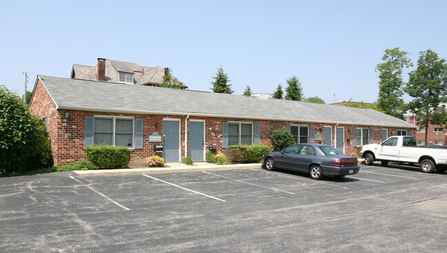
649 South Ave
16-13-03137-05
South Ave Office Condo
Officecondo
1STY CONDO OFFICE UNIT 7
X
Delaware
42045C0116F
Pennsylvania
2024
0.98 AC
2025
Delaware County
407902
Philadelphia
1,200 SF
Philadelphia-Camden-Wilmington, PA-NJ-DE-MD
DEMOGRAPHICS near 649 South Ave
1 Mile
3 Mile
5 Mile
2024 Total Population
23,906
179,847
453,599
2029 Population
23,688
177,607
446,664
Pop Growth 2024-2029
(0.91%)
(1.25%)
(1.53%)
Average Age
40
40
39
2024 Total Households
9,606
68,872
171,568
HH Growth 2024-2029
(0.91%)
(1.32%)
(1.62%)
Median Household Inc
$72,052
$73,701
$64,107
Avg Household Size
2.40
2.50
2.50
2024 Avg HH Vehicles
2.00
2.00
1.00
Median Home Value
$206,204
$215,454
$206,370
Median Year Built
1956
1953
1951
Nearby Places
Map Layers
Map Styles
 Street
 Aerial
- Restaurants
- Banks
- Shops
- Fitness
- Groceries
PUBLIC TRANSPORTATION
TRANSIT/SUBWAY
Secane (R3 - Southeastern Pennsylvania Transportation Authority Regional Rail (SEPTA Regional Rail))
DRIVE
WALK
Distance
Secane (R3 - Southeastern Pennsylvania Transportation Authority Regional Rail (SEPTA Regional Rail))
1 min
5 min
0.3 mi
Primos (R3 - Southeastern Pennsylvania Transportation Authority Regional Rail (SEPTA Regional Rail))
DRIVE
WALK
Distance
Primos (R3 - Southeastern Pennsylvania Transportation Authority Regional Rail (SEPTA Regional Rail))
3 min
20 min
1.0 mi
COMMUTER RAIL
Secane (R3 - Southeastern Pennsylvania Transportation Authority Regional Rail (SEPTA Regional Rail))
DRIVE
WALK
Distance
Secane (R3 - Southeastern Pennsylvania Transportation Authority Regional Rail (SEPTA Regional Rail))
1 min
5 min
0.3 mi
Primos (R3 - Southeastern Pennsylvania Transportation Authority Regional Rail (SEPTA Regional Rail))
DRIVE
WALK
Distance
Primos (R3 - Southeastern Pennsylvania Transportation Authority Regional Rail (SEPTA Regional Rail))
3 min
1.1 mi
AIRPORT
Philadelphia International
DRIVE
WALK
Distance
Philadelphia International
17 min
7.1 mi
Trenton Mercer
DRIVE
WALK
Distance
Trenton Mercer
73 min
46.6 mi
Freight Ports
Broadway Terminal - Pier 5
DRIVE
WALK
Distance
Broadway Terminal - Pier 5
30 min
14.6 mi
Nearby Properties
Address
Land Use
TOTAL SIZE
Lot Size
Zoning
Address
Land Use
TOTAL SIZE
Lot Size
Zoning
6,637 SF
198.92 AC
Address
Land Use
TOTAL SIZE
Lot Size
Zoning
175,978 SF
15.95 AC
Address
Land Use
TOTAL SIZE
Lot Size
Zoning
15,660 SF
56.60 AC
Address
Land Use
TOTAL SIZE
Lot Size
Zoning
702,532 SF
11 AC
Address
Land Use
TOTAL SIZE
Lot Size
Zoning
20,880 SF
27.20 AC
Address
Land Use
TOTAL SIZE
Lot Size
Zoning
6,040 SF
16.45 AC
Address
Land Use
TOTAL SIZE
Lot Size
Zoning
25,680 SF
31.64 AC
Address
Land Use
TOTAL SIZE
Lot Size
Zoning
241,578 SF
14 AC
Address
Land Use
TOTAL SIZE
Lot Size
Zoning
136,972 SF
27 AC
Address
Land Use
TOTAL SIZE
Lot Size
Zoning
312,988 SF
24 AC
Address
Land Use
TOTAL SIZE
Lot Size
Zoning
255,316 SF
6 AC
Address
Land Use
TOTAL SIZE
Lot Size
Zoning
61,860 SF
6.29 AC
Address
Land Use
TOTAL SIZE
Lot Size
Zoning
2,608 SF
198.92 AC
Address
Land Use
TOTAL SIZE
Lot Size
Zoning
2,562 SF
198.92 AC
Address
Land Use
TOTAL SIZE
Lot Size
Zoning
12,100 SF
7 AC
Address
Land Use
TOTAL SIZE
Lot Size
Zoning
40,572 SF
6.52 AC
Address
Land Use
TOTAL SIZE
Lot Size
Zoning
702,532 SF
Address
Land Use
TOTAL SIZE
Lot Size
Zoning
68,096 SF
7.78 AC
Address
Land Use
TOTAL SIZE
Lot Size
Zoning
282,520 SF
24.44 AC
Address
Land Use
TOTAL SIZE
Lot Size
Zoning
86,052 SF
7.63 AC
Address
Land Use
TOTAL SIZE
Lot Size
Zoning
187,056 SF
16 AC
Address
Land Use
TOTAL SIZE
Lot Size
Zoning
164,834 SF
13 AC
Address
Land Use
TOTAL SIZE
Lot Size
Zoning
60,588 SF
9.43 AC
Address
Land Use
TOTAL SIZE
Lot Size
Zoning
110,424 SF
5.32 AC
Address
Land Use
TOTAL SIZE
Lot Size
Zoning
40,850 SF
25.81 AC
Address
Land Use
TOTAL SIZE
Lot Size
Zoning
122,018 SF
16.24 AC
Address
Land Use
TOTAL SIZE
Lot Size
Zoning
150,450 SF
9 AC
Address
Land Use
TOTAL SIZE
Lot Size
Zoning
51,280 SF
7 AC
Address
Land Use
TOTAL SIZE
Lot Size
Zoning
152,403 SF
16.98 AC
Address
Land Use
TOTAL SIZE
Lot Size
Zoning
13,200 SF
7 AC
The World's #1 Commercial Real Estate Marketplace
Connect with us
© 2025 CoStar Group
The information above has been obtained from sources believed reliable. While we do not doubt its accuracy we have not verified it and make no guarantee, warranty or representation about it. It is your responsibility to independently confirm its accuracy and completeness. Any projections, opinions, assumptions, or estimates used are for example only and do not represent the current or future performance of the property. The value of this transaction to you depends on tax and other factors which should be evaluated by your tax, financial, and legal advisors. You and your advisors should conduct a careful, independent investigation of the property to determine to your satisfaction the suitability of the property for your needs.