Property Record
65 Black Rd Ne, White, GA 30184

Property Detail
65 Black Rd Ne
Atlanta-Sandy Springs-Roswell, GA
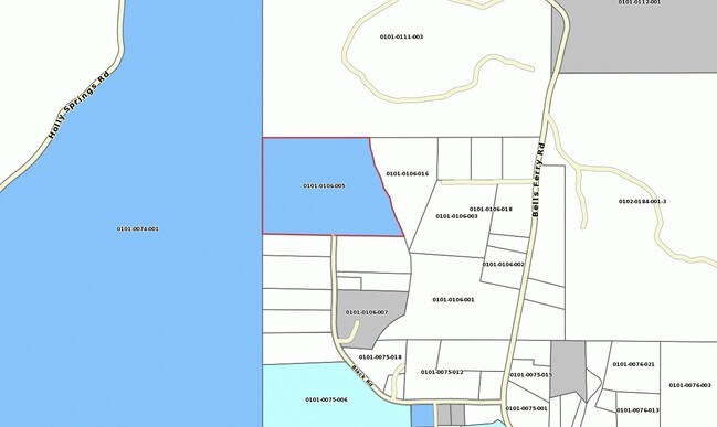
LL 106 LD 22 TR 1
0101-0106-005
BARTOW
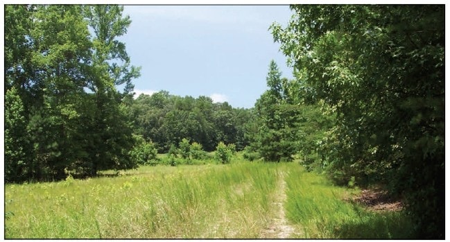
Agriculturalland
Georgia
B and X Area of moderate flood hazard, usually the area between the limits of the 100-year and 500-year floods.
1
2025
24.98 AC
2025
Bartow County
960103
Atlanta
NEARBY LISTINGS FOR SALE OR LEASE
-
-
View all White listings for sale on LoopNet.com
DEMOGRAPHICS near 65 Black Rd Ne
1 mile
3 mile
5 mile
2025 Total Population
788
4,893
11,548
2030 Population
845
5,241
12,394
Pop Growth 2025-2030
+ 7.23%
+ 7.11%
+ 7.33%
Average Age
40
41
41
2025 Total Households
271
1,723
4,239
HH Growth 2025-2030
+ 7.38%
+ 7.14%
+ 7.29%
Median Household Inc
$88,257
$94,121
$93,866
Avg Household Size
2.90
2.80
2.70
2025 Avg HH Vehicles
2.00
2.00
2.00
Median Home Value
$353,333
$344,802
$341,184
Median Year Built
2002
2000
1997
Nearby Places
Map Layers
Map Styles
 Street
 Aerial
Transit
 Traffic
 Biking
Places
Listings with unknown addresses are not visible on the map
- Restaurants
- Banks
- Shops
- Fitness
- Groceries
SALE & LEASE HISTORY
LISTING DATE
SALE/LEASE

Mar 06, 2018
For Sale
Nearby Properties
Address
Land Use
TOTAL SIZE
Lot Size
Zoning
Address
Land Use
TOTAL SIZE
Lot Size
Zoning
13,199.15 AC
Address
Land Use
TOTAL SIZE
Lot Size
Zoning
1,008 SF
711.08 AC
Address
Land Use
TOTAL SIZE
Lot Size
Zoning
8,500 SF
8.71 AC
IN
Address
Land Use
TOTAL SIZE
Lot Size
Zoning
11,404 SF
4.82 AC
IN
Address
Land Use
TOTAL SIZE
Lot Size
Zoning
28,386 SF
2.60 AC
Address
Land Use
TOTAL SIZE
Lot Size
Zoning
14,364 SF
3.23 AC
C1
Address
Land Use
TOTAL SIZE
Lot Size
Zoning
12,914 SF
6.15 AC
A1
Address
Land Use
TOTAL SIZE
Lot Size
Zoning
43.76 AC
I2
Address
Land Use
TOTAL SIZE
Lot Size
Zoning
30,000 SF
1.62 AC
Address
Land Use
TOTAL SIZE
Lot Size
Zoning
276.33 AC
A1
Address
Land Use
TOTAL SIZE
Lot Size
Zoning
4,900 SF
10.19 AC
IN
Address
Land Use
TOTAL SIZE
Lot Size
Zoning
10,640 SF
1.86 AC
Address
Land Use
TOTAL SIZE
Lot Size
Zoning
38,221 SF
5 AC
Address
Land Use
TOTAL SIZE
Lot Size
Zoning
Address
Land Use
TOTAL SIZE
Lot Size
Zoning
3,072 SF
2.02 AC
IN
Address
Land Use
TOTAL SIZE
Lot Size
Zoning
Address
Land Use
TOTAL SIZE
Lot Size
Zoning
633.12 AC
Address
Land Use
TOTAL SIZE
Lot Size
Zoning
290.62 AC
Address
Land Use
TOTAL SIZE
Lot Size
Zoning
19.64 AC
A1
Address
Land Use
TOTAL SIZE
Lot Size
Zoning
215.17 AC
Address
Land Use
TOTAL SIZE
Lot Size
Zoning
29,650 SF
1.88 AC
IN
Address
Land Use
TOTAL SIZE
Lot Size
Zoning
73.09 AC
A1
Address
Land Use
TOTAL SIZE
Lot Size
Zoning
13,400 SF
3.08 AC
Address
Land Use
TOTAL SIZE
Lot Size
Zoning
14,201 SF
28.21 AC
Address
Land Use
TOTAL SIZE
Lot Size
Zoning
21,260 SF
2.46 AC
I1
Address
Land Use
TOTAL SIZE
Lot Size
Zoning
13,884 SF
1.52 AC
A1
Address
Land Use
TOTAL SIZE
Lot Size
Zoning
400 SF
8.78 AC
I1
Address
Land Use
TOTAL SIZE
Lot Size
Zoning
996 SF
155 AC
Address
Land Use
TOTAL SIZE
Lot Size
Zoning
16,500 SF
3.91 AC
I1
Address
Land Use
TOTAL SIZE
Lot Size
Zoning
8,000 SF
1.35 AC
A1
The World's #1 Commercial Real Estate Marketplace
Connect with us
© 2026 CoStar Group
The information above has been obtained from sources believed reliable. While we do not doubt its accuracy we have not verified it and make no guarantee, warranty or representation about it. It is your responsibility to independently confirm its accuracy and completeness. Any projections, opinions, assumptions, or estimates used are for example only and do not represent the current or future performance of the property. The value of this transaction to you depends on tax and other factors which should be evaluated by your tax, financial, and legal advisors. You and your advisors should conduct a careful, independent investigation of the property to determine to your satisfaction the suitability of the property for your needs.