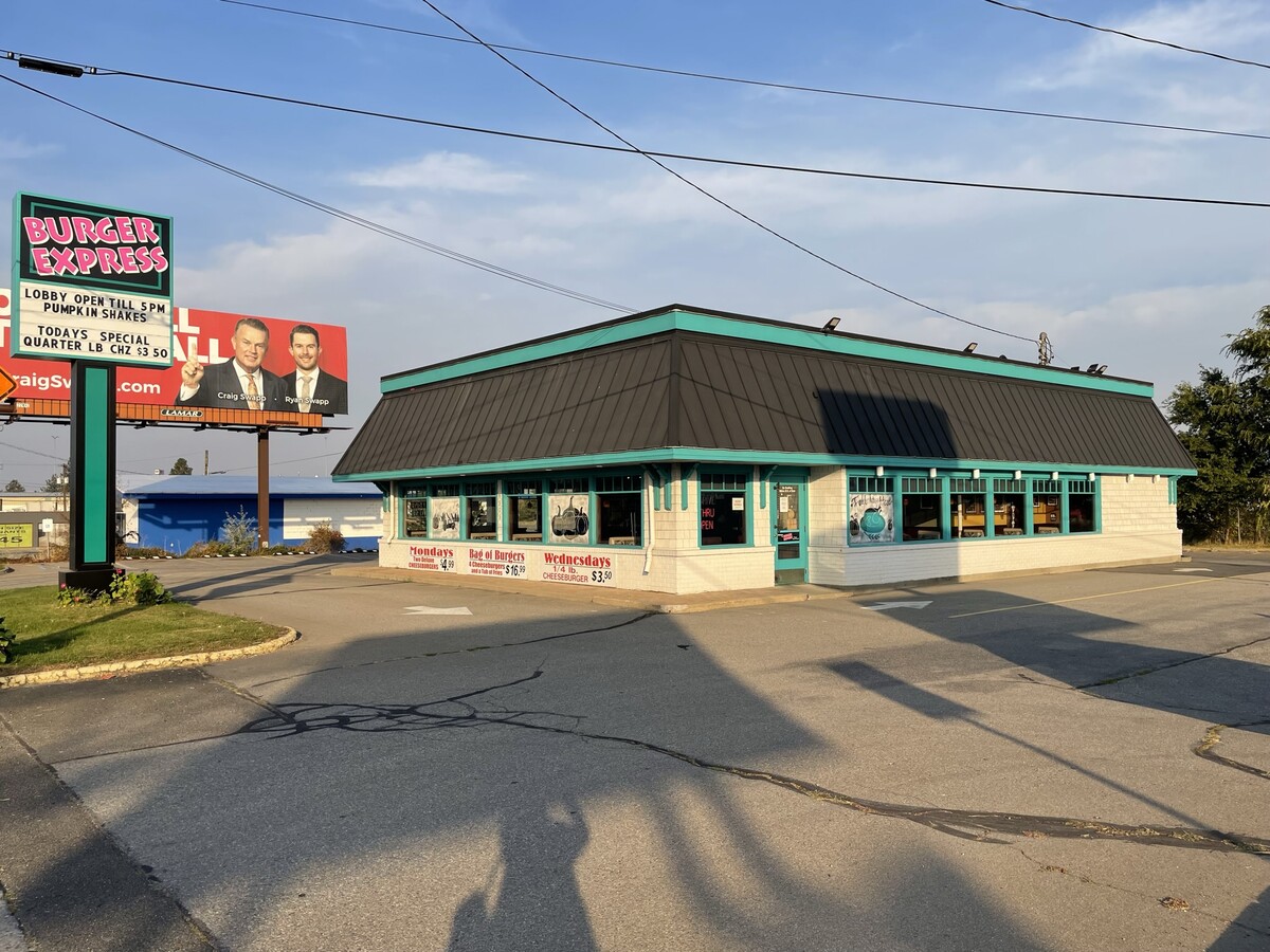
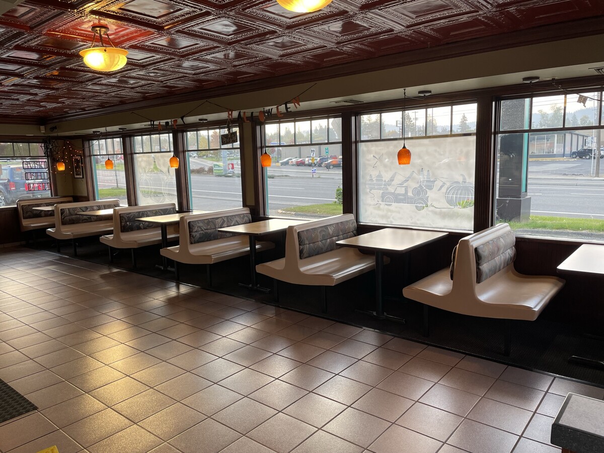
Property Record
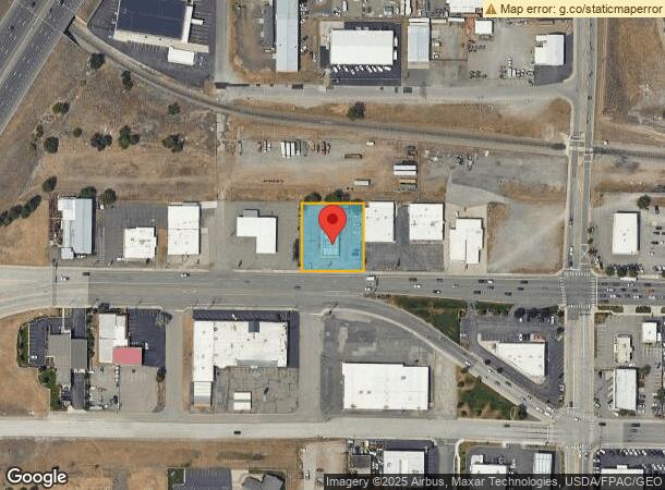
6505 E Sprague Ave, Spokane Valley, WA 99212
NEARBY LISTINGS FOR SALE OR LEASE
Property Detail
6505 E Sprague Ave
Spokane-Spokane Valley, WA
Koons Sub
35133.2607
KOONS SUB, EAST SPOKANE B29-30 LOTS 11-12 & E48FT L13 B30
Storebuilding
Spokane
X
Washington
53063C0562D
11,12
2025
0.57 AC
2024
Valley
012200
Spokane
2,406 SF
DEMOGRAPHICS near 6505 E Sprague Ave
1 Mile
3 Mile
5 Mile
2024 Total Population
6,351
60,741
210,024
2029 Population
6,796
64,515
223,618
Pop Growth 2024-2029
+ 7.01%
+ 6.21%
+ 6.47%
Average Age
42
40
40
2024 Total Households
2,723
24,148
84,968
HH Growth 2024-2029
+ 7.05%
+ 6.32%
+ 6.72%
Median Household Inc
$54,593
$65,368
$60,547
Avg Household Size
2.20
2.40
2.30
2024 Avg HH Vehicles
2.00
2.00
2.00
Median Home Value
$244,711
$292,165
$327,350
Median Year Built
1974
1971
1973
Nearby Places
- Restaurants
- Banks
- Shops
- Fitness
- Groceries
PUBLIC TRANSPORTATION
COMMUTER RAIL
Spokane (Empire Builder - Amtrak)
DRIVE
WALK
Distance
Spokane (Empire Builder - Amtrak)
9 min
5.0 mi
AIRPORT
Spokane International
DRIVE
WALK
Distance
Spokane International
16 min
10.9 mi
Freight Ports
Port of Everett
DRIVE
WALK
Distance
Port of Everett
344 min
306.5 mi
SALE & LEASE HISTORY
LISTING DATE
SALE/LEASE

Oct 27, 2022
For Sale
Nearby Properties
Address
Land Use
TOTAL SIZE
Lot Size
Zoning
Address
Land Use
TOTAL SIZE
Lot Size
Zoning
915,855 SF
100.66 AC
LI
Address
Land Use
TOTAL SIZE
Lot Size
Zoning
333,352 SF
35.83 AC
I-2
Address
Land Use
TOTAL SIZE
Lot Size
Zoning
365,804 SF
16.13 AC
RSF
Address
Land Use
TOTAL SIZE
Lot Size
Zoning
116,096 SF
17.38 AC
R-2
Address
Land Use
TOTAL SIZE
Lot Size
Zoning
58,522 SF
19.91 AC
HI
Address
Land Use
TOTAL SIZE
Lot Size
Zoning
107,442 SF
5.57 AC
MF-2
Address
Land Use
TOTAL SIZE
Lot Size
Zoning
133,015 SF
5.89 AC
HDR
Address
Land Use
TOTAL SIZE
Lot Size
Zoning
96,267 SF
9.04 AC
I-1
Address
Land Use
TOTAL SIZE
Lot Size
Zoning
172,388 SF
13.59 AC
RSF
Address
Land Use
TOTAL SIZE
Lot Size
Zoning
75,680 SF
3.93 AC
RSF
Address
Land Use
TOTAL SIZE
Lot Size
Zoning
150,812 SF
17.49 AC
RC
Address
Land Use
TOTAL SIZE
Lot Size
Zoning
47,612 SF
3.38 AC
CMU
Address
Land Use
TOTAL SIZE
Lot Size
Zoning
118,818 SF
7.96 AC
HDR
Address
Land Use
TOTAL SIZE
Lot Size
Zoning
200 SF
159.15 AC
LI
Address
Land Use
TOTAL SIZE
Lot Size
Zoning
50,179 SF
5.54 AC
RSF
Address
Land Use
TOTAL SIZE
Lot Size
Zoning
68,600 SF
5.25 AC
MF-2
Address
Land Use
TOTAL SIZE
Lot Size
Zoning
104,760 SF
6.96 AC
HDR
Address
Land Use
TOTAL SIZE
Lot Size
Zoning
138,078 SF
8.44 AC
HI
Address
Land Use
TOTAL SIZE
Lot Size
Zoning
38,974 SF
114.18 AC
LI
Address
Land Use
TOTAL SIZE
Lot Size
Zoning
91,811 SF
6.02 AC
LI
Address
Land Use
TOTAL SIZE
Lot Size
Zoning
57,499 SF
23.21 AC
LI
Address
Land Use
TOTAL SIZE
Lot Size
Zoning
79,046 SF
4.10 AC
HDR
Address
Land Use
TOTAL SIZE
Lot Size
Zoning
102,875 SF
7.44 AC
RC
Address
Land Use
TOTAL SIZE
Lot Size
Zoning
182,166 SF
6.61 AC
O
Address
Land Use
TOTAL SIZE
Lot Size
Zoning
26,561 SF
2.72 AC
CMU
Address
Land Use
TOTAL SIZE
Lot Size
Zoning
143,038 SF
8.31 AC
CB
Address
Land Use
TOTAL SIZE
Lot Size
Zoning
32,000 SF
1.72 AC
CC2
Address
Land Use
TOTAL SIZE
Lot Size
Zoning
89,510 SF
2.48 AC
C
Address
Land Use
TOTAL SIZE
Lot Size
Zoning
79,620 SF
5.64 AC
MF-2
Address
Land Use
TOTAL SIZE
Lot Size
Zoning
73,760 SF
6.01 AC
MF-2
The World's #1 Commercial Real Estate Marketplace
Connect with us
© 2025 CoStar Group
The information above has been obtained from sources believed reliable. While we do not doubt its accuracy we have not verified it and make no guarantee, warranty or representation about it. It is your responsibility to independently confirm its accuracy and completeness. Any projections, opinions, assumptions, or estimates used are for example only and do not represent the current or future performance of the property. The value of this transaction to you depends on tax and other factors which should be evaluated by your tax, financial, and legal advisors. You and your advisors should conduct a careful, independent investigation of the property to determine to your satisfaction the suitability of the property for your needs.